Subject: United States
Period: 1879 (dated)
Publication:
Color: Hand Color
Size:
28.3 x 19.6 inches
71.9 x 49.8 cm
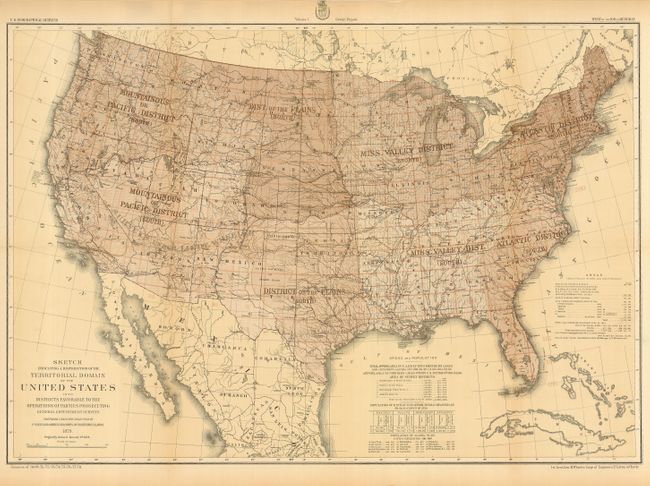
Lieutenant George Wheeler was the Engineer Officer on the staff of the Commanding General of the Army's Department of California (which covered California, Nevada, and Arizona). Not yet 27, he was ordered to organize and equip a party to make the first survey and reconnaissance of a portion of Nevada to the limit of navigation on the Colorado River to gather data for the purpose of a wagon road and future military posts. This was a period of intense effort by the likes of Clarence King, Ferdinand Hayden, John Wesley Powell, and the military to advance the knowledge of the West. Previously, surveys were undertaken as an adjunct to some overriding objective such as building a transcontinental railroad or during time of war. This map is an effort by Wheeler, a man of science and objective thought, much like Clarence King, to set out a systematic plan for the scientific mapping and survey of the country. This map is from Vol. I of Wheeler's Geographical Report. It shows Wheeler's comprehensive plan, proposed in the report, for surveying the entire U.S. in eight districts in 210 rectangular grids applying the same scientific standard throughout. In fact, this is the same method Wheeler used in his earlier western surveys. An important map in the history of the surveying of the United States.
References:
Condition: A
Folding as issued. A hint of marginal age toning and one small fold intersection split, else fine.