Subject: Colonial Mid Atlantic
Period: 1714 (circa)
Publication:
Color: Hand Color
Size:
22.6 x 19 inches
57.4 x 48.3 cm
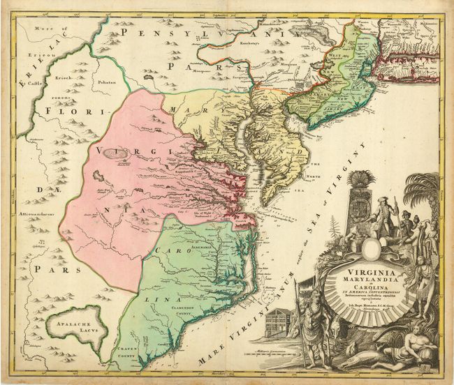
Handsome map of the mid-Atlantic colonies balanced with a pictorial cartouche filling the lower right. There is a large hypothetical lake (Apalache Lacus) west of Craven County, Carolina. Some counties and many rivers of eastern Virginia are shown, but western Virginia is vague with only Germantown, Mister Krug's Plantation and Fort Christ Anna located. Florida is shown extending west of Virginia, all the way north to Lake Erie. Maryland along Cheseapeake Bay [sic] shows many rivers and towns with soundings in most bays, and the coastline of North Carolina is fairly accurate. Philadelphia is clearly shown although Pennsylvania is divided by a rambling Sasquesahanag River and is only vaguely depicted. New Jersey is divided vertically into west and east sections. There is a large Sandy Hook, a minuscule Manhattan, and a thin Long Island Sound. The huge title cartouche depicts European merchants, Indians, trade goods, and the fruits of land and sea - imagery intended to attract people to the New World. This is the second state with the addition of privilege in the cartouche.
References: Cumming (SE) #156, Williams & Johnson #7.
Condition: B
Sharp impression and original color. Toning and wear in margins and a tissue repair on a short fold separation/tear at bottom.