Subject: Canada & United States
Period: 1876-1880 (circa)
Publication:
Color: Hand Color
Size:
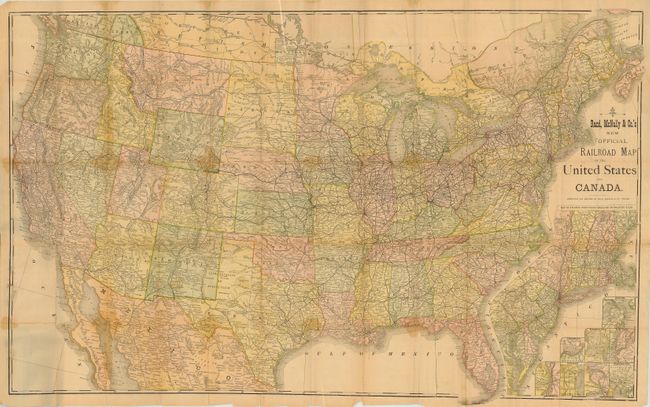
42 x 27 inches
106.7 x 68.6 cm
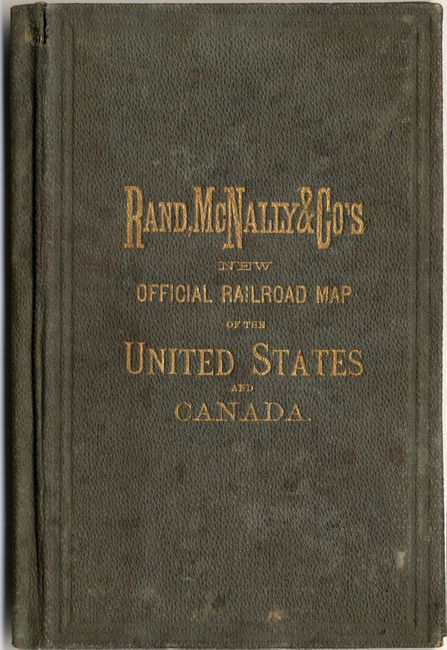
Very early Rand McNally pocket map that folds into boards with green cloth and gilt stamped title. This very large, colorful map features terrific railroad detail along with wagon roads, watershed, cities and villages, and much more. Inset "Map of Atlantic Coast States Engraved on a Large Scale," plus individual city plans of Boston, Cincinnati, New York, Philadelphia, St. Louis, Chicago, Buffalo & Niagara Falls, and Washington. The map is undated, but appears to be circa 1876. Modelski lists a similar, but larger map in the same year. In dating the map we used the following clues: Custer City, founded in 1875 is shown in the Black Hills, and Virginia City is shown as the capital of Montana, which was moved to Helena in 1875. A seldom seen map, much more so in pocket map format.
References: cf Modelski #59.
Condition: C
The map has numerous fold splits with light staining along some folds. Paper is delicate and should be professionally backed. Covers are rubbed and stained or water spotted, but quite sound.