Subject: Canada & United States
Period: 1804 (published)
Publication: New and Elegant General Atlas
Color: Hand Color
Size:
8 x 9.8 inches
20.3 x 24.9 cm
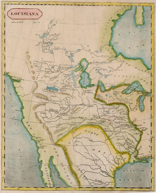
This small but significant map covers most of North America west of the Mississippi River. It is based on the 1795 map by Antoine Soulard and represents the extent of the existing geographic knowledge on the eve of Lewis and Clark's historic expedition. The Rocky Mountains are shown too far to the west and there is no hint of the Colorado River. Several Indian villages are located throughout the West, and in Canada there are a number of English Camps and forts. Drawn by Samuel Lewis and engraved by Henry S. Tanner.
References: Lemmon, Magill & Wiese # 70; Wheat [TMW] #259.
Condition: A
Narrow bottom margin, as issued.