Catalog Archive
Auction 117, Lot 138

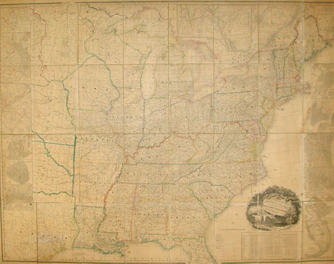
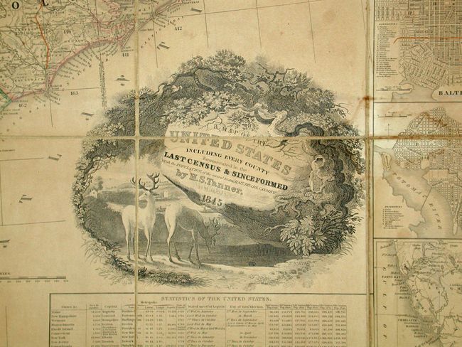
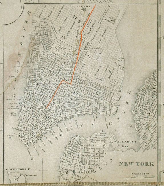
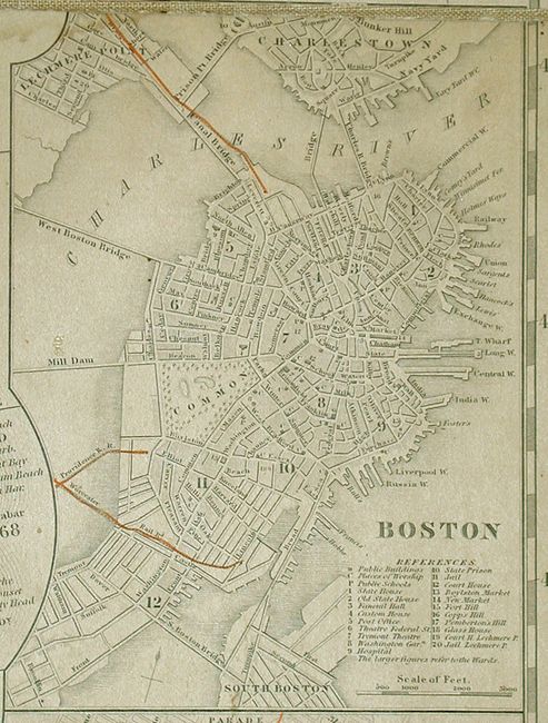
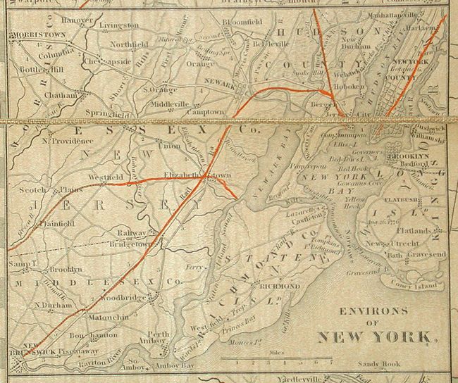
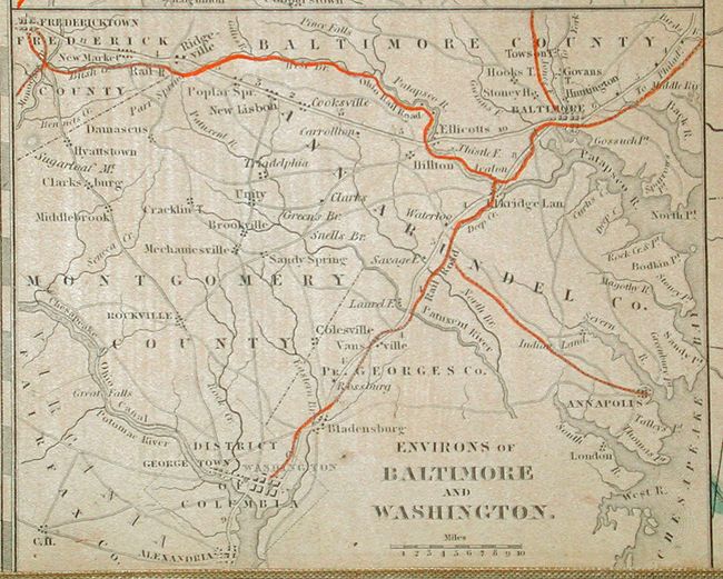
"A Map of the United States Including Every County Enumerated in the Last Census & Since Formed with Population, of the several States, Railroads Canals &c.", Tanner, Henry Schenck

Subject: United States

Period: 1845 (dated)

Publication:

Color: Hand Color

Size:
61 x 46 inches
154.9 x 116.8 cm
Download High Resolution Image
(or just click on image to launch the Zoom viewer)

This rare and ambitious map was separately issued and is segmented and mounted on linen. This map was first engraved in 1829 with major revisions in 1843 as indicated by the copyright. This updated example is dated 1845 in the title. The map was engraved by Tanner with assistance from E.B. Dawson, W. Allen, and J. Knight. It shows the Independent Republic of Texas as "Part of Texas." Curiously, Victoria county is not named, but the short-lived judicial county of Spring Creek is shown. Locates counties and land grants. Names San Antonio, Colorado, Gonzales, Bastrop, La Feyette, Ft. Houston, Robertson, Red River, and Jasper to name a few.

The U.S. Canadian boundary is delineated to about the Lake of the Woods area where a comment mentions the Treaty of 1818 and the significance of the 49th Parallel. In the Northeast the border settlement by the Convention of 1842 is shown as is the earlier 1831 boundary as settled through arbitration by William I, King of Holland. Click here for one of the more informative articles on the history of this portion of the border. Good details along the Missouri River, naming Fort Mandan and numerous Indian tribes, with their populations noted. Locates routes and portages between lakes, the American Fur Co., and numerous trading posts. The map is bounded at the sides with 14 large city plans and a chart of the "South Part of Florida." The plans include the cities of New Orleans, Charleston, Cincinnati, two of New York City, Boston, Albany, Baltimore, Philadelphia, Pittsburgh, and Washington D.C., which contains a floor plan of the Capitol building. Above the main map is a large inset "Oregon and Mandan Districts" that contains a small inset "Outlet of Oregon River" which names Astoria. The legend describes Important Towns, Small Towns & Villages, Canals, Rail Roads, and McAdamized Roads. Good detail of the National Road that was fully McAdamized between Cambridge, Ohio and Terra Haute, Indiana.
The map is filled with a remarkable level of detail and information including watershed, topography, roads, and locates a few thousand villages and towns. At lower right is a large "Table of Statistics of the Untied States" with much information for each state plus the Florida District, and Iowa & W. Dist. The table give legislative dates, square area, and census figures for each census since 1790. The 1840 population is 17 million. The pictorial cartouche, engraved by J.W. Steel, features a pastoral scene with two antlered deer in the foreground. Segmented into 32 panels and mounted on linen that folds into self backs with marbled paper (8" x 12"). A rare issue in lovely, unrestored condition.

References: Ristow p.198.

Condition: A

A very nice copy with overall even age toning. One repaired tear in the New York town inset, not affecting the image, and a few light spots, else fine for a separately issued map of this size. Marbled paper backs are a little rubbed. A beautiful, unadulterated example.

Estimate: $14,000 - $18,000

Unsold

Closed on 12/6/2006

Archived