Subject: Colonial Great Lakes
Period: 1775 (dated)
Publication: Atlas Universel dresse sur les Meilleures Cartes Modernes
Color: Hand Color
Size:
22.3 x 18.9 inches
56.6 x 48 cm
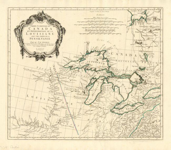
Very fine and uncommon map of the Great Lakes and upper Mississippi River region based on D'Anville's influential map of North America (1746). The map extends from the upper Mississippi River valley east to include most of Lake Ontario, north to James Bay and southeast to Philadelphia. Chicagon (Chicago) and Detroit are both located. Green Bay in present-day Wisconsin is named Bay des Puans (which is variously translated as bay of evil smells or bay of stinkards). There is meticulous detail of other early settlements, numerous French forts, and Indian villages. The map includes a fine depiction of the Missouri River to Kansez including Ft. d'Orleans. D’Anville influenced not only French, but also all contemporary geographers in the second half of the 18th century. According to Tooley, "His representation of the Great Lakes is superior to that of his contemporary, John Mitchell." This is the first state, published in 1776.
References: Kershaw #977; Tooley (Amer) p. 317.
Condition: A
Nearly pristine with one small spot of candle wax in map.