Subject: Eastern United States
Period: 1787 (published)
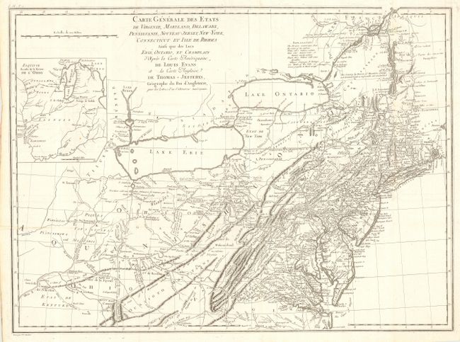
Publication: Letters from an American Farmer
Color: Black & White
Size:
25.6 x 18.8 inches
65 x 47.8 cm
This fine map is based on Thomas Jefferys' version of Lewis Evan's seminal map of 1755. It illustrates the region from Montreal and the lower end of Lake Huron to the North Carolina border, and from the Falls of the Ohio to Narragansett Bay, with an inset of the Ohio River Valley showing the extent of the western frontier. De Crevecoeur includes updated information in New England particularly in Vermont, where Dartmouth College, Putney, Bennington & Westminster are located. Crevecoeur's interest in the Indian tribes is evidenced by the many references to them on the map.
Crevecoeur was a French-born surveyor who settled in New York, where he produced this classic collection of twelve essays that reflected on the nature of American life, particularly its customs and manners. His description of bountiful American lands spurred many French people to immigrate to America. Engraved by P.F. Tardieu.
References:
Condition: B
Issued folding, now pressed. One fold repaired with archival tape and a very small area of replaced paper with facsimile of neatlines and part of one letter between 30° and 40° at left.