Subject: United States & Canada
Period: 1787 (published)
Publication: Histoire des troubles de l'Amerique anglaises
Color: Black & White
Size:
19.5 x 24.2 inches
49.5 x 61.5 cm
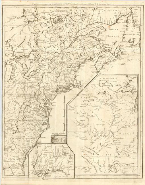
This interesting map began life in 1755 with the title Canada et Louisiane to illustrate the hostilities in the French and Indian War. It was then revised in 1777 and re-titled Theatre de la Guerre en Amerique to illustrate the Revolutionary War. Finally it was re-titled again (this map) and issued in the 1787 edition of Francois Soules' history of the American Revolution. The map covers the eastern seaboard from northern Florida to the Gulf of St. Laurence, and inland to Lake Michigan and James Bay. Large insets delineate the Gulf Coast and the Mississippi River valley, and a vignette of Niagara Falls. The map is filled with information on cities, towns, forts, trails, Indian villages and tribal territory, and battlegrounds (both French and Indian War and Revolutionary War).
References: cf McCorkle #755.23 & #777.13; Sellers and Van Ee #33 & 154.
Condition: B
Issued folding, now pressed. Narrow left margin due to binding trim with short binding tear just entering border.