Filtered by Category:United States(Show All Categories)
Showing results for:Auction 107
Catalog Archive
135 lots
Page 1 of 3
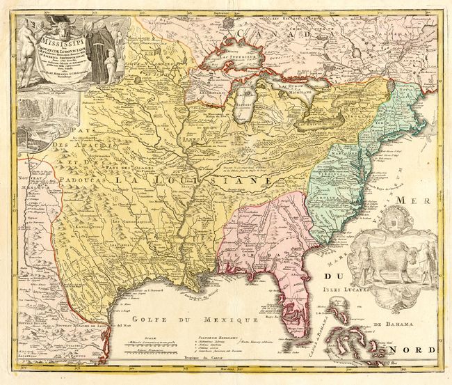
Auction 107, Lot 92
Subject: Colonial North America
Homann, Johann Baptist
Amplissimae Regionis Mississipi Seu Provinciae Ludovicianae…, 1730
Size: 23 x 19.2 inches (58.4 x 48.8 cm)
Estimate: $2,000 - $2,400
Sold for: $1,700
Closed on 6/9/2004
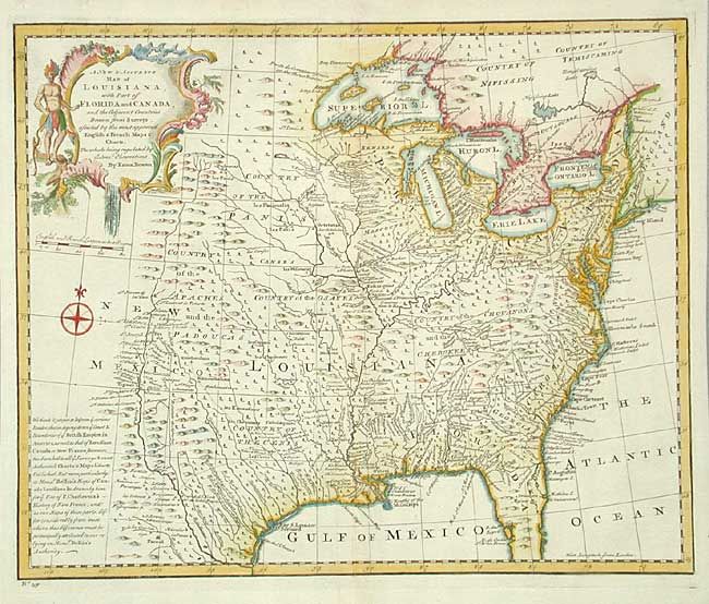
Auction 107, Lot 93
Subject: Colonial Louisiana
Bowen, Emanuel
A New & Accurate Map of Louisiana, with Part of Florida and Canada…, 1747
Size: 16.4 x 13.5 inches (41.7 x 34.3 cm)
Estimate: $750 - $900
Sold for: $1,100
Closed on 6/9/2004
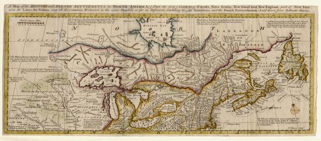
Auction 107, Lot 94
Subject: Colonial United States and Canada
Bowen, Thomas
A Map of the British and French Settlements in North America [Part the first]…, 1755
Size: 19.2 x 7.5 inches (48.8 x 19.1 cm)
Estimate: $400 - $500
Sold for: $800
Closed on 6/9/2004
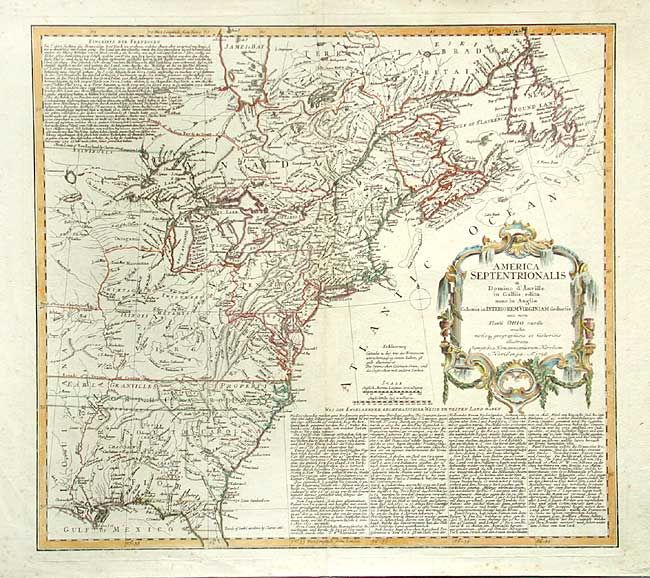
Auction 107, Lot 95
Subject: Colonial North America
Homann Heirs
America Septentrionalis a Domino d'Anville in Galliis edita nunc in Anglia Coloniis in Interiorem Virginiam deductis nec non Fluvii Ohio cursu…, 1756
Size: 20 x 18 inches (50.8 x 45.7 cm)
Estimate: $700 - $800
Sold for: $400
Closed on 6/9/2004
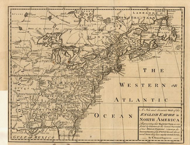
Auction 107, Lot 96
Subject: Colonial North America
Bennett, Richard
A New and Accurate Map of the English Empire in North America…, 1758
Size: 13 x 10 inches (33 x 25.4 cm)
Estimate: $600 - $700
Sold for: $950
Closed on 6/9/2004
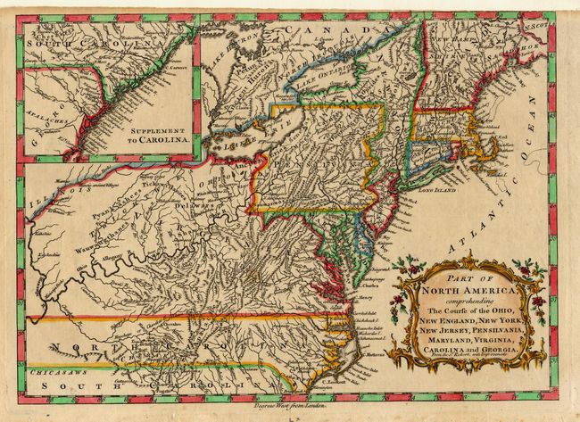
Auction 107, Lot 97
Subject: Colonial United States
Robert de Vaugondy, Didier
Part of North America, comprehending The Course of the Ohio, New England, New York, New Jersey, Pensilvania, Maryland, Virginia, Carolina and Georgia. From the Sr. Robert, with Improvements, 1759-60
Size: 11.7 x 8.5 inches (29.7 x 21.6 cm)
Estimate: $300 - $350
Sold for: $350
Closed on 6/9/2004
Auction 107, Lot 100
Subject: Colonial United States and Canada
Lotter, Mathias Albrecht
Carte Nouvelle de l'Amerique Angloise contenant tout ce que Anglois possedent sur le Continent de l'Amerique Septentrionale Savoir le Canada, la Nouvelle Ecosse ou Acadie, les treize Provinces unies…, 1776
Size: 19.4 x 23.7 inches (49.3 x 60.2 cm)
Estimate: $1,500 - $1,700
Sold for: $1,100
Closed on 6/9/2004
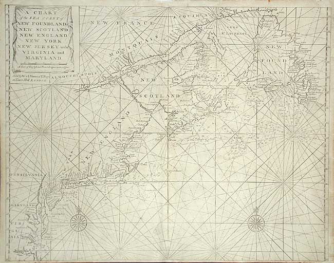
Auction 107, Lot 102
Subject: Colonial United States and Canada
Thornton, John
A Chart of the Sea Coast of New Foundland New Scotland New England New York New Jersey with Virginia and Maryland, 1747-1794
Size: 22.8 x 18 inches (57.9 x 45.7 cm)
Estimate: $1,400 - $1,800
Sold for: $1,000
Closed on 6/9/2004
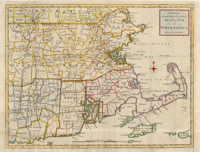
Auction 107, Lot 103
Subject: Colonial New England
Anon.
A New and accurate Map of the Present Seat of War in North America, from a late Survey, 1775
Size: 14.7 x 11.4 inches (37.3 x 29 cm)
Estimate: $400 - $450
Sold for: $700
Closed on 6/9/2004
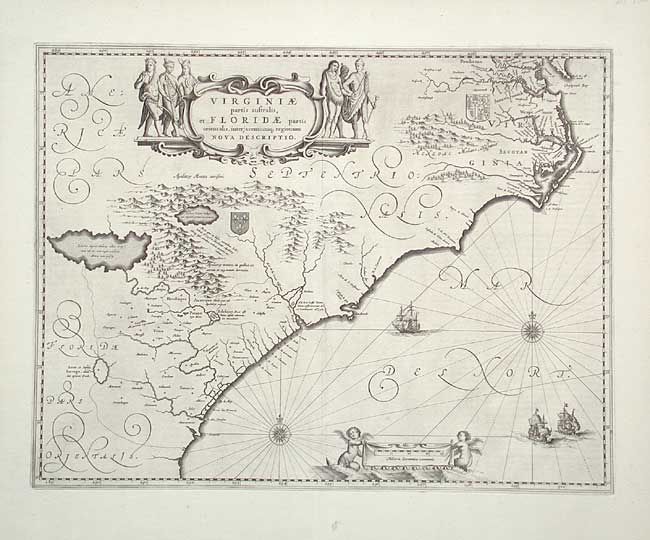
Auction 107, Lot 104
Subject: Colonial Southeast
Jansson, Jan
Virginiae partis australis, et Floridae partis orientalis, interjacentiumq regionum Nova Descriptio, 1639
Size: 19.7 x 15.2 inches (50 x 38.6 cm)
Estimate: $1,500 - $2,000
Sold for: $1,100
Closed on 6/9/2004
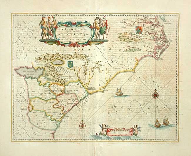
Auction 107, Lot 105
Subject: Colonial Southeast
Blaeu, Willem
Virginiae partis australis, et Floridae partis orientalis, interjacentiumq regionum Nova Descriptio, 1662
Size: 19.7 x 15.2 inches (50 x 38.6 cm)
Estimate: $1,400 - $1,800
Sold for: $1,000
Closed on 6/9/2004
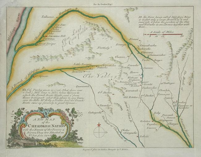
Auction 107, Lot 106
Subject: Colonial Southeast
Kitchin, Thomas
A New Map of the Cherokee Nation with the Names of the Towns & Rivers…, 1760
Size: 8.8 x 6.6 inches (22.4 x 16.8 cm)
Estimate: $800 - $1,000
Sold for: $600
Closed on 6/9/2004
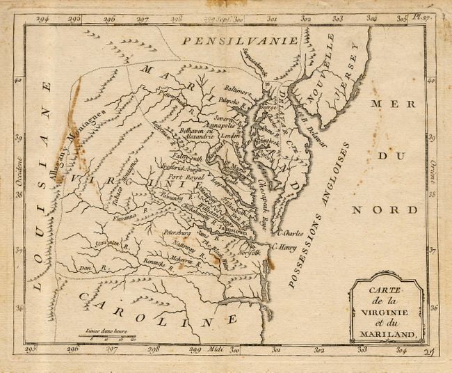
Auction 107, Lot 107
Subject: Colonial Southeast
Laporte, Joseph de
Carte de la Virginie et du Mariland, 1768
Size: 8.7 x 7 inches (22.1 x 17.8 cm)
Estimate: $200 - $250
Sold for: $190
Closed on 6/9/2004
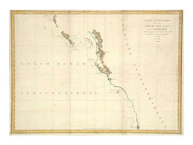
Auction 107, Lot 115
Subject: Western Canada & United States
La Perouse, Comte Jean F. Galoup, de
Carte Particuliere de la Cote du Nord-Ouest de l'Amerique reconnue par les Fregates Francaises la Boussole et l'Astrolabe en 1786. 2e. Feuille, 1799
Size: 27 x 19.6 inches (68.6 x 49.8 cm)
Estimate: $230 - $275
Unsold
Closed on 6/9/2004
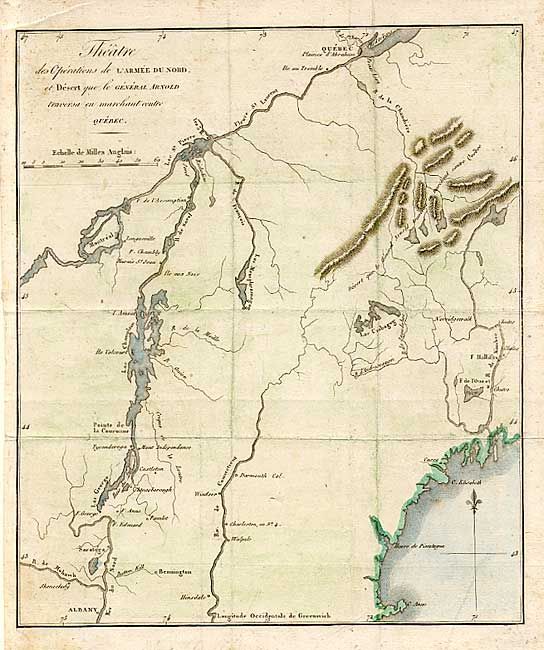
Auction 107, Lot 116
Subject: New England and Canada
Marshall, John
Theatre des Operations de l'Armee du Nord, et Desert que le General Arnold traversa en marchant contre Quebec, 1807
Size: 8.5 x 10 inches (21.6 x 25.4 cm)
Estimate: $120 - $150
Sold for: $140
Closed on 6/9/2004
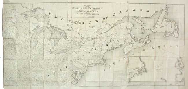
Auction 107, Lot 117
Subject: Canada & United States
Andrews, Israel D.
Map of the Basin of the St. Lawrence showing also the Natural and Artificial Routes between the Atlantic Ocean and the Interior of North America, 1852
Size: 75 x 35 inches (190.5 x 88.9 cm)
Estimate: $250 - $325
Sold for: $250
Closed on 6/9/2004
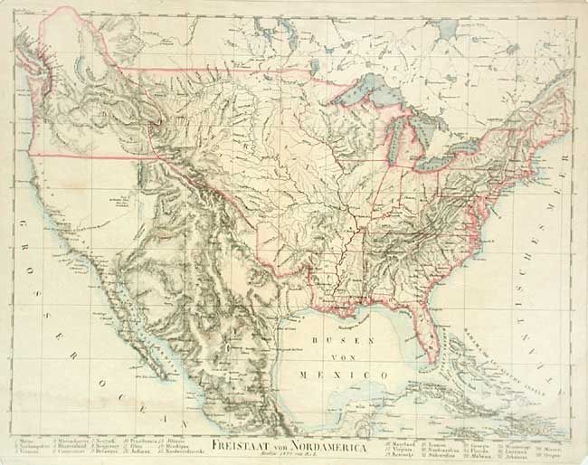
Auction 107, Lot 118
Subject: United States
Lilienstern, R. von
Freistaat von Nord America, 1824
Size: 17.7 x 13.5 inches (45 x 34.3 cm)
Estimate: $325 - $375
Sold for: $240
Closed on 6/9/2004
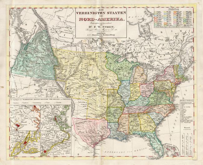
Auction 107, Lot 119
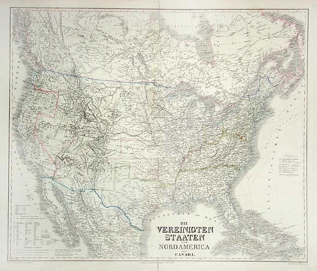
Subject: United States
Streit, Friedrich Wilhelm
Die Vereinigten Staaten von Nord-America, 1840
Size: 18.5 x 15.1 inches (47 x 38.4 cm)
Estimate: $400 - $500
Sold for: $300
Closed on 6/9/2004
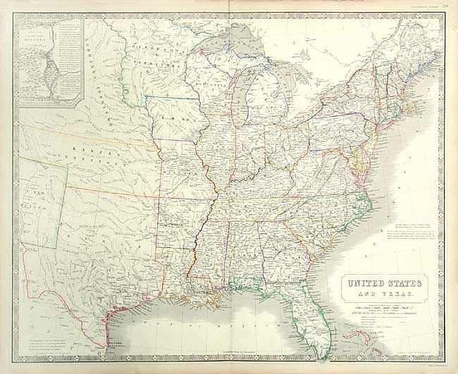
Auction 107, Lot 120
Subject: United States
Johnston, Alexander K.
United States and Texas, 1855
Size: 24 x 19.7 inches (61 x 50 cm)
Estimate: $800 - $900
Sold for: $600
Closed on 6/9/2004
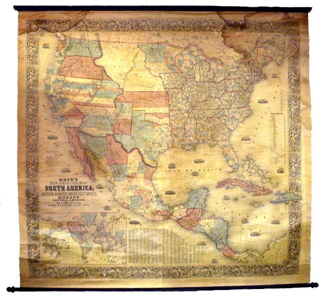
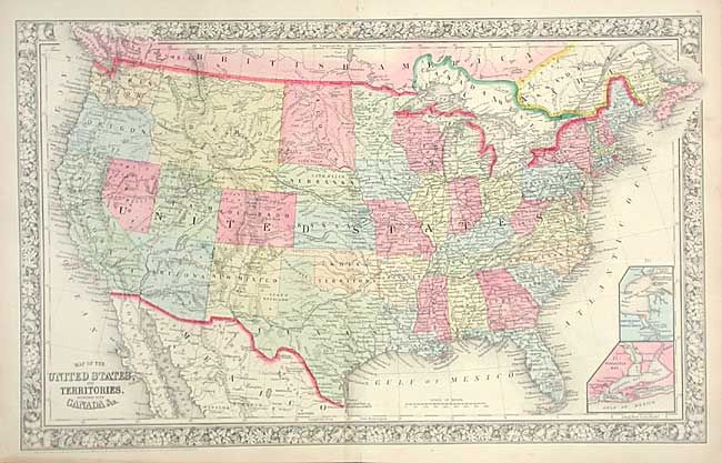
Auction 107, Lot 121
Subject: United States
Monk, Jacob
Monk's New America Map. North America, United States and Territories, Mexico and Central America. Including the West India Islands, Canada, New Brunswick and Nova Scotia, 1856
Size: 61 x 58 inches (154.9 x 147.3 cm)
Estimate: $1,000 - $1,200
Sold for: $600
Closed on 6/9/2004
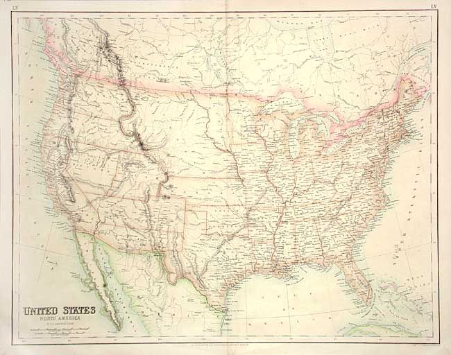
Auction 107, Lot 122
Subject: United States
Kiepert, Heinrich C.
Die Vereinigten Staaten von Nord America nebst Canada, 1858
Size: 24.7 x 20.7 inches (62.7 x 52.6 cm)
Estimate: $180 - $240
Sold for: $130
Closed on 6/9/2004
Auction 107, Lot 123
Subject: United States
Mitchell, Samuel Augustus
Map of the United States and Territories, together with Canada &c., 1860
Size: 21.5 x 13.5 inches (54.6 x 34.3 cm)
Estimate: $180 - $240
Sold for: $275
Closed on 6/9/2004
Auction 107, Lot 124
Subject: United States
Swanston, George H.
United States North America, 1861
Size: 20.7 x 16.2 inches (52.6 x 41.1 cm)
Estimate: $300 - $350
Sold for: $325
Closed on 6/9/2004
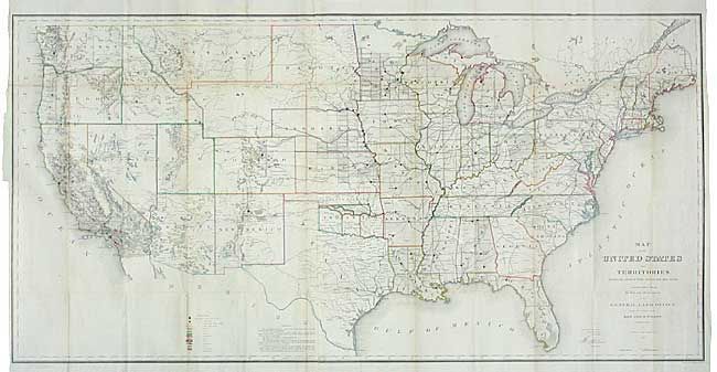
Auction 107, Lot 125
Subject: United States
General Land Office
Map of the United States and Territories Showing the extent of Public Surveys and other details constructed from the Plats and official sources of the General Land Office…, 1866
Size: 54.5 x 28 inches (138.4 x 71.1 cm)
Estimate: $450 - $550
Sold for: $300
Closed on 6/9/2004
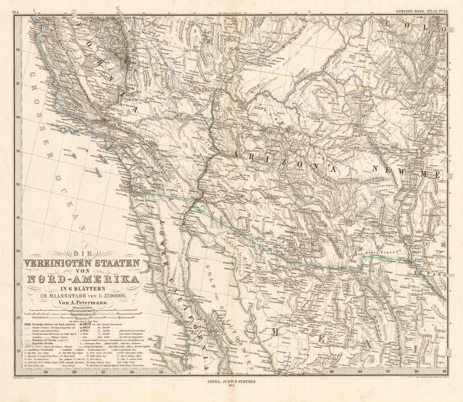
Auction 107, Lot 126
Subject: United States
Petermann, Augustus Herman
Die Vereinigten Staaten von Nord-Amerika in 6 Blattern, 1873
Size: 16 x 13.2 inches (40.6 x 33.5 cm)
Estimate: $300 - $350
Unsold
Closed on 6/9/2004
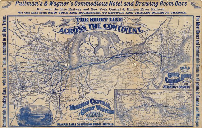
Auction 107, Lot 127
Subject: United States
Railroad Companies, (Various)
Michigan Central and Great Western Railways and Connections via Niagara Falls, 1874
Size: 19.5 x 11.7 inches (49.5 x 29.7 cm)
Estimate: $100 - $150
Sold for: $75
Closed on 6/9/2004
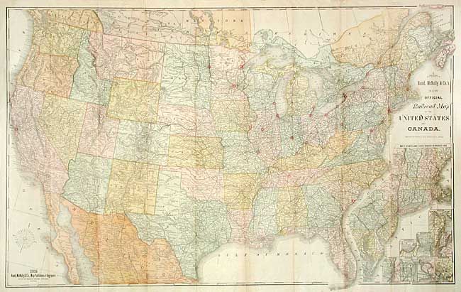
Auction 107, Lot 128
Subject: United States
Rand McNally & Co.
New Official Railroad Map of the United States and Canada, 1885
Size: 42.5 x 26.5 inches (108 x 67.3 cm)
Estimate: $250 - $300
Sold for: $180
Closed on 6/9/2004
Auction 107, Lot 129
Subject: United States
[Lot of 30], 1896
Size: 10 x 13.2 inches (25.4 x 33.5 cm)
Estimate: $150 - $200
Sold for: $110
Closed on 6/9/2004
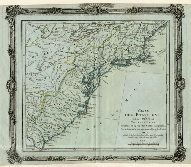
Auction 107, Lot 130
Subject: United States - Eastern
Brion de la Tour/Desnos
Carte des Etats-Unis de l'Amerique Septentrionale, Dressee d'apres des Cartes Anglaises, 1780
Size: 12.2 x 11 inches (31 x 27.9 cm)
Estimate: $400 - $450
Sold for: $240
Closed on 6/9/2004
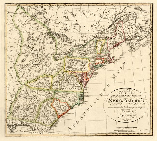
Auction 107, Lot 131
Subject: United States - Eastern
Gussefeld, Franz Ludwig
Charte der XV Vereinigten Staaten von Nord-America…, 1804
Size: 20.5 x 18.2 inches (52.1 x 46.2 cm)
Estimate: $1,400 - $1,600
Sold for: $1,400
Closed on 6/9/2004
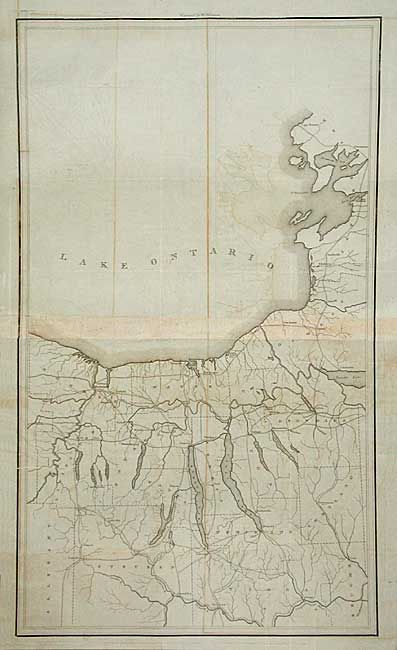
Auction 107, Lot 132
Subject: United States - Eastern
U.S. War Dept.
Map of the Country embracing the Several Routes examined with a view to a National Road from Washington to Lake Ontario, 1829
Size: See Description
Estimate: $350 - $450
Sold for: $300
Closed on 6/9/2004
Auction 107, Lot 133
Subject: United States - Eastern
Rogers & Johnston
[Lot of 6 - Eastern States], 1857
Size: 16 x 13 inches (40.6 x 33 cm)
Estimate: $700 - $800
Unsold
Closed on 6/9/2004
Auction 107, Lot 134
Subject: United States - Eastern
Graf, C.
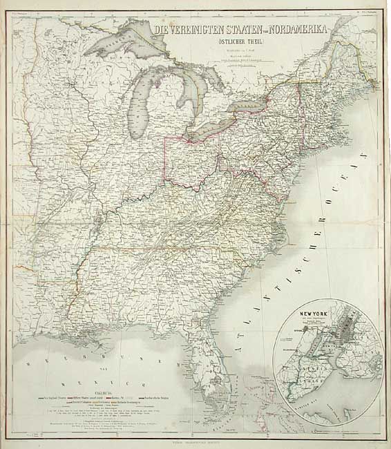
Die Vereinigten Staaten von Nordamerika (Ostlicher Theil), 1858
Size: 22 x 24.8 inches (55.9 x 63 cm)
Estimate: $220 - $275
Unsold
Closed on 6/9/2004
Auction 107, Lot 135
Subject: United States - Southern
Rochefoucald Liancourt, Francois Alexander
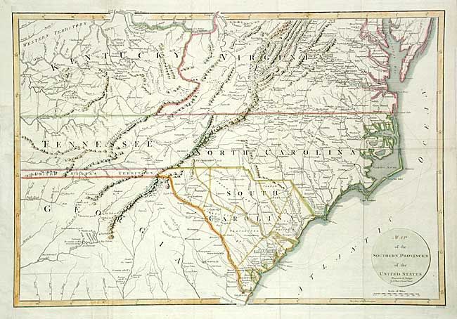
Map of the Southern Provinces of the United States, 1799
Size: 20 x 13.5 inches (50.8 x 34.3 cm)
Estimate: $350 - $400
Sold for: $400
Closed on 6/9/2004
Auction 107, Lot 136
Subject: United States - Midwest and Mid Atlantic
Conder, Thomas
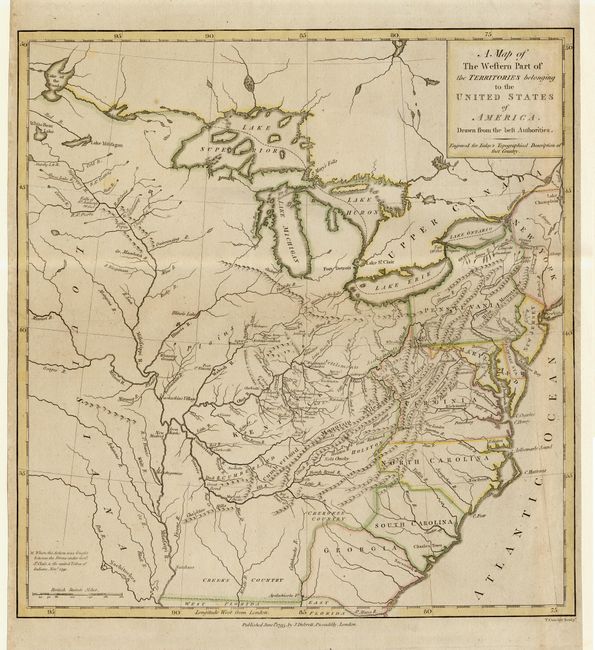
A Map of the Western part of the Territories belonging to the United States of America, 1795
Size: 13 x 13.7 inches (33 x 34.8 cm)
Estimate: $600 - $800
Sold for: $650
Closed on 6/9/2004
Auction 107, Lot 137
Subject: United States - Midwest and Mid Atlantic
Cary, John
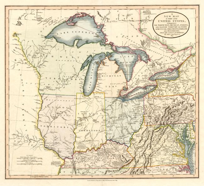
A New Map of Part of the United States, exhibiting the North West, Michigan, Indiana, and Illinois Territory, the States of Kentucky, Ohio, Virginia, Maryland and Pennsylvania, 1819
Size: 20.2 x 18 inches (51.3 x 45.7 cm)
Estimate: $1,000 - $1,500
Sold for: $1,300
Closed on 6/9/2004
Auction 107, Lot 138
Subject: United States - Central
U.S. War Dept.
Hydrographical Basin of the Upper Mississippi River from Astronomical and Barometrical Observations Surveys and Information…, 1843
Size: 30.2 x 36 inches (76.7 x 91.4 cm)
Estimate: $400 - $500
Sold for: $550
Closed on 6/9/2004
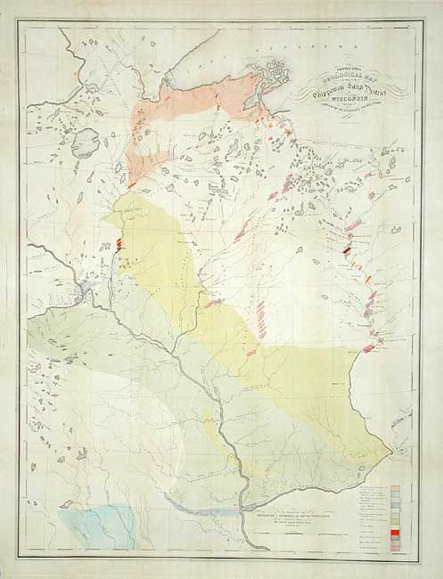
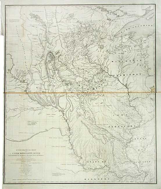
Auction 107, Lot 139
Subject: United States - Central
Owen, David Dale
Provisional Geological Map of Part of the Chippeway Land District of Wisconsin with Part of Iowa & of Minnesota Territory, 1847
Size: 25.5 x 34 inches (64.8 x 86.4 cm)
Estimate: $250 - $350
Sold for: $700
Closed on 6/9/2004
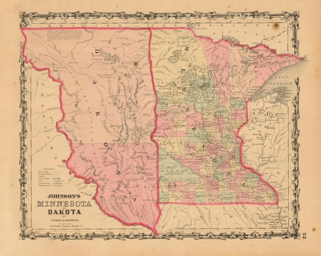
Auction 107, Lot 140
Subject: United States - Central
Johnson & Browning
Johnson's Minnesota and Dakota, 1861
Size: 15.3 x 12.5 inches (38.9 x 31.8 cm)
Estimate: $120 - $150
Unsold
Closed on 6/9/2004
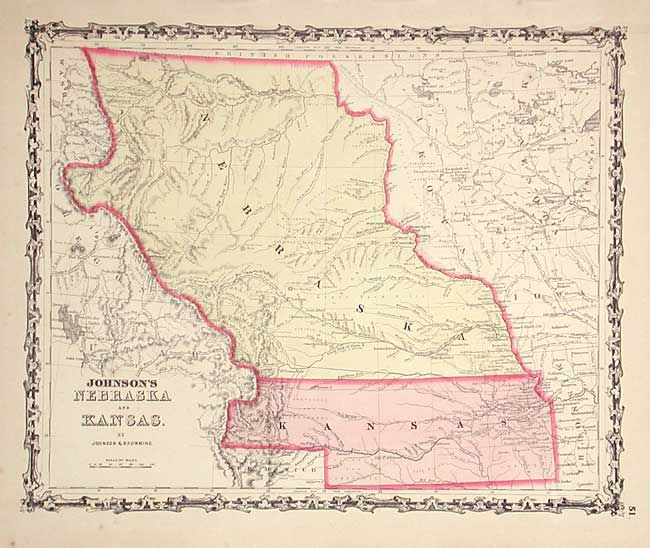
Auction 107, Lot 141
Subject: United States - Central
Johnson & Browning
Johnson's Nebraska and Kansas, 1861
Size: 15.3 x 12.5 inches (38.9 x 31.8 cm)
Estimate: $200 - $250
Sold for: $325
Closed on 6/9/2004
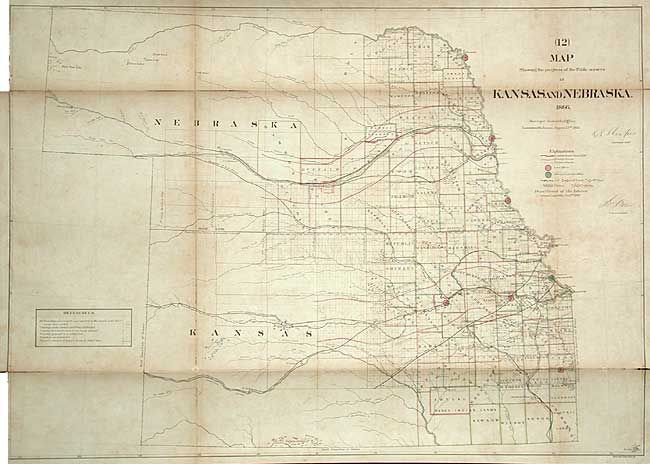
Auction 107, Lot 142
Subject: United States - Central
General Land Office
Map Showing the progress of the Public surveys in Kansas and Nebraska, 1866
Size: 33 x 23.4 inches (83.8 x 59.4 cm)
Estimate: $250 - $300
Sold for: $150
Closed on 6/9/2004
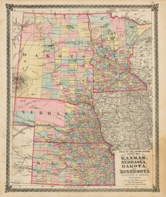
Auction 107, Lot 143
Subject: United States - Central
Warner & Beers
County Map of Kansas, Nebraska, Dakota and Minnesota, 1872
Size: 14.3 x 17.5 inches (36.3 x 44.5 cm)
Estimate: $100 - $120
Unsold
Closed on 6/9/2004
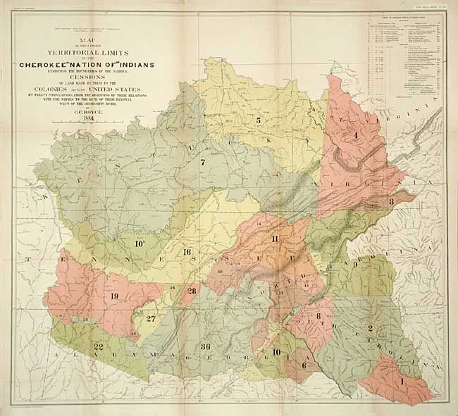
Auction 107, Lot 144
Subject: United States - Central & Oklahoma
Royce, C. C.
[Pair] Map of the Former Territorial Limits of the Cherokee Nation of Indians [together with] Map Showing the Territory Originally Assigned to the Cherokee Nation of Indians West of the Mississippi…, 1884
Size: See Description
Estimate: $250 - $350
Sold for: $190
Closed on 6/9/2004
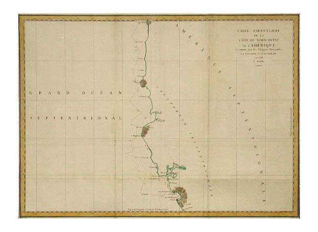
Auction 107, Lot 145
Subject: United States - Western
La Perouse, Comte Jean F. Galoup, de
Carte Particuliere de la Cote du Nord-Ouest de l'Amerique reconnue par les Fregates Francaises la Boussole et l'Astrolabe en 1786. 3e. Feuille, 1799
Size: 27 x 19.6 inches (68.6 x 49.8 cm)
Estimate: $250 - $300
Unsold
Closed on 6/9/2004
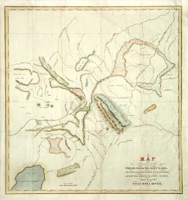
Auction 107, Lot 146
Subject: United States - Western
Bonneville, Benjamin L. E. de
A Map of the Sources of the Colorado & Big Salt Lake, Platte, Yellow-Stone, Muscle-Shell, Missouri, & Salmon & Snake Rivers, branches of the Columbia River, 1837
Size: 15.5 x 16.7 inches (39.4 x 42.4 cm)
Estimate: $400 - $500
Sold for: $600
Closed on 6/9/2004
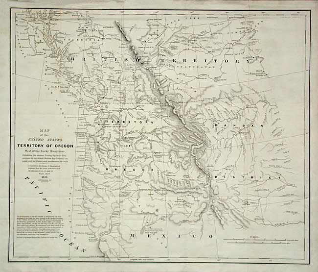
Auction 107, Lot 147
Subject: United States - Western
Abert/Hood
Map of the United States Territory of Oregon West of the Rocky Mountains Exhibiting the vaious Trading Depots or Forts occupied by the British Hudson Bay Company connected with the Western and Northwestern Fur Trade, 1838
Size: 20.5 x 17.3 inches (52.1 x 43.9 cm)
Estimate: $500 - $600
Sold for: $600
Closed on 6/9/2004
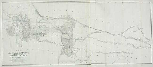
Auction 107, Lot 148
Subject: United States - Western
Stansbury, M. Howard (Capt.)
Map of a Reconnaissance between Fort Leavenworth on the Missouri River, and the Great Salt Lake in the Territory of Utah, made in 1849 and 1850…, 1852
Size: 67 x 28 inches (170.2 x 71.1 cm)
Estimate: $400 - $450
Sold for: $300
Closed on 6/9/2004
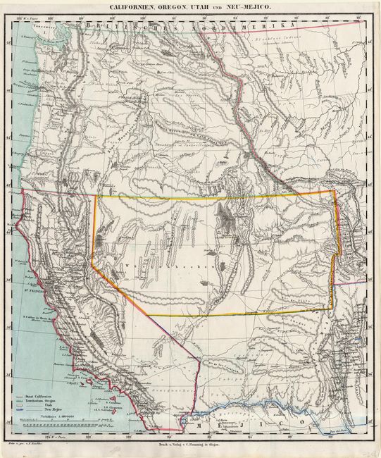
Auction 107, Lot 149
Subject: United States - Western
Flemming, Carl
Californien, Oregon, Utah und Neu-Mejico, 1855
Size: 13.6 x 15.7 inches (34.5 x 39.9 cm)
Estimate: $200 - $250
Sold for: $190
Closed on 6/9/2004
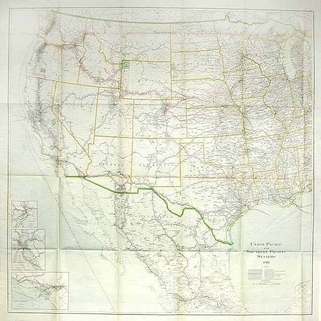
Auction 107, Lot 150
Subject: United States - Western
Railroad Companies, (Various)
[Lot of 2] Union Pacific and Southern Pacific Systems 1909 [and] 1910, 1909-1910
Size: See Description
Estimate: $180 - $220
Sold for: $130
Closed on 6/9/2004
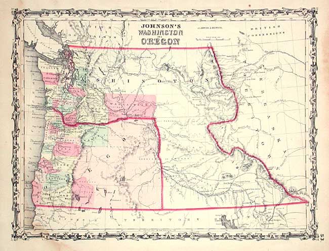
Auction 107, Lot 151
Subject: Pacific Northwest
Johnson & Browning
Johnson's Washington and Oregon, 1861
Size: 16.4 x 12.3 inches (41.7 x 31.2 cm)
Estimate: $150 - $200
Sold for: $130
Closed on 6/9/2004
135 lots
Page 1 of 3