Subject: United States - Western
Period: 1852 (published)
Publication: An Expedition to the Valley of the Great Salt Lake of Utah…
Color: Hand Color
Size:
67 x 28 inches
170.2 x 71.1 cm
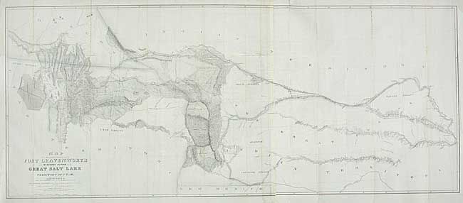
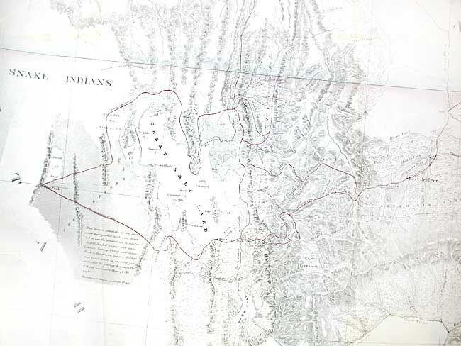
Made under the orders of Col. J.J. Albert, chief of the Topographical Bureau, by Capt. Howard Stansbury of the Corps of Topographical Engineers, aided by Lieut. J.W. Gunnison and Albert Carrington. Drawn by Lieut. Gunnison and Charles Preuss. Thus bringing together some of the most important names in Western cartography. This immense map covers the Great Plains, Colorado, Wyoming and Utah in considerable detail on a scale of 1" to about 16 miles. The detail is particularly evident in present-day Colorado, the Laramie Mountains (here labeled Black Hills), and in the vicinity of Salt Lake. Wheat devotes more than eight pages of text to this map, calling it "one of the most important [maps] of its decade, bringing permanently into Western cartography a number of outstanding details." Lithographed by Ackerman. Two sheets joined.
References: Wagner-Camp #219:1; Wheat [TMW] #764.
Condition: B
Backed with archival tissue. A little toning at folds. Three-inch tear into map at binding corner, well closed on verso. Paper laid in at binding trim for appearance.