Catalog Archive
Auction 107, Lot 103

"A New and accurate Map of the Present Seat of War in North America, from a late Survey", Anon.

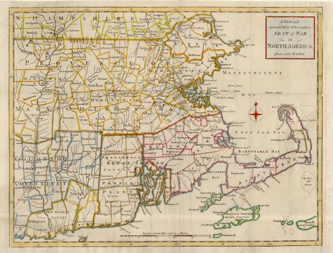
Subject: Colonial New England

Period: 1775 (published)

Publication: Universal Magazine

Color: Hand Color

Size:
14.7 x 11.4 inches
37.3 x 29 cm
Download High Resolution Image
(or just click on image to launch the Zoom viewer)

This uncommon map was issued just following the outbreak of the Revolutionary War in October of 1775. It covers Rhode Island and Massachusetts with parts of Connecticut and New Hampshire. It depicts provinces, counties, townships, towns, meeting-houses, roads, forts, and landmarks along the Connecticut River. The March of the Provincials following the battle of Concord and Lexington is noted through Massachusetts.

References: Jolly UNIV-173; McCorkle #775.11; Sellers & Van Ee #814; Phillips (M) p. 585.

Condition: B

Tissue repair of long binding tear at right. Margin extended at binding side with tiny loss of neatline.

Estimate: $400 - $450

Sold for: $700

Closed on 6/9/2004

Archived