Catalog Archive
Auction 107, Lot 97
"Part of North America, comprehending The Course of the Ohio, New England, New York, New Jersey, Pensilvania, Maryland, Virginia, Carolina and Georgia. From the Sr. Robert, with Improvements", Robert de Vaugondy, Didier
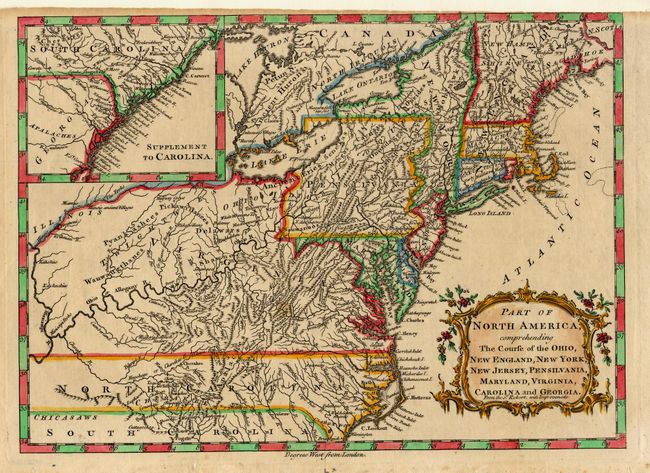
Subject: Colonial United States
Period: 1759-60 (published)
Publication: New Geographical Dictionary
Color: Hand Color
Size:
11.7 x 8.5 inches
29.7 x 21.6 cm
Download High Resolution Image
(or just click on image to launch the Zoom viewer)
(or just click on image to launch the Zoom viewer)