Subject: Colonial Southeast
Period: 1768 (circa)
Publication:
Color: Black & White
Size:
8.7 x 7 inches
22.1 x 17.8 cm
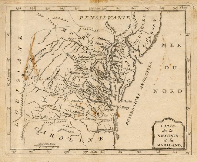
Early edition of this interesting small map of region. Maryland is an ill-defined wedge between Virginia and Pennsylvania and does not extend beyond the Appalachians. Maryland's most prominent settlement is St. Marie, the colony's first capital. The Delaware, here labeled Delaware Cte., boundary is defined indicating the map was made following the conclusion of a long land dispute between Lord Baltimore and the Penn family in 1760. Strangely, Philadelphia is missing from the map while Alexandria is also called Belhaven. The colonies are labeled Possessions Angolises and Louisiane is clearly marked on the western slope of the Allagany Montagnes. Locates many interesting areas including the Tabaco Mtns.
References:
Condition: B
Good impression on thick paper. Some scattered staining and some tape reside in four places at edges of margins.