Catalog Archive
Auction 107, Lot 106

"A New Map of the Cherokee Nation with the Names of the Towns & Rivers…", Kitchin, Thomas

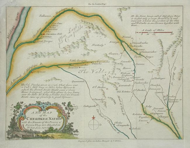
Subject: Colonial Southeast

Period: 1760 (published)

Publication: London Magazine

Color: Hand Color

Size:
8.8 x 6.6 inches
22.4 x 16.8 cm
Download High Resolution Image
(or just click on image to launch the Zoom viewer)

Terrific, uncommon map of the region of Tennessee, western North Carolina and northern Georgia that was drawn "from an Indian Draught." Kitchin most likely used information from John Mitchell's map of 1755 as well. It is one of the earliest printed maps of western North Carolina. The map focuses on the Cherokee lands at the headwaters of the French Broad, Little Tennessee, and Savannah Rivers and was issued as a result of the Indian attacks of 1759-60.

References: Cumming (SE) 327; Jolly LOND-183; Sellers van Van Ee #1387.

Condition: A

Tissue repairs in blank margins and one tiny tear just entering map at left.

Estimate: $800 - $1,000

Sold for: $600

Closed on 6/9/2004

Archived