Subject: Colonial United States and Canada
Period: 1755 (published)
Publication: General Magazine of Arts & Sciences
Color: Hand Color
Size:
19.2 x 7.5 inches
48.8 x 19.1 cm
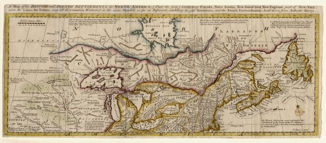
This uncommon map is one of two maps issued to accompany a 4-part account of North America. It covers Canada, New England, parts of New York and Pennsylvania, and the Great Lakes. It was issued just prior to the French and Indian War and presents a decidedly British point of view with several interesting boundaries shown: the Bounds of the Six Nations, the Bounds of Hudson Bay by the Treaty of Utrecht, and Northern Bounds of New England by Charter Nov. 3rd 1620, and which extends Westward to the Sth. Sea. Filled with other interesting notations and the locations of Indian tribes, villages, forts and early settlements.
References: Jolly GENMAS-68; Kershaw #352; McCorkle #755.6; Seller & Van Ee #81.
Condition: B
Some minor soil and extraneously creases.