Subject: United States
Period: 1896 (published)
Publication: Encyclopedia Britannica
Color: Printed Color
Size:
10 x 13.2 inches
25.4 x 33.5 cm
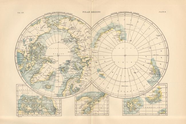
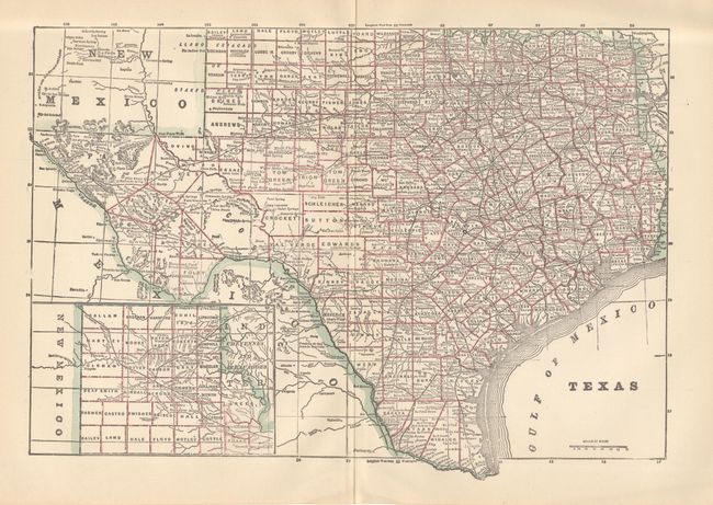
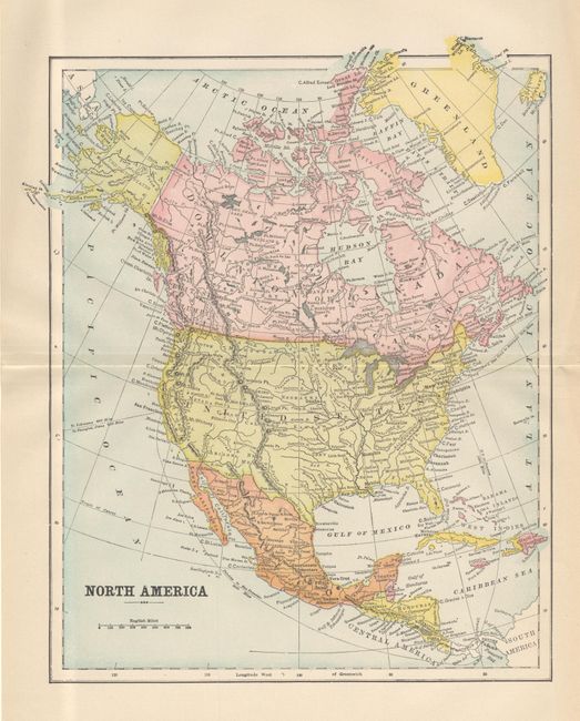
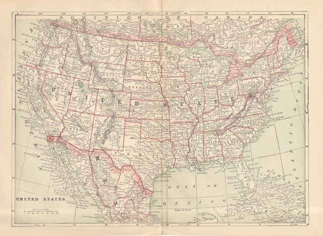
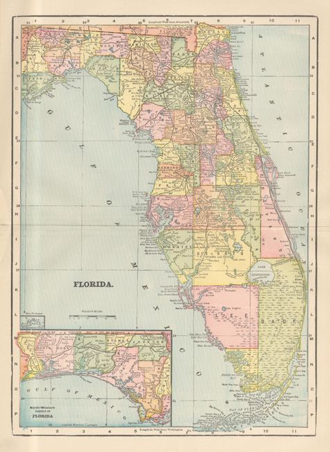
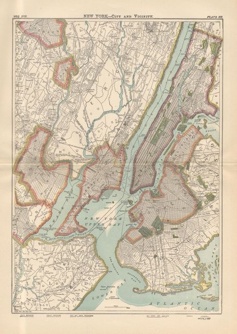
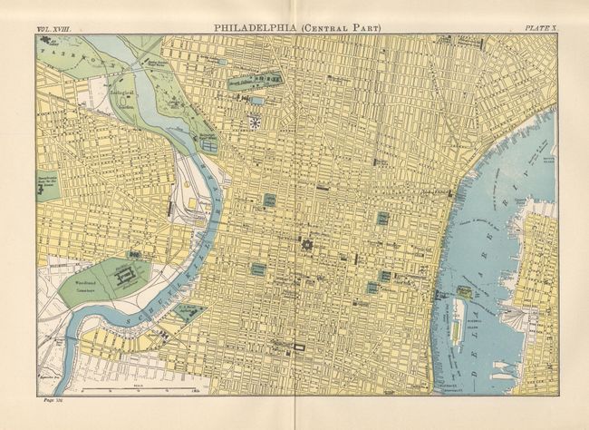
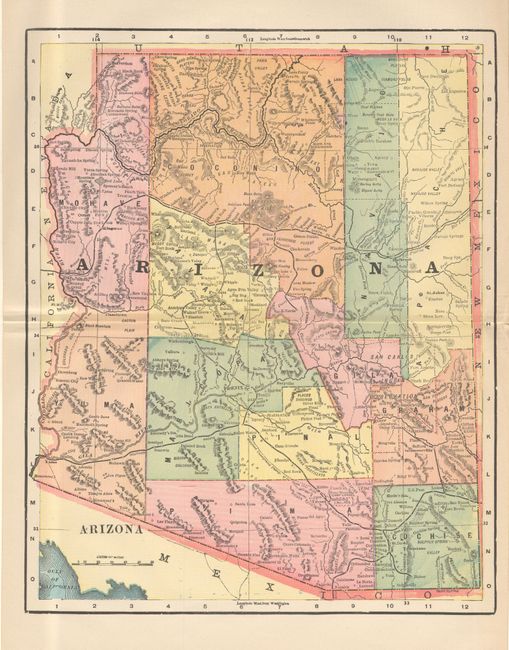
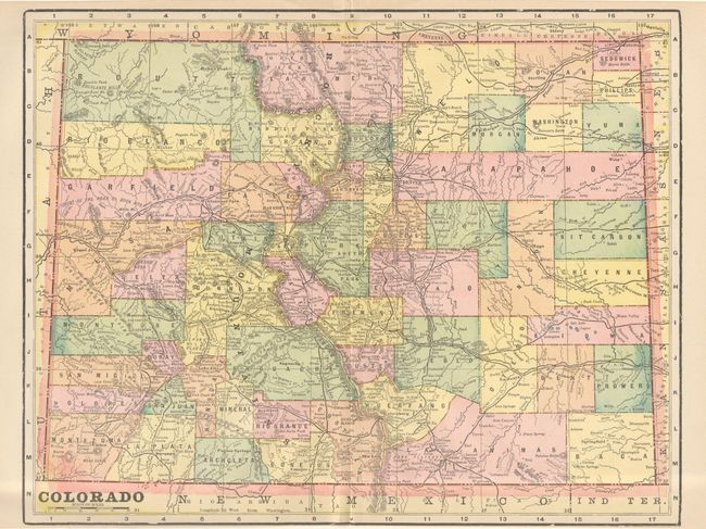
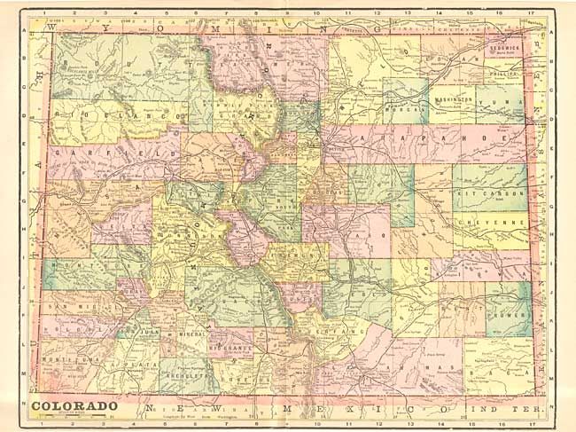
Nice group of primarily western state maps and city plans. Each map is printed on one side only, which is unusual for maps of this period. Each provides good detail of the counties, railroads, cities and towns. Includes Idaho, Oklahoma and Indian Ters. (2), Colorado, South Dakota, North Dakota, Florida, Texas, Washington, Oregon, California, Wyoming, Minnesota, Montana, Utah, New Mexico, Arizona, Alaska, Nevada, Nebraska, Hawaii, Philadelphia (2), New York City (3), United States (2), World on Polar Projection, and North America.
References:
Condition: A+