Subject: Colonial North America
Period: 1758 (published)
Publication: Grand Magazine of Universal Intelligence
Color: Black & White
Size:
13 x 10 inches
33 x 25.4 cm
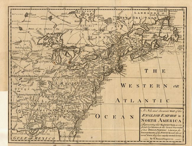
A very scarce little map issued during the French and Indian War. The map is based on the map of the same title published by Herbert and Sayer for the Society of Anti-Gallicans. The map is a striking example of how maps were used for propaganda and illustrates by far the most pro-British representation of land claims in North America. The only French possessions on the continent are squeezed into the region, labeled Canada, along the St. Laurence River between Montreal and Tadoussac, and Anticosti, Prince Edward and Cape Breton Island and the north shore of Newfoundland. The Encroachments of the French are graphically plotted throughout the map.
References: Jolly GMUI-7.
Condition: B
Issued folding, now pressed. Couple of small spots and tissue reinforced folds and a short binding tear. Trimmed close at binding side.