Catalog Archive
Auction 107, Lot 93

"A New & Accurate Map of Louisiana, with Part of Florida and Canada…", Bowen, Emanuel

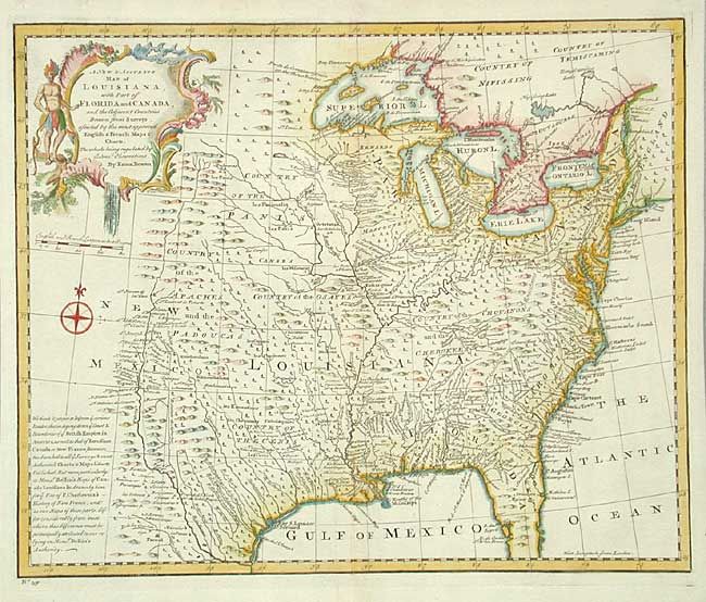
Subject: Colonial Louisiana

Period: 1747 (published)

Publication: A Complete System of Geography

Color: Hand Color

Size:
16.4 x 13.5 inches
41.7 x 34.3 cm
Download High Resolution Image
(or just click on image to launch the Zoom viewer)

A beautifully detailed map that extends west to the Rio Grande and features oversized Great Lakes and Texas labeled Country of the Cenis. Filled with place names, many Indian tribes, forts, and much more. A long note gives credit for the geography of the French portion of the map to the French cartographer Jacques Bellin. Large, decorative cartouche and compass rose ornament the map.

References: Phillips (A) #603-2-58; Lemmon, Magill & Wiese (Charting Louisiana) #25.

Condition: A+

Slight toning and a tissue repair in blank margin.

Estimate: $750 - $900

Sold for: $1,100

Closed on 6/9/2004

Archived