Showing Unsold Lots $100 to $250(remove filter)
Current Auction
180 lots
Page 1 of 4
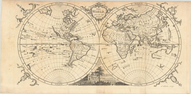
Lot 20
Subject: World
Kitchin, Thomas
The World, from the Best Authorities, 1770
Size: 14.6 x 7.5 inches (37.1 x 19.1 cm)
Estimate: $220 - $250
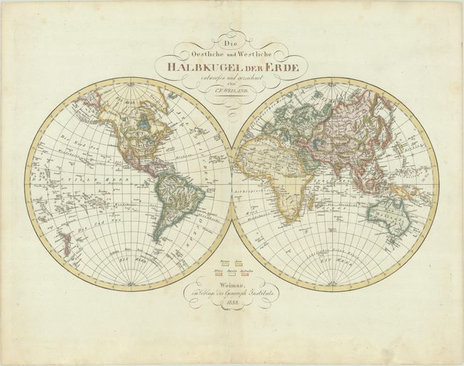
Lot 28
Subject: World
Weiland, Carl Ferdinand
Die Oestliche und Westliche Halbkugel der Erde, 1833
Size: 17 x 11.8 inches (43.2 x 30 cm)
Estimate: $275 - $350
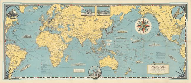
Lot 32
Subject: World, World War II
Dudley Chase, Ernest
Total War Battle Map, 1943
Size: 35.5 x 14.9 inches (90.2 x 37.8 cm)
Estimate: $275 - $350
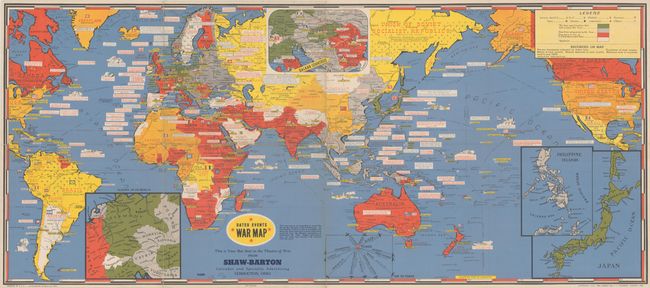
Lot 33
Subject: World, World War II
Turner, Stanley
Dated Events War Map [21st Edition] , 1944
Size: 38.6 x 16.9 inches (98 x 42.9 cm)
Estimate: $140 - $170
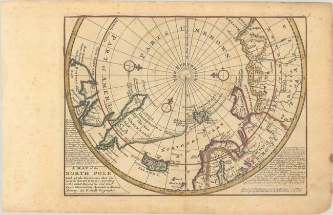
Lot 45
Subject: North Pole
Moll, Herman
A Map of the North Pole with All the Territories that Lye Near It, Known to Us &c..., 1745
Size: 10.9 x 8.1 inches (27.7 x 20.6 cm)
Estimate: $200 - $230
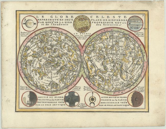
Lot 47
Subject: Celestial
Chiquet, Jacques
Le Globe Celeste Represente en Deux Plans-Hemispheres par Monsr. de la Hire Professeur Royal et de l'Academie des Sciences, 1719
Size: 8.5 x 6.6 inches (21.6 x 16.8 cm)
Estimate: $275 - $350

Lot 55
Subject: Cartographic Miscellany, Canada
The Canada Rose, 1858
Size: 9.1 x 9.1 inches (23.1 x 23.1 cm)
Estimate: $200 - $230
Views of Canada in a Souvenir Rose
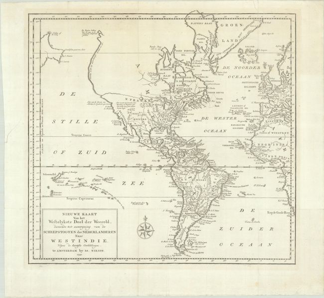
Lot 68
Subject: Western Hemisphere - America
Tirion, Isaac
Nieuwe Kaart van het Westelykste Deel der Weereld, Dienende tot Aanwyzing van de Scheepstogten der Nederlanderen naar Westindie..., 1754
Size: 14.3 x 13.5 inches (36.3 x 34.3 cm)
Estimate: $160 - $190
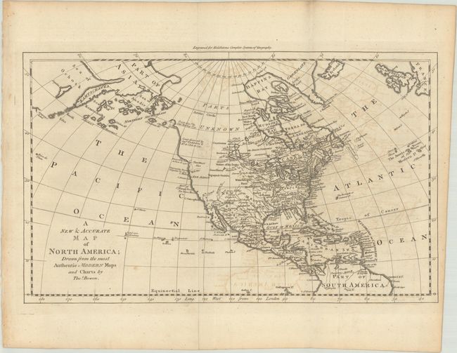
Lot 82
Subject: Colonial North America
Bowen, Thomas
A New & Accurate Map of North America; Drawn from the Most Authentic Modern Maps and Charts, 1778
Size: 17.1 x 10.4 inches (43.4 x 26.4 cm)
Estimate: $160 - $190
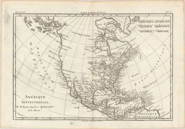
Lot 83
Subject: Colonial North America
Bonne/Raynal
Amerique Septentrionale, 1780
Size: 12.8 x 8.5 inches (32.5 x 21.6 cm)
Estimate: $120 - $150
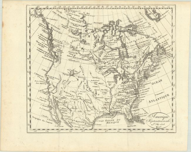
Lot 86
Subject: North America
Amerique Septentrionale L'An 1806 G.S., 1806
Size: 8.4 x 7.3 inches (21.3 x 18.5 cm)
Estimate: $200 - $230
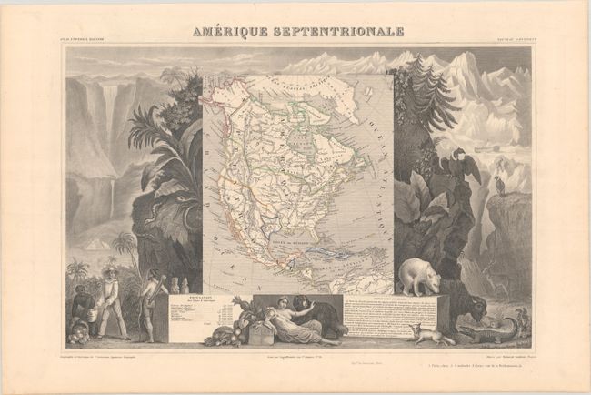
Lot 91
Subject: North America, Texas
Levasseur, Victor
Amerique Septentrionale, 1856
Size: 16.8 x 10.9 inches (42.7 x 27.7 cm)
Estimate: $150 - $180
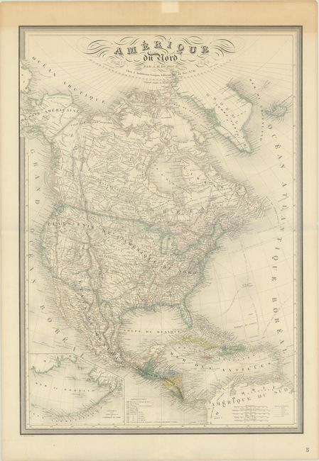
Lot 92
Subject: North America
Dufour, Auguste-Henri
Amerique du Nord, 1859
Size: 24.8 x 35.6 inches (63 x 90.4 cm)
Estimate: $200 - $230
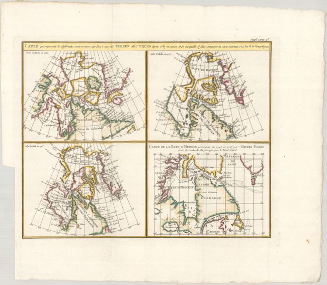
Lot 100
Subject: Eastern Canada
Robert de Vaugondy/Diderot
Carte qui Represente les Differentes Connoissances que l'on a eues des Terres Arctiques Depuis 1650 Jusqu'en 1747..., 1773
Size: 15.1 x 11.9 inches (38.4 x 30.2 cm)
Estimate: $140 - $170
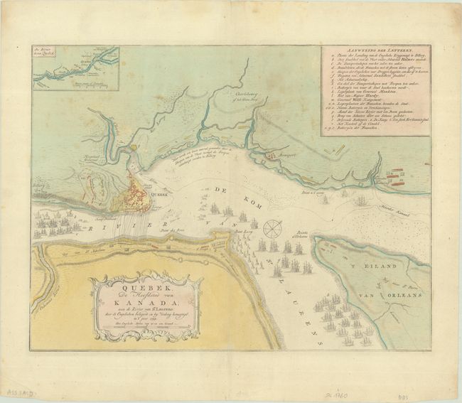
Lot 103
Subject: Quebec City & St. Lawrence River, Canada
Tirion, Isaac
Quebek, de Hoofdstad van Kanada; aan de Rivier van st. Laurens..., 1769
Size: 17 x 13 inches (43.2 x 33 cm)
Estimate: $160 - $190
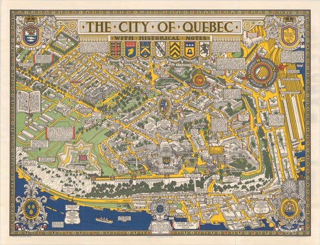
Lot 105
Subject: Quebec City, Canada
The City of Quebec with Historical Notes, 1932
Size: 33.4 x 25.1 inches (84.8 x 63.8 cm)
Estimate: $200 - $230
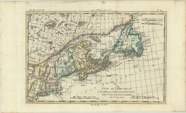
Lot 122
Subject: Colonial Northeastern United States & Canada
Bonne, Rigobert
L'Isle de Terre-Neuve l'Acadie, ou la Nouvelle Ecosse, l'Isle St. Jean et la Partie Orientale du Canada, 1780
Size: 12.5 x 8.3 inches (31.8 x 21.1 cm)
Estimate: $140 - $170
Lot 123
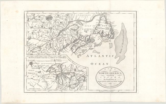
Subject: Northeastern United States & Canada, Great Lakes
Part of North America, Containing Canada, the North Parts of New England and New York; with Nova Scotia and Newfoundland, 1794
Size: 11.3 x 8.2 inches (28.7 x 20.8 cm)
Estimate: $160 - $190
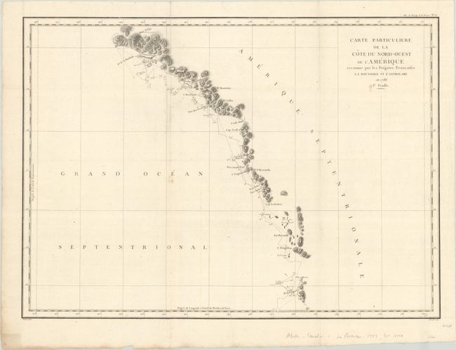
Lot 127
Subject: Northwestern United States & Canada, Alaska
La Perouse, Comte Jean F. Galoup, de
[Lot of 2] Carte Particuliere de la Cote du Nord-Ouest de l'Amerique Reconnue par les Fregates Francaises la Boussole et l'Astrolabe en 1786. 1e Feuille [and] ... 2e Feuille, 1797
Size: 27.1 x 19.5 inches (68.8 x 49.5 cm)
Estimate: $275 - $350
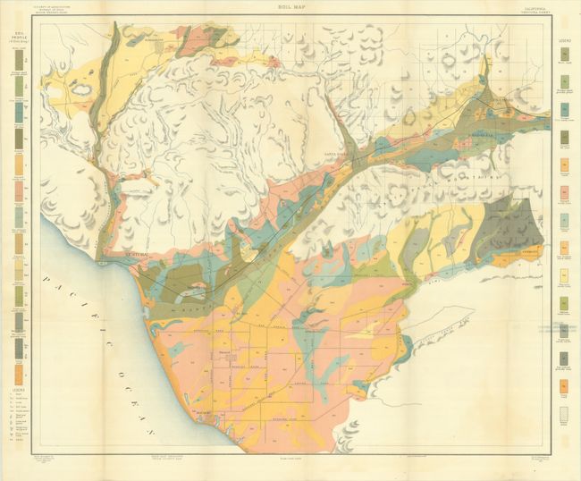
Lot 133
Subject: United States
U.S.D.A.
[Lot of 31 - U.S.D.A. Soil Maps] Field Operations of the Bureau of Soils - 1901 - Maps, 1901
Size: 6 x 9.5 inches (15.2 x 24.1 cm)
Estimate: $200 - $230
Features A Number of Maps of Southern California
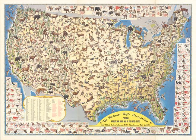
Lot 139
Subject: United States
The National Rifle Association Pictorial Wildlife and Game Map of the United States, 1972
Size: 26.9 x 18.9 inches (68.3 x 48 cm)
Estimate: $200 - $230
Lot 140
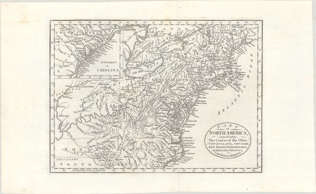
Subject: Eastern United States
Cary, John
Part of North America, Comprehending the Course of the Ohio, New England, New York, New Jersey, Pennsylvania, Maryland, Virginia, Carolina & Georgia, 1795
Size: 11.8 x 8.5 inches (30 x 21.6 cm)
Estimate: $240 - $300
Lot 148
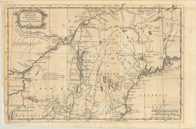
Subject: Colonial New England & Mid-Atlantic United States
Anon.
A Map of That Part of America Which Was the Principal Seat of War, in 1756, 1757
Size: 13.2 x 8.8 inches (33.5 x 22.4 cm)
Estimate: $275 - $350
Lot 153
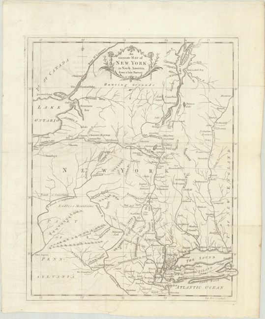
Subject: Colonial New England United States, New York
Anon.
An Accurate Map of New York in North America, from a Late Survey, 1780
Size: 10.8 x 13.3 inches (27.4 x 33.8 cm)
Estimate: $200 - $230
Lot 169
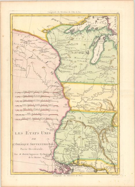
Subject: Central United States
Bonne, Rigobert
Les Etats Unis de l'Amerique Septentrionale, Partie Occidentale, 1787
Size: 9.3 x 13.6 inches (23.6 x 34.5 cm)
Estimate: $220 - $250
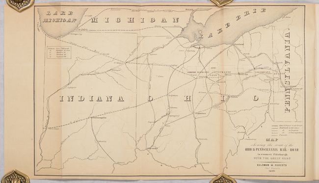
Lot 173
Subject: Pennsylvania & Ohio
Roberts, Solomon W.
[Map in Report] Map Showing the Route of the Ohio & Pennsylvania Rail-Road to Connect Pittsburgh with the Great West [in] Report to the President and Directors of the Ohio and Pennsylvania Rail-Road Company, 1849
Size: 15.1 x 9.5 inches (38.4 x 24.1 cm)
Estimate: $160 - $190

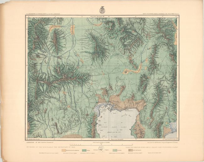
Lot 183
Subject: Western United States
Hayden, Ferdinand Vandeveer
[Lot of 2] Geological Map of Portions of Wyoming, Idaho and Utah [and] Parts of Western Wyoming, Southeastern Idaho and Northeastern Utah, 1883
Size: See Description
Estimate: $180 - $220
Colorful Maps from Hayden’s Geological and Geographical Survey of the Territories
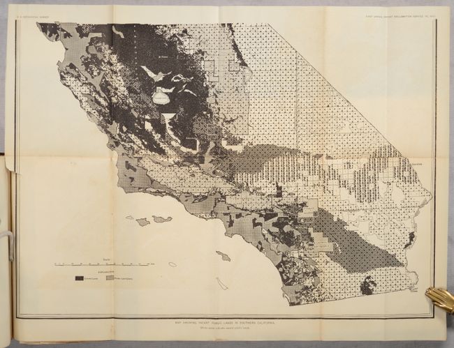
Lot 185
Subject: Western United States
U.S. Geological Survey (USGS)
First Annual Report of the Reclamation Service from June 17 to December 1, 1902, 1903
Size: 6 x 9.4 inches (15.2 x 23.9 cm)
Estimate: $140 - $170
Lot 188
Subject: Southern Idaho & Northern Utah
Wheeler, George (Lt)
[Lot of 2] Parts of Southern Idaho & Northern Utah Atlas Sheet No. 41 (A) [and] Land Classification Map of Part of South Eastern Idaho. Atlas Sheet No. 32 (C.), 1880-81
Size: 18.4 x 15.1 inches (46.7 x 38.4 cm)
Estimate: $160 - $190

Lot 191
Subject: Southwestern United States
Eddy, Gerald
Panoramic Perspective of the Area Adjacent to Las Vegas - Hoover Dam and Lake Mead National Recreation Area, 1953
Size: 30.3 x 21 inches (77 x 53.3 cm)
Estimate: $120 - $150

Lot 192
Subject: Southwestern United States
Navajoland U.S.A., 1968
Size: 27.7 x 20.6 inches (70.4 x 52.3 cm)
Estimate: $140 - $170

Lot 196
Subject: Southeastern Alaska
La Perouse, Comte Jean F. Galoup, de
Plan du Port des Francais sur la Cote du Nord-Ouest de l'Amerique, par 58°37' de Latitude Nord et 139°50' de Longitude Occidentale, Decouverte le 2 Juillet 1786, par les Fregates Francaise la Boussole et l'Astrolabe, 1797
Size: 27.3 x 19.7 inches (69.3 x 50 cm)
Estimate: $200 - $230
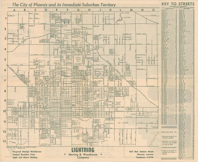
Lot 199
Subject: Phoenix, Arizona
[Lot of 3] The City of Phoenix and Its Immediate Suburban Territory [and] Map of the City of Phoenix Arizona [and] Map of the City of Phoenix Arizona, 1943-52
Size: See Description
Estimate: $160 - $190
Three Pocket Maps Document Phoenix Entering Explosive Growth Period
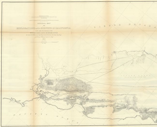
Lot 200
Subject: California
Williamson, R. S. (Lt.)
General Map of Explorations and Surveys in California Made Under the Direction of the Hon. Jefferson Davis Secretary of War..., 1853
Size: 72.4 x 24.4 inches (183.9 x 62 cm)
Estimate: $275 - $350
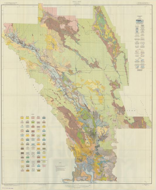
Lot 204
Subject: Napa, California
U.S.D.A.
[Map with Report] Soil Map Napa Area California [with] Soil Survey of the Napa Area, California, 1938
Size: 32.3 x 38.6 inches (82 x 98 cm)
Estimate: $180 - $220
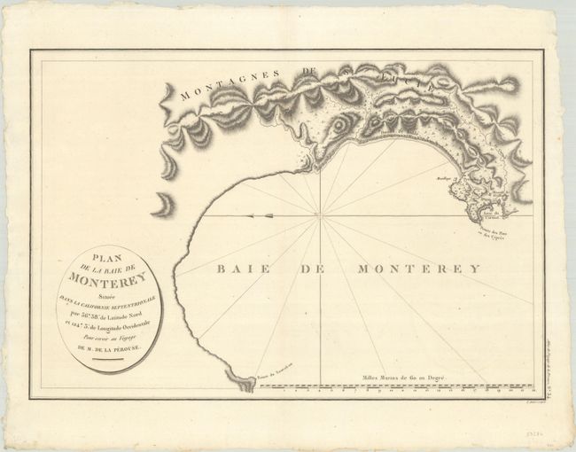
Lot 208
Subject: Monterey Bay, California
La Perouse, Comte Jean F. Galoup, de
Plan de la Baie de Monterey Situee dans la Californie Septentrionale..., 1797
Size: 19.4 x 13.2 inches (49.3 x 33.5 cm)
Estimate: $240 - $300
Earliest Obtainable Printed Map of Monterey Bay
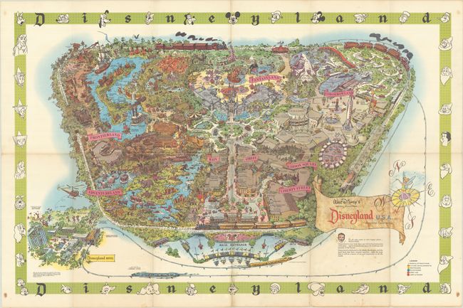
Lot 212
Subject: Anaheim, California
Walt Disney's Magic Kingdom - Disneyland U.S.A. - Anaheim, California, 1964
Size: 42.8 x 27.9 inches (108.7 x 70.9 cm)
Estimate: $180 - $220
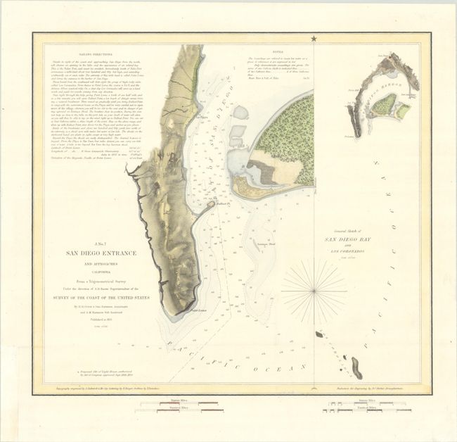
Lot 213
Subject: San Diego, California
U.S. Coast Survey
San Diego Entrance and Approaches California... [on sheet with] General Sketch of San Diego Bay and Los Coronados, 1851
Size: 13 x 11.8 inches (33 x 30 cm)
Estimate: $140 - $170

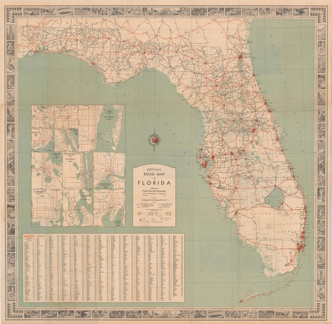
Lot 220
Subject: Florida
Conners Highway Map of Main Highways of Florida Showing Surfacing of Roads and Mileage Between Cities, 1924
Size: 10.8 x 16.8 inches (27.4 x 42.7 cm)
Estimate: $140 - $170
Map and Land Promotion for Connors' Pioneering Toll Road Through the Everglades
Lot 221
Subject: Florida
Official Road Map of Florida, 1936
Size: 27.1 x 26.6 inches (68.8 x 67.6 cm)
Estimate: $140 - $170
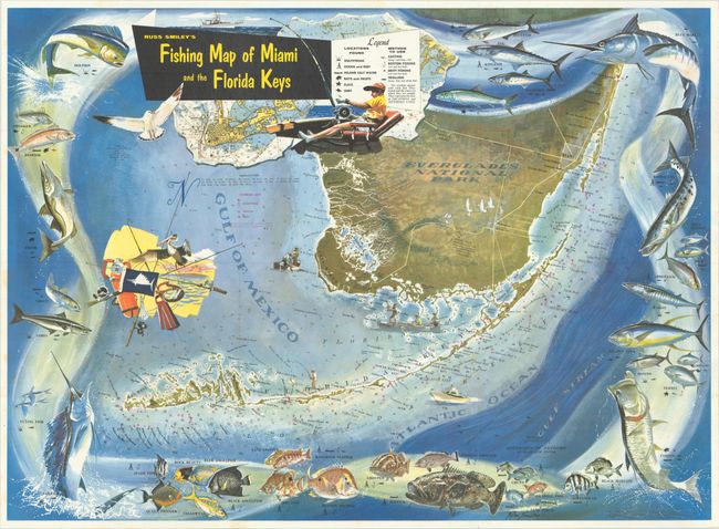
Lot 222
Subject: Southern Florida
Russ Smiley's Fishing Map of Miami and the Florida Keys, 1956
Size: 29.4 x 21.4 inches (74.7 x 54.4 cm)
Estimate: $150 - $180

Lot 225
Subject: Florida, Natives
Bry, Theodore de
[The Youth] Warinn sie ire Jugend Uben, 1591
Size: 8.3 x 6 inches (21.1 x 15.2 cm)
Estimate: $180 - $210
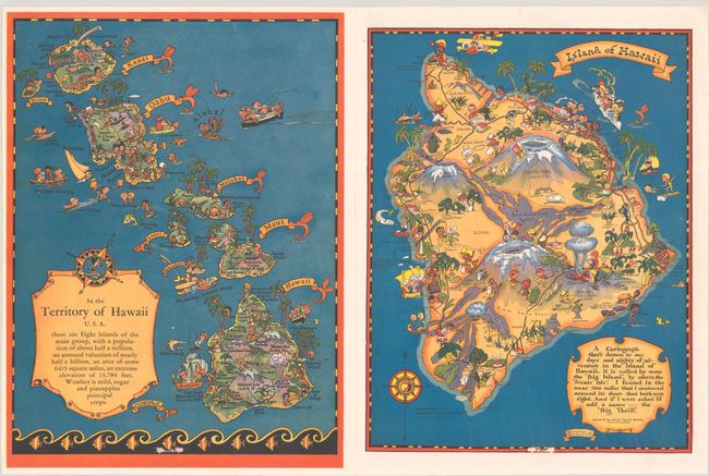
Lot 229
Subject: Hawaii
White, Ruth Taylor
[5 Maps] Aloha and Cordial Greetings from Hawaii U.S.A. [with] In the Territory of Hawaii U.S.A. [and] Island of Hawaii [and] Island of Maui [and] Island of Oahu [and] Island of Kauai, 1943
Size: 8.4 x 11.3 inches (21.3 x 28.7 cm)
Estimate: $180 - $220
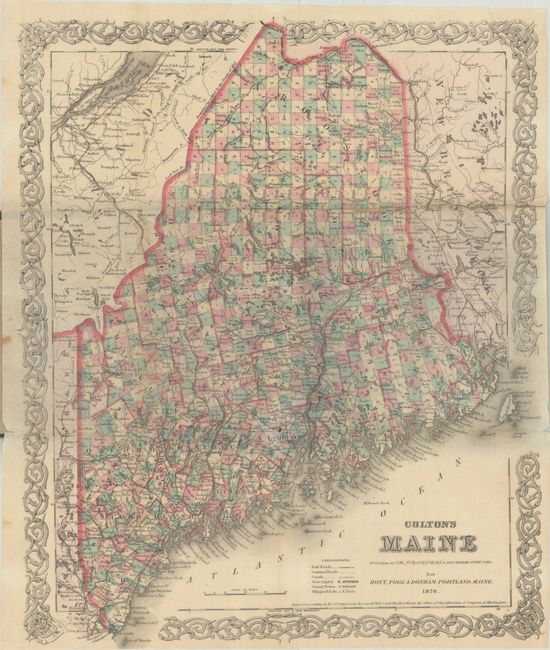
Lot 241
Subject: Maine
Colton, G.W. & C.B.
Colton's Maine, 1880
Size: 12.8 x 15.5 inches (32.5 x 39.4 cm)
Estimate: $150 - $180
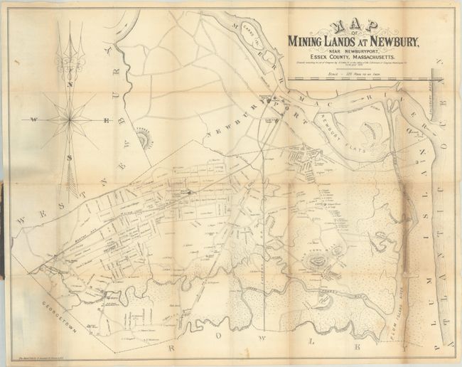
Lot 247
Subject: Newburyport, Massachusetts
Little, Jr., N.
Map of Mining Lands at Newbury, Near Newburyport, Essex County, Massachusetts, 1875
Size: 22.5 x 17.8 inches (57.2 x 45.2 cm)
Estimate: $180 - $220
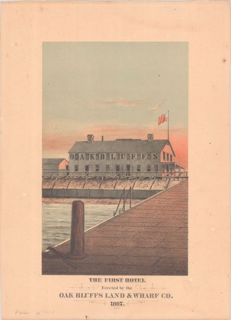
Lot 249
Subject: Martha's Vineyard, Massachusetts
The First Hotel Erected by the Oak Bluffs Land & Wharf Co. 1867, 1878
Size: 6.4 x 10.3 inches (16.3 x 26.2 cm)
Estimate: $150 - $180
Martha’s Vineyard First Hotel
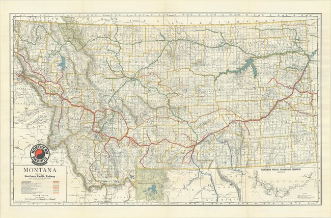
Lot 253
Subject: Montana
Railroad Companies, (Various)
Montana - Montana Railroad Map, 1948
Size: 36 x 22.2 inches (91.4 x 56.4 cm)
Estimate: $140 - $170
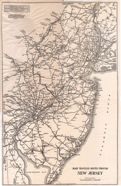
Lot 257
Subject: New Jersey
[Map in Guide] Main Traveled Routes Through New Jersey [in] Motor Highways of New Jersey, 1915
Size: 9.2 x 14.4 inches (23.4 x 36.6 cm)
Estimate: $140 - $170
Unrecorded Early New Jersey Motor Highways Tour Guide and Map
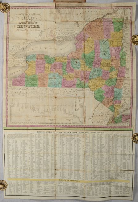
Lot 260
Subject: New York
Pierce, Justin
A Reference & Distance Map of the State of New York, 1831
Size: 19.5 x 19.1 inches (49.5 x 48.5 cm)
Estimate: $250 - $325

Lot 261
Subject: New York
Colton, G.W. & C.B.
Colton's Railroad & Township Map of the State of New York, with Parts of the Adjoining States & Canada, 1871
Size: 28.4 x 25.2 inches (72.1 x 64 cm)
Estimate: $140 - $170
180 lots
Page 1 of 4