Subject: World
Period: 1833 (dated)
Publication: Allgemeiner Hand-Atlas der Ganzen Erde
Color: Hand Color
Size:
17 x 11.8 inches
43.2 x 30 cm
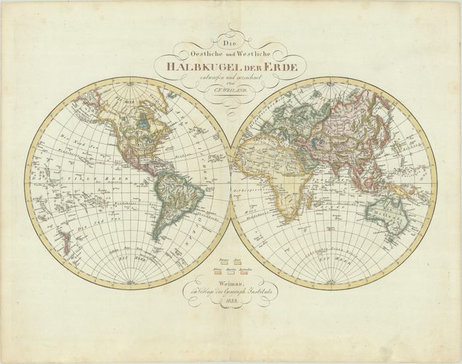
This uncommon German double-hemisphere world map features nice detail of the continents including rivers, mountains and costal place names. In North America, Mexico is in control of the Southwest and Texas is not yet named. In the Pacific Northwest, there is no established boundary with present-day Canada, reflecting the Oregon Boundary Dispute. In the Pacific Ocean, numerous islands are identified and Hokkaido is Jesso. A couple fragments of coastline near the South Pole hint at Antarctica including Graham's Land and Alexander Island. Published by Geographisches Institut.
References:
Condition: A
A crisp impression with some faint spots and minor dampstaining confined to the bottom blank margin.