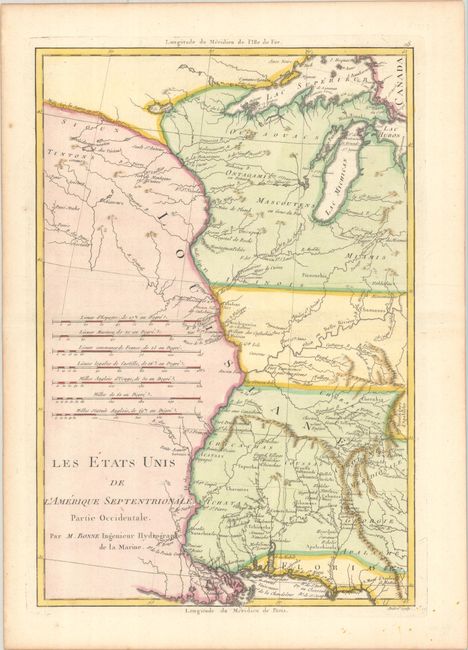
Subject: Central United States
Period: 1787 (circa)
Publication: Atlas Encyclopedique
Color: Hand Color
Size:
9.3 x 13.6 inches
23.6 x 34.5 cm
This fascinating early map of the western portion of the brand-new United States centers on the Mississippi River. The southern states' borders have been extended to the Mississippi with the western portions being Indian lands. Early settlements, frontier forts, missions, mines, Indian villages, as well as some trails and portages are revealed in great detail. Seven distance scales fill the left of the map. Engraved by Andre.
Rigobert Bonne was an important French cartographer of the late 18th century. In 1773 he succeeded Jacques Bellin as the royal cartographer in the Office of the Hydrographer at the Depot de la Marine. Working in his official capacity, Bonne compiled some of the most detailed and accurate maps of the period.
References: Phillips (Atlases) #666, Vol. 2 #118; Sellers & Van Ee #794.
Condition: A
A nice impression on a clean sheet.