Subject: North America
Period: 1806 (dated)
Publication:
Color: Black & White
Size:
8.4 x 7.3 inches
21.3 x 18.5 cm
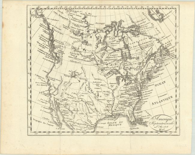
This small map of North America presents the United States extending to the Mississippi River with a large Louisiana and New Mexico to its west. There is a large Lac Pikes in the vicinity of present-day Wyoming with Teguayo and Quivira noted along its southern shore. In the north, a network of rivers and lakes connect between Hudson Bay and the Pacific Ocean, suggesting the existence of a Northwest Passage. In northern Canada, there are notations that both Mackenzie (1789) and Hearn (1771) had seen the sea. Decorated by a simple circular cartouche with fancy titiling. Engraved by Jacques Grasset Saint-Sauveur (G.S.).
References:
Condition: A
A crisp impression on a bright sheet with a bit of foxing mostly in the blank margins. Issued folding.