Current Auction
Lot 122
Current Auction

"L'Isle de Terre-Neuve l'Acadie, ou la Nouvelle Ecosse, l'Isle St. Jean et la Partie Orientale du Canada", Bonne, Rigobert
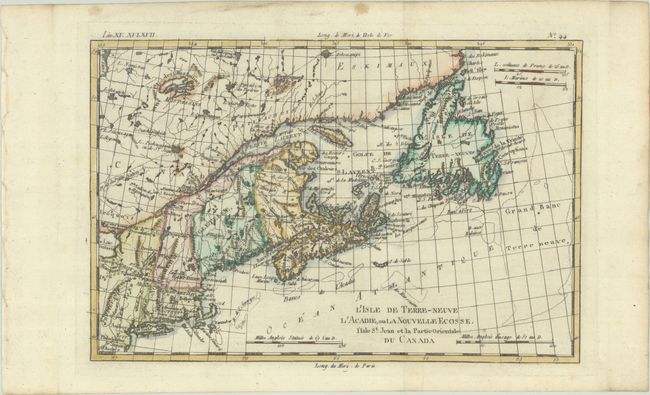
Subject: Colonial Northeastern United States & Canada

Period: 1780 (circa)

Publication: L'Histoire Philosophique et Politique…

Color: Hand Color

Size:
12.5 x 8.3 inches
31.8 x 21.1 cm
Download High Resolution Image
(or just click on image to launch the Zoom viewer)

This small map covers the Maritimes and extends as far west as Lake Ontario and south to New England and Philadelphia. Details include the provinces, towns, forts, harbors, Indian tribes, and the fishing banks in the North Atlantic.

Rigobert Bonne was an important French cartographer of the late 18th century. In 1773 he succeeded Jacques Bellin as the royal cartographer in the Office of the Hydrographer at the Depot de la Marine. Working in his official capacity, Bonne compiled some of the most detailed and accurate maps of the period.

References: Kershaw #725; McCorkle #782.3; Sellers and van Ee #172.

Condition: A

A crisp impression, issued folding on a bright, watermarked sheet with binding holes at far left and some soiling along the edges of the sheet.

Estimate: $140 - $170

Current High Bid:
$0

Reserve: Reserve Not Met
Next Bid: $70

Bid Increments
$50 - $99$5
$100 - $249$10
$250 - $499$25
$500 - $999$50
Terms & Conditions