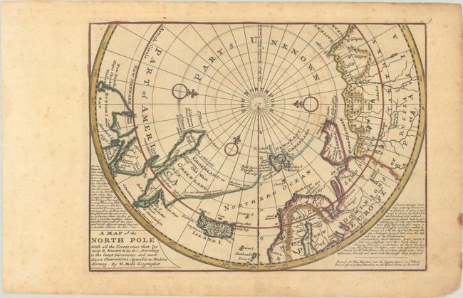
Subject: North Pole
Period: 1745 (circa)
Publication: Atlas Minor
Color: Hand Color
Size:
10.9 x 8.1 inches
27.7 x 20.6 cm
This unusual map depicts the North Pole and shows incomplete northern coastlines for North America and Greenland. Novaya Zemlya is correctly shown as an island facilitating a Northeast Passage to Asia. Above the Pole is Parts Unknown, and three compass roses complete the composition. This is the fifth state of the map, which includes a publisher's imprint, and two panels of text flanking the map, with erasures of the volume and page number outside the neatline at top left.
References: Kershaw #411; Shirley (BL Atlases) T.MOLL-9b.
Condition: B
A sharp impression with contemporary outline color that has been partially refreshed, on a lightly toned sheet with an "IA" watermark. There is scattered foxing and a few stains along the edges of the sheet.