Subject: Napa, California
Period: 1938 (published)
Publication:
Color: Printed Color
Size:
32.3 x 38.6 inches
82 x 98 cm
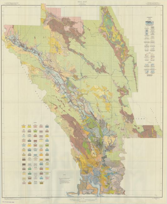
This large folding map shows the famous Napa Valley in remarkable detail on a scale of one inch per mile. The map extends from Calistoga south to Napa, and was produced as the Prohibition era ended and Napa’s wine industry began its recovery. Beautifully colored and finely engraved, the map locates all towns, villages, roads, railroads, and even individual buildings. It locates Stags Leap Manor, Zinfandel, Oak Knoll, Rutherford, Myrtledale Hot Springs, the Pacific Union College and much more. An impressive 64 geological types are identified with different colors and patterns. The extensive legend locates numerous physical features. The map is accompanied by the 76-page report "Soil Survey of the Napa Area, California" with printed paper wrappers. The map and report have been rebound in a very neat library binding with map housed in a rear pocket. Hardbound in blue cloth with gilt title on the spine.
References:
Condition: A
The folding map is very clean and colorful with an old library stamp in the bottom blank margin. Text is clean and bright with some old library markings on the front wrapper. Modern library binding has minimal wear with a "discard" stamp on the front endpaper.