Filtered by Category:United States(Show All Categories)
Showing results for:Auction 94
Catalog Archive
87 lots
Page 1 of 2
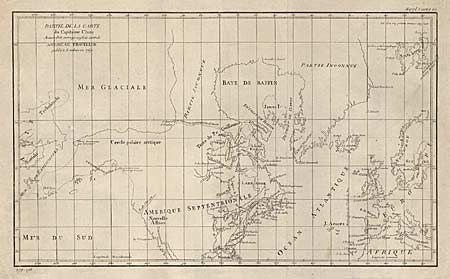
Auction 94, Lot 79
Subject: Western Hemisphere
Robert de Vaugondy, Didier
Partie de la Carte du Capitaine Cluny Auteur d'un ouvrage Anglois Intitule American Traveller, 1769
Size: 19 x 11.2 inches (48.3 x 28.4 cm)
Estimate: $200 - $250
Sold for: $150
Closed on 3/7/2001
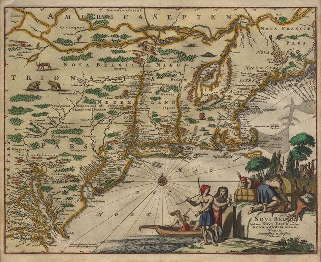
Auction 94, Lot 88
Subject: Colonial America
Montanus, Arnoldus
Novi Belgii, quod nunc Novi Jorck Vocatur, Novae qz. Angliae & Partis Virginiae Accuratissima et Novissima Delineatio, 1671
Size: 14.5 x 11.5 inches (36.8 x 29.2 cm)
Estimate: $1,800 - $2,000
Sold for: $1,900
Closed on 3/7/2001
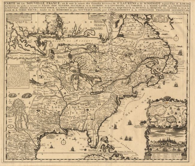
Auction 94, Lot 89
Subject: Colonial America
Chatelain, Henry Abraham
Carte de la Nouvelle France, ou se voit le cours des Grandes Rivieres de S. Laurens & de Mississipi Aujour d'hui S. Louis, Aux Environs des-quelles se trouvent les Etats, Pais, Nations, Peuples &c., 1719
Size: 19 x 16.5 inches (48.3 x 41.9 cm)
Estimate: $2,200 - $2,400
Sold for: $1,800
Closed on 3/7/2001
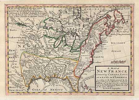
Auction 94, Lot 91
Subject: Colonial United States and Canada
Moll, Herman
A Map of New France Containing Canada, Louisiana &c. in Nth. America According to the Patent granted by the King of France to Monsieur Crozat, dated the 14th of Sep. 1712 N.S. and registered in the Parliament of Paris the 24th of the same Month, 1745
Size: 10.2 x 7.2 inches (25.9 x 18.3 cm)
Estimate: $400 - $450
Sold for: $475
Closed on 3/7/2001
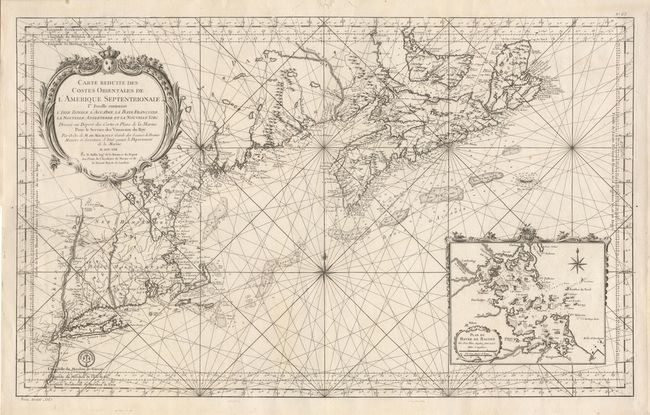
Auction 94, Lot 92
Subject: Colonial Canada and United States
Bellin, Jacques Nicolas
Carte Reduite des Costes Orientales de l'Amerique Septentrionale. 1st Feuille Contenant l'Isle Royale, l'Accadie, la Bay Francoise, la Nouvelle Angleterre et la Nouvelle Yorc …, 1757
Size: 35 x 21.5 inches (88.9 x 54.6 cm)
Estimate: $2,750 - $3,250
Sold for: $2,300
Closed on 3/7/2001
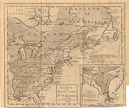
Auction 94, Lot 93
Subject: Colonial Canada and United States
Gibson, John
An Accurate Map of the British Empire in Nth. America as settled by the Preliminaries in 1762., 1762
Size: 9.5 x 8 inches (24.1 x 20.3 cm)
Estimate: $220 - $250
Sold for: $325
Closed on 3/7/2001
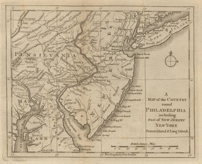
Auction 94, Lot 94
Subject: Colonial Mid-Atlantic
Anon.
A Map of the Country round Philadelphia including Part of New Jersey, New York, Staten Island & Long Island, 1776
Size: 8.7 x 7.1 inches (22.1 x 18 cm)
Estimate: $200 - $250
Sold for: $210
Closed on 3/7/2001

Auction 94, Lot 95
Subject: Colonial New York
Mount & Page
A Draught of New York from the Hook to New York Town by Mark Tiddeman, 1755-80
Size: 22.2 x 18 inches (56.4 x 45.7 cm)
Estimate: $1,300 - $1,400
Unsold
Closed on 3/7/2001
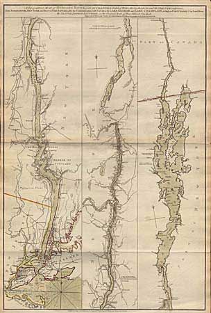
Auction 94, Lot 96
Subject: Colonial New York
Sauthier/Faden
A Topographical Map of Hudson's River … from Sandy-Hook … to Fort Edward, also the Communication with Canada by Lake George and Lake Champlain, as high as Fort Chambly on Sorel River, 1776
Size: 20.7 x 31 inches (52.6 x 78.7 cm)
Estimate: $3,500 - $4,000
Sold for: $3,500
Closed on 3/7/2001
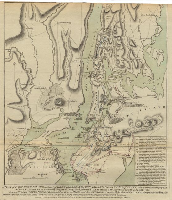
Auction 94, Lot 97
Subject: Colonial America - New York
Faden, William
A Plan of New York Island with part of Long Island, Staten Island & East New Jersey, with a particular Description of the Engagement on the Woody Heights of Long Island … on the 27th of August 1776, 1776
Size: 16.6 x 18.6 inches (42.2 x 47.2 cm)
Estimate: $4,500 - $5,500
Unsold
Closed on 3/7/2001
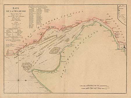
Auction 94, Lot 98
Subject: Colonial America
Le Rouge, George Louis
Baye de la Delaware Avec les Ports, Sondes, Dangers, Bancs. &c. depuis les Caps, Jusqu'q Philadelphie de'Apres la Carte de Joshua Fisher publiee a Philadelphie, 1777
Size: 25 x 18.2 inches (63.5 x 46.2 cm)
Estimate: $3,750 - $4,000
Sold for: $2,200
Closed on 3/7/2001
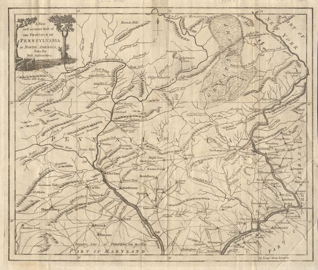
Auction 94, Lot 99
Subject: Colonial America
Anon.
A New and accurate Map of the Province of Pennsylvania in North America, from the Best Authorities, 1780
Size: 12.8 x 10.6 inches (32.5 x 26.9 cm)
Estimate: $450 - $550
Sold for: $300
Closed on 3/7/2001
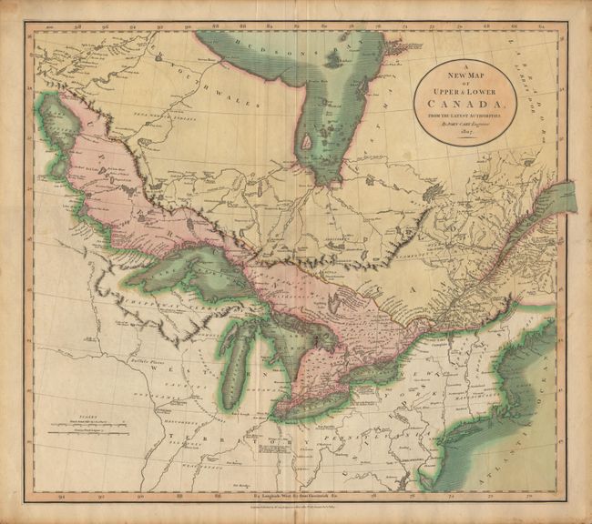
Auction 94, Lot 104
Subject: Canada and United States
Cary, John
A New Map of Upper & Lower Canada From the Latest Authorities, 1807
Size: 20 x 18 inches (50.8 x 45.7 cm)
Estimate: $300 - $400
Sold for: $400
Closed on 3/7/2001

Auction 94, Lot 105
Subject: Canada and United States
SDUK Society for the Diffusion of Useful Knowledge
[Set of 15 maps], 1832-34
Size: 12 x 15 inches (30.5 x 38.1 cm)
Estimate: $1,300 - $1,400
Unsold
Closed on 3/7/2001
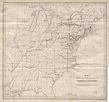
Auction 94, Lot 106
Subject: Eastern United States
Map Shewing the Routes of the Principal Canals & Railways in the United States & Canada, 1841
Size: 10.2 x 9.5 inches (25.9 x 24.1 cm)
Estimate: $30 - $50
Sold for: $95
Closed on 3/7/2001
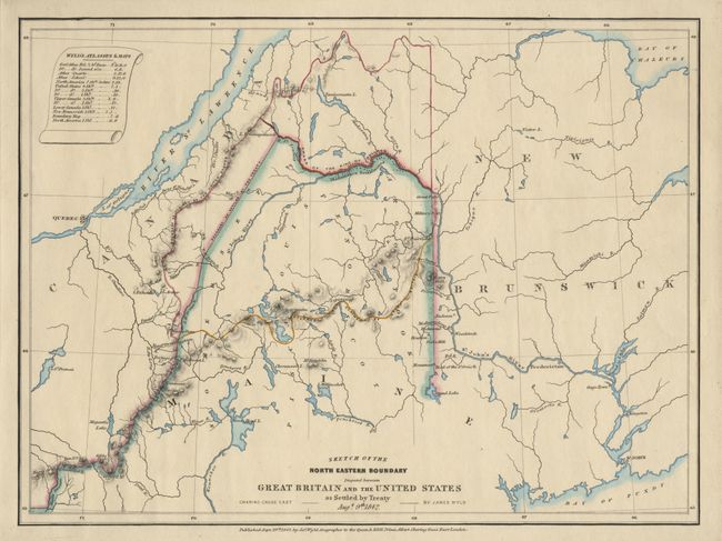
Auction 94, Lot 107
Subject: Canda and United States
Wyld
Sketch of the North Eastern Boundary disputed between Great Britain and the United States as Settled by Treaty Augt. 9th 1842, 1842
Size: 12.6 x 9.4 inches (32 x 23.9 cm)
Estimate: $150 - $200
Sold for: $140
Closed on 3/7/2001
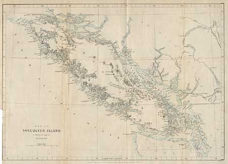
Auction 94, Lot 108
Subject: Canada and United States
Murray, J.
Map of Vancouver Island to illustrate the Paper of Dr. D.C. Forbes, R.N., 1864
Size: 14.5 x 10.5 inches (36.8 x 26.7 cm)
Estimate: $70 - $90
Sold for: $85
Closed on 3/7/2001
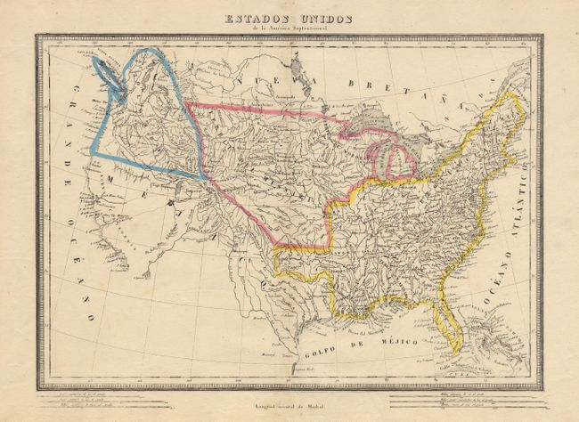
Auction 94, Lot 109
Subject: United States
Alabern, Pablo
Estados Unidos de la America Septentrional, 1817
Size: 16.1 x 11.3 inches (40.9 x 28.7 cm)
Estimate: $400 - $450
Sold for: $600
Closed on 3/7/2001
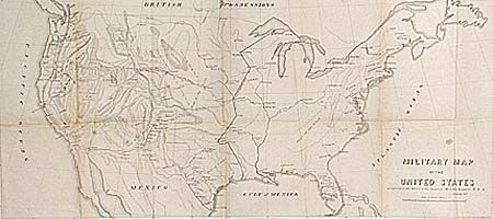
Auction 94, Lot 110
Subject: United States
U.S. War Dept.
Military Map of the United States, 1857
Size: 29.3 x 13.5 inches (74.4 x 34.3 cm)
Estimate: $150 - $200
Sold for: $120
Closed on 3/7/2001
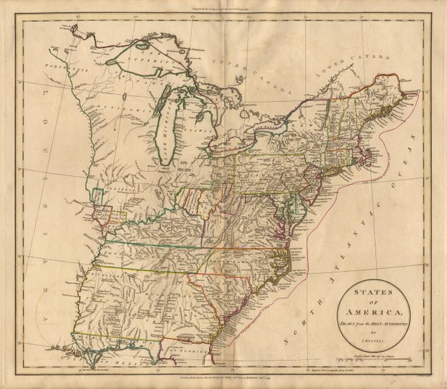
Auction 94, Lot 111
Subject: Eastern United States
Russell, John C.
States of America, Drawn from the Best Authorities, 1799
Size: 17.7 x 15.5 inches (45 x 39.4 cm)
Estimate: $300 - $400
Sold for: $350
Closed on 3/7/2001
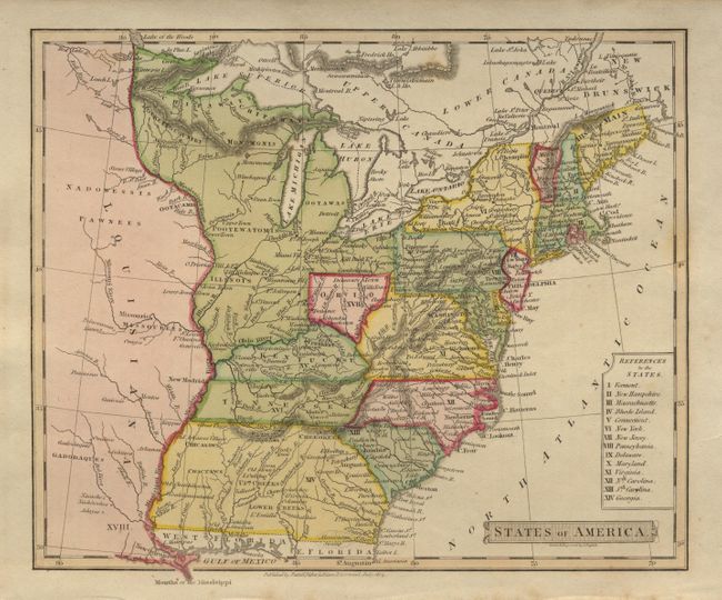
Auction 94, Lot 112
Subject: Eastern United States
Russell, John C.
States of America, 1814
Size: 8.8 x 7.2 inches (22.4 x 18.3 cm)
Estimate: $200 - $250
Sold for: $425
Closed on 3/7/2001
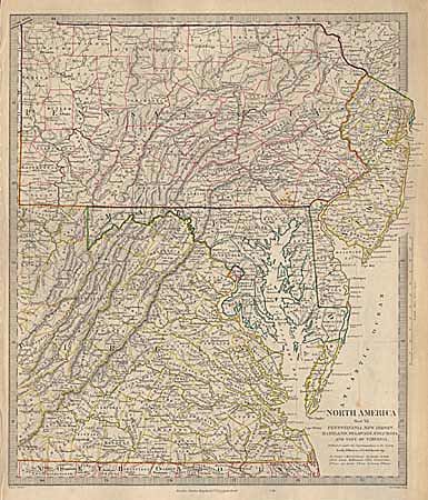
Auction 94, Lot 113
Subject: Eastern United States
SDUK Society for the Diffusion of Useful Knowledge
North America Sheet VII - Pennsylvania, New Jersey, Maryland, Delaware, Columbia and part of Virginia, 1844-52
Size: 12.3 x 14.5 inches (31.2 x 36.8 cm)
Estimate: $60 - $90
Sold for: $0
Closed on 3/7/2001
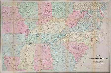
Auction 94, Lot 114
Subject: Southcentral United States
U.S. War Department
Map of United States Military Rail Roads, Showing the Rail Roads Operated during the War from 1862-1866, as Military Lines under the Direction of Bvt. Brig. Gen. B.C. McCallum, Director and General Manager, 1866
Size: 38.2 x 25 inches (97 x 63.5 cm)
Estimate: $300 - $400
Sold for: $275
Closed on 3/7/2001
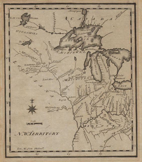
Auction 94, Lot 115
Subject: North Central United States
Scott, Joseph
N. W. Territory, 1800
Size: 6.1 x 7.2 inches (15.5 x 18.3 cm)
Estimate: $200 - $250
Sold for: $800
Closed on 3/7/2001
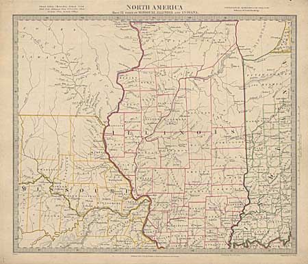
Auction 94, Lot 116
Subject: Central United States
SDUK Society for the Diffusion of Useful Knowledge
North America Sheet IX parts of Missouri, Illinois and Indiana, 1833
Size: 14.1 x 12 inches (35.8 x 30.5 cm)
Estimate: $120 - $150
Sold for: $90
Closed on 3/7/2001
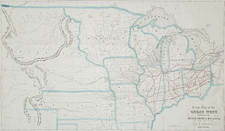
Auction 94, Lot 117
Subject: Central United States
Beadle, D. W.
A New Map of the Great West, 1856
Size: 25.2 x 14.7 inches (64 x 37.3 cm)
Estimate: $150 - $250
Sold for: $300
Closed on 3/7/2001
Auction 94, Lot 118
Subject: Central United States
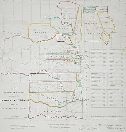
U.S. War Dept.
Map Showing the Lands assigned to Emigrant Indians West of Arkansas & Missouri, 1860
Size: 17.7 x 18.7 inches (45 x 47.5 cm)
Estimate: $325 - $375
Sold for: $300
Closed on 3/7/2001
Auction 94, Lot 119
Subject: Central United States
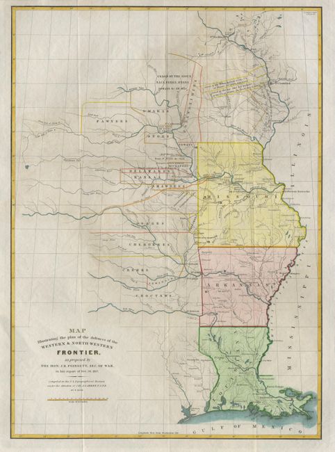
Poinsett, J. R.
Map Illustrating the plan of the defences of the Western & North-Western Frontier, as proposed by the Hon: J.R. Poinsett, Sec. of War, in his report of Dec. 30, 1837, 1860
Size: 15.4 x 21.3 inches (39.1 x 54.1 cm)
Estimate: $375 - $425
Sold for: $375
Closed on 3/7/2001
Auction 94, Lot 120
Subject: Central United States
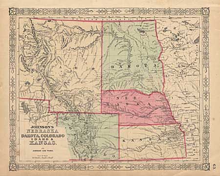
Johnson and Ward
Johnson's Nebraska, Dakota, Colorado, Idaho & Kansas, 1864
Size: 15.5 x 12.5 inches (39.4 x 31.8 cm)
Estimate: $70 - $90
Sold for: $120
Closed on 3/7/2001
Auction 94, Lot 121
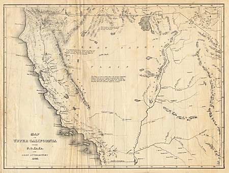
Subject: Western United States
Wilkes, Charles
Map of Upper California by the U.S. Ex. Ex. And Best Authorities, 1841
Size: 11.2 x 8.5 inches (28.4 x 21.6 cm)
Estimate: $220 - $250
Sold for: $120
Closed on 3/7/2001
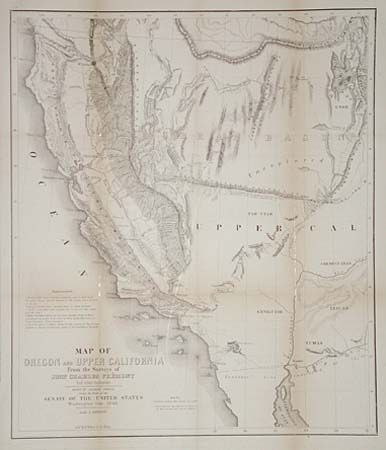
Auction 94, Lot 122
Subject: Western United States
Fremont/Preuss
Map of Oregon and Upper California from the Surveys of John Charles Fremont and other Authorities, 1848
Size: 16.5 x 19.5 inches (41.9 x 49.5 cm)
Estimate: $350 - $400
Sold for: $325
Closed on 3/7/2001
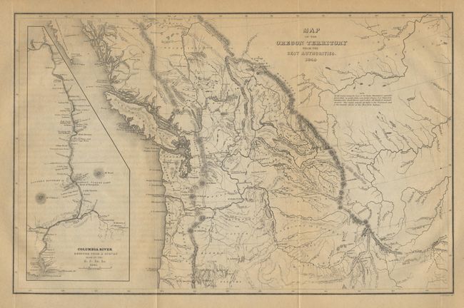
Auction 94, Lot 123
Subject: Northwestern United States
Wilkes, Charles
Map of the Oregon Territory by the U.S. Ex. Ex, 1849
Size: 8.5 x 13 inches (21.6 x 33 cm)
Estimate: $350 - $400
Sold for: $325
Closed on 3/7/2001
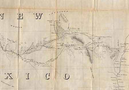
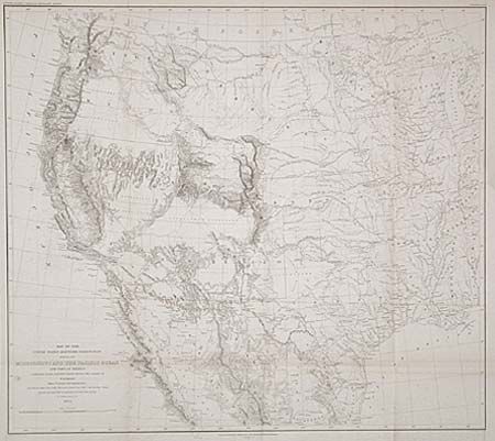
Auction 94, Lot 124
Subject: Southwestern United States
Whipple, Amiel Weekes
Map No. 2. From the Rio Grande to the Pacific Ocean…under the direction of the Hon. Jefferson Davis…by Lieut. A.W. Whipple, Topogl. Engrs. And Lieut. J.C. Ives, Topogl. Engrs., 1853-54
Size: 52 x 22 inches (132.1 x 55.9 cm)
Estimate: $450 - $500
Sold for: $160
Closed on 3/7/2001
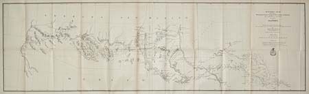
Auction 94, Lot 125
Subject: Southwestern United States
Whipple, Amiel Weekes
Map No. 2. Reconnaissance and Survey of a Railway Route from the Mississippi River near 35th parallel North Lat to Pacific Ocean…by Lieut. A.W. Whipple…J.C. Ives Top Eng…A.H. Campbell Civ. Eng. 1853-4, 1853-54
Size: 75 x 26.2 inches (190.5 x 66.5 cm)
Estimate: $300 - $350
Sold for: $150
Closed on 3/7/2001
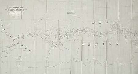
Auction 94, Lot 126
Subject: New Mexico
Whipple, Amiel Weekes
Preliminary Map of the Western Portion of the Reconnaissance and Survey for a Pacific Railroad Route Near the 35th Parallel Made by Capt. A.W. Whipple. T.E. in 1853-4…, 1858
Size: 48.7 x 26.2 inches (123.7 x 66.5 cm)
Estimate: $200 - $250
Sold for: $190
Closed on 3/7/2001
Auction 94, Lot 127
Subject: Southwestern United States
Outline Map showing a New Route from Texas to Fort Yuma, California, for Cattle Droves and Trains En route to California, 1870
Size: 14.5 x 49 inches (36.8 x 124.5 cm)
Estimate: $200 - $250
Sold for: $150
Closed on 3/7/2001
Auction 94, Lot 128
Subject: Western United States and Mexico
Emory, William Hemsley
Map of the United States and Their Territories Between the Mississippi and the Pacific Ocean and Part of Mexico Compiled from Surveys…, 1857-8
Size: 23 x 20.2 inches (58.4 x 51.3 cm)
Estimate: $300 - $350
Sold for: $375
Closed on 3/7/2001
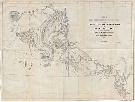
Auction 94, Lot 129
Subject: Western United States
U.S. War Department
Map of a Reconnaissance for a Military Road from the Dalles of the Columbia River to Great Salt Lake under the command of Capt. H.D. Wallen. 4th Inf. By Lieut. Joseph Dixon, T. Engrs, 1859
Size: 21.7 x 16.4 inches (55.1 x 41.7 cm)
Estimate: $120 - $150
Sold for: $160
Closed on 3/7/2001
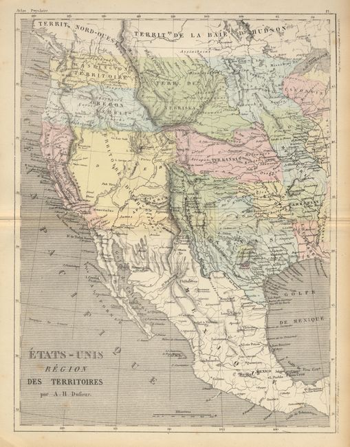
Auction 94, Lot 130
Subject: United States & Mexico
Dufour, Guillaume Henri
Etats-Unis Region des Territoires, 1860
Size: 9.5 x 12.5 inches (24.1 x 31.8 cm)
Estimate: $120 - $150
Sold for: $475
Closed on 3/7/2001
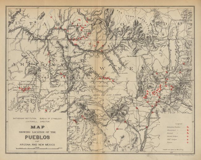
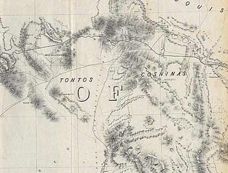
Auction 94, Lot 131
Subject: Arizona and New Mexico
U.S. Bureau of Ethnology
Map of the Province of Tusayan, Arizona Surveyed by A.L. Webster, 1881 [together with] Map Showing the Location of the Pueblos of Arizona and New Mexico, 1881
Size: 11.1 x 8 inches (28.2 x 20.3 cm)
Estimate: $250 - $300
Sold for: $140
Closed on 3/7/2001
Auction 94, Lot 132
Subject: California
U.S. Government
[Lot of 2], 1848
Size: 18.2 x 9.5 inches (46.2 x 24.1 cm)
Estimate: $300 - $350
Sold for: $240
Closed on 3/7/2001
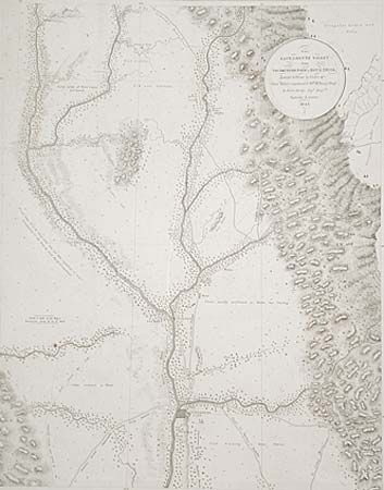
Auction 94, Lot 133
Subject: California
Derby, George Horatio (Lt)
The Sacramento Valley from American River to Butte Creek, Surveyed and drawn by Order of Genl. Riley , commandg. 10th Military Dept. by Lieut. Derby, Topl. Engrs. September & October 1849, 1849
Size: 17.5 x 22.5 inches (44.5 x 57.2 cm)
Estimate: $250 - $300
Sold for: $220
Closed on 3/7/2001
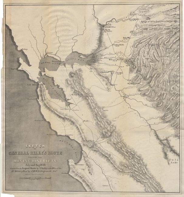
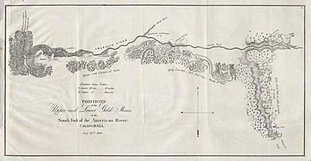
Auction 94, Lot 134
Subject: California & Gold Rush
Derby, George Horatio (Lt)
Sketch of General Riley's Route Through the Mining Districts July and Aug. 1849, 1850
Size: 19.8 x 21 inches (50.3 x 53.3 cm)
Estimate: $400 - $500
Sold for: $325
Closed on 3/7/2001
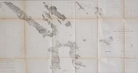
Auction 94, Lot 135
Subject: California
U.S. Coast Survey
Preliminary Chart of Entrance to San Francisco Bay California, 1856
Size: 38.7 x 20 inches (98.3 x 50.8 cm)
Estimate: $220 - $275
Sold for: $160
Closed on 3/7/2001
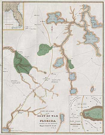
Auction 94, Lot 136
Subject: Florida
U.S. War Dept.
Copy of a Map of the Seat of War in Florida, 1836
Size: 12.2 x 15.7 inches (31 x 39.9 cm)
Estimate: $150 - $180
Sold for: $120
Closed on 3/7/2001
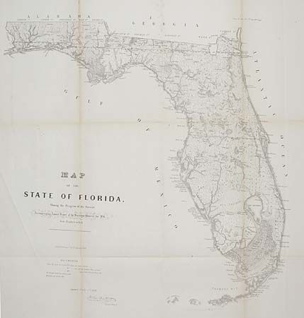
Auction 94, Lot 137
Subject: Florida
U.S. State Surveys
Map of the State of Florida Showing the Progress of the Surveys…, 1856
Size: 26.5 x 28.5 inches (67.3 x 72.4 cm)
Estimate: $150 - $180
Sold for: $170
Closed on 3/7/2001
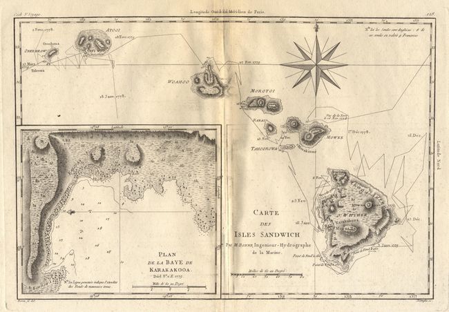
Auction 94, Lot 138
Subject: Hawaii
Bonne, Rigobert
Carte des Isles Sandwich, 1780
Size: 13.5 x 9 inches (34.3 x 22.9 cm)
Estimate: $350 - $400
Sold for: $275
Closed on 3/7/2001
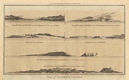
Auction 94, Lot 139
Subject: Hawaii
Hogg, Alexander
Views of Sandwich Islands, 1784
Size: 14.2 x 8.2 inches (36.1 x 20.8 cm)
Estimate: $60 - $80
Sold for: $90
Closed on 3/7/2001
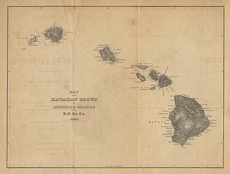
Auction 94, Lot 140
Subject: Hawaii
Wilkes, Charles
Map of the Hawaiian Group or Sandwich Islands by the U.S. Ex. Ex., 1841
Size: 11 x 8.4 inches (27.9 x 21.3 cm)
Estimate: $150 - $200
Sold for: $190
Closed on 3/7/2001
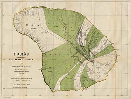
Auction 94, Lot 141
Subject: Hawaii
Hawaii Territorial Surveys
Lanai Government Survey, 1878
Size: 26.3 x 19.5 inches (66.8 x 49.5 cm)
Estimate: $100 - $130
Sold for: $140
Closed on 3/7/2001
87 lots
Page 1 of 2