Catalog Archive
Auction 94, Lot 97
"A Plan of New York Island with part of Long Island, Staten Island & East New Jersey, with a particular Description of the Engagement on the Woody Heights of Long Island … on the 27th of August 1776", Faden, William
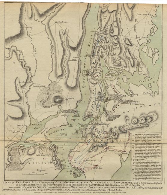
Subject: Colonial America - New York
Period: 1776 (dated)
Publication: North American Atlas
Color: Hand Color
Size:
16.6 x 18.6 inches
42.2 x 47.2 cm
Download High Resolution Image
(or just click on image to launch the Zoom viewer)
(or just click on image to launch the Zoom viewer)