Subject: Northwestern United States
Period: 1849 (dated)
Publication: U.S. Exploring Expedition
Color: Black & White
Size:
8.5 x 13 inches
21.6 x 33 cm
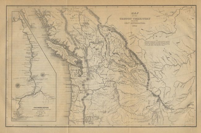
This map was a major contribution to American cartography and the most detailed map of the region north of the Sacramento River. It provided Americans with an accurate view of an area still almost unknown. Wilkes supported the view of Senator Lewis Linn that the boundary of the American claim should be 54 deg. 40' N. This map was used to support his claim, which was based on 'topographical' grounds and was instrumental in setting the scene for American interests in the territory. Large inset of the Columbia River from Ft. Walla Walla to its mouth, where one of Wilkes' ships, the "Peacock", was lost on the famous Columbia Bar.
References: Wheat (TMW) #655, and Hayes #199.
Condition: B