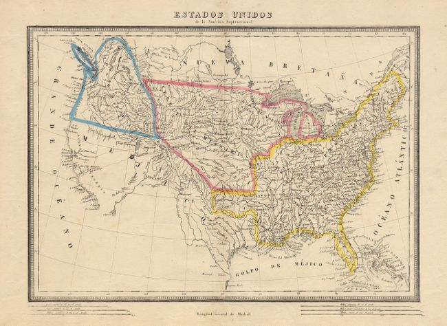
Subject: United States
Period: 1817 (circa)
Publication:
Color: Hand Color
Size:
16.1 x 11.3 inches
40.9 x 28.7 cm
Very uncommon Spanish map showing the United States at the beginning of the westward expansion. Alabama and Mississippi are territories. West of the Mississippi River there are several provisional divisions including Arkansas, Lawrence and Howard. The upper Mid-West includes the territories of Northwest, Illinois, and Missouri. The Pacific Northwest is named Columbia and includes the U.S. claims into present-date British Columbia. Mexico controls all of the present-day Southwest and Texas. Two rivers in the west are shown by dotted line linking Lake Timpanogos with the Pacific. Keyboard style border. The map is filled with detail and the names of Indian tribes.
References:
Condition: A
Slight toning along fold and light foxing in margins.