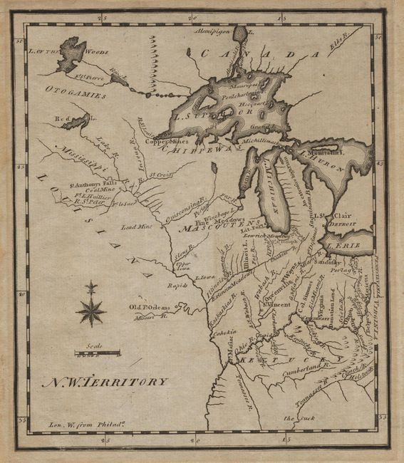
Subject: North Central United States
Period: 1800 (circa)
Publication:
Color: Black & White
Size:
6.1 x 7.2 inches
15.5 x 18.3 cm
The earliest printed map to show the North West Territory. It covers the region of the upper Mississippi valley and the Great Lakes. It shows the rivers and streams together with settlements, mines and forts. Lit. Fort appears at the mouth of the Chicago River and Old Ft. Orleans appears on the Missouri River. The southern end of Lake Michigan is placed almost a full degree further north than the southern shore of Lake Erie, an error which resulted in a series of boundary disputes between Michigan and its neighbors in the 19th century. The fictitious Charlevoix-Bellin islands appear in Lake Superior. This is the second state of this important map as evidenced by the re-engraved city locators for Detroit, Sandusky and Marietta.
References: Wheat & Brun #674; Kershaw #CXIII.
Condition: A
Slight mat burn in margins with a tiny hole in bottom margin, well away from image.