Catalog Archive
Auction 94, Lot 121

"Map of Upper California by the U.S. Ex. Ex. And Best Authorities", Wilkes, Charles

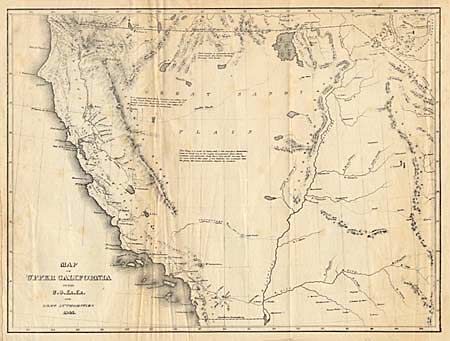
Subject: Western United States

Period: 1841 (dated)

Publication: U.S. Exploring Expedition

Color: Black & White

Size:
11.2 x 8.5 inches
28.4 x 21.6 cm
Download High Resolution Image
(or just click on image to launch the Zoom viewer)

Folding map covering all the American West south of 42 deg. N. and west of the Rocky (Anahuac) Mountains, with by far the greatest detail in California. The Colorado River is shown trending in an odd straight course. The Great Basin is called the Great Sandy Basin and is crossed by Smith's Track. Interesting notes explain the unknown qualities of the land and describe the Indians as "the most miserable objects of creation".

References: Wheat #458.

Condition: B

Folding as issued.

Estimate: $220 - $250

Sold for: $120

Closed on 3/7/2001

Archived