Catalog Archive
Auction 94, Lot 124

"Map No. 2. From the Rio Grande to the Pacific Ocean…under the direction of the Hon. Jefferson Davis…by Lieut. A.W. Whipple, Topogl. Engrs. And Lieut. J.C. Ives, Topogl. Engrs.", Whipple, Amiel Weekes

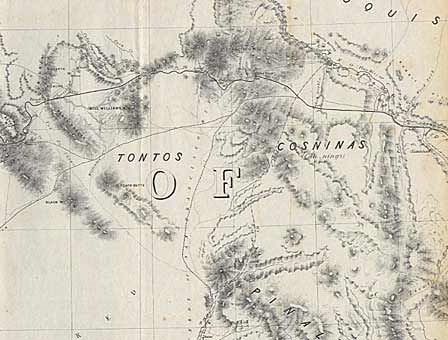
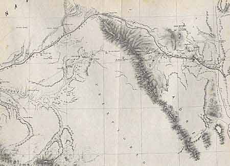
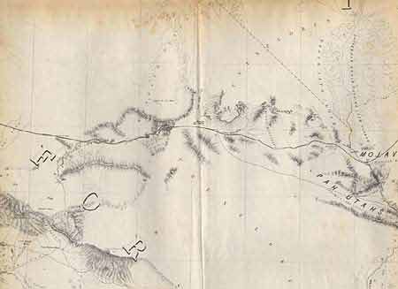
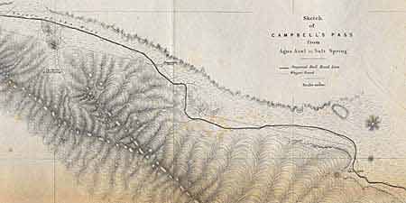
Subject: Southwestern United States

Period: 1853-54 (dated)

Publication: Pacific RR Reports, quarto edition. Vol XI, 33rd Congress

Color: Black & White

Size:
52 x 22 inches
132.1 x 55.9 cm
Download High Resolution Image
(or just click on image to launch the Zoom viewer)

An impressive and notable map that covers the railroad surveys between Albuquerque and Los Angeles. Insets: Sketches Aztec Pass & Campbell's Pass from Agua Azul to Salt Spring. It carries the route from Isleta (on the Rio Grande) past Laguna through Campbell's Pass and down the Rio Puerco of the West across the Territory of New Mexico/Arizona to Los Angeles. Topography and hydrography are shown in great detail. Zuni and Inscription Rock are shown on the trail of Lt. Beckwith in 1847.

References: Wheat TMW 875.

Condition: B

Backed with archival tissue, toned along folds.

Estimate: $450 - $500

Sold for: $160

Closed on 3/7/2001

Archived