Catalog Archive
Auction 94, Lot 125
"Map No. 2. Reconnaissance and Survey of a Railway Route from the Mississippi River near 35th parallel North Lat to Pacific Ocean…by Lieut. A.W. Whipple…J.C. Ives Top Eng…A.H. Campbell Civ. Eng. 1853-4", Whipple, Amiel Weekes
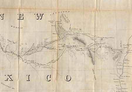
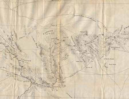
Subject: Southwestern United States
Period: 1853-54 (dated)
Publication: Pacific RR Surveys, octavo edition
Color: Black & White
Size:
75 x 26.2 inches
190.5 x 66.5 cm
Download High Resolution Image
(or just click on image to launch the Zoom viewer)
(or just click on image to launch the Zoom viewer)