Subject: Eastern United States
Period: 1799 (dated)
Publication:
Color: Hand Color
Size:
17.7 x 15.5 inches
45 x 39.4 cm
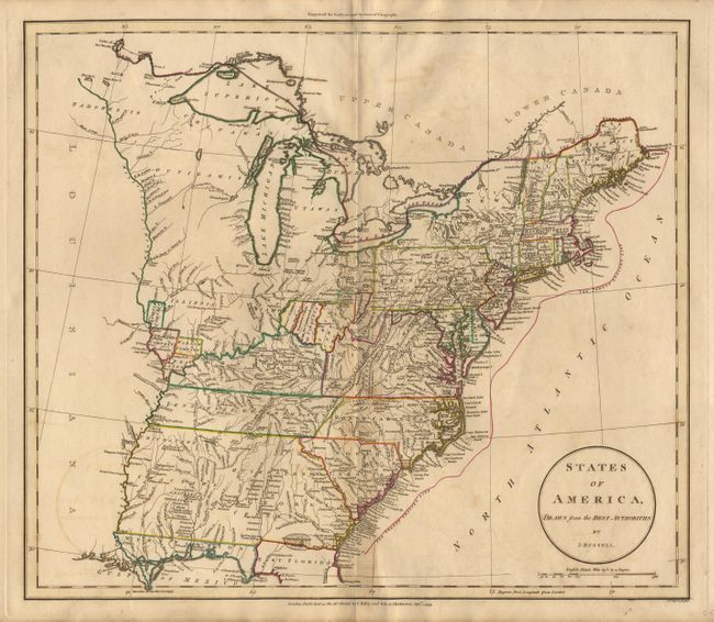
Detailed copper engraved map that extends to the Mississippi, but shows only the northern portion of Florida Filled with information on rivers, settlements, Indian tribes, etc. Shows several interesting areas including: Ohio Company, Donation Lands from the Commonwealth of Virginia, a region labeled simply 'Col. Simmes', Seven Ranges, and Tennessee Government. Indiana is named, but is a small area at the northwest corner of Virginia and below the Seven Ranges tract. Michigan is nearly blank with the name "Utawas" at its center, and several Indian tribes are located in the Wisconsin/Minnesota area, but nothing else. Near the confluence of the Mississippi and Missouri rivers are lands belonging to the Illinois, New Jersey, Wabash Companies and Army Lands.
References:
Condition: B
Delicate coloring on early machine-made paper.