Filtered by Category:Canada(Show All Categories)
Showing results for:Auction 94
Catalog Archive
14 lots
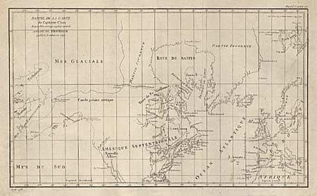
Auction 94, Lot 79
Subject: Western Hemisphere
Robert de Vaugondy, Didier
Partie de la Carte du Capitaine Cluny Auteur d'un ouvrage Anglois Intitule American Traveller, 1769
Size: 19 x 11.2 inches (48.3 x 28.4 cm)
Estimate: $200 - $250
Sold for: $150
Closed on 3/7/2001
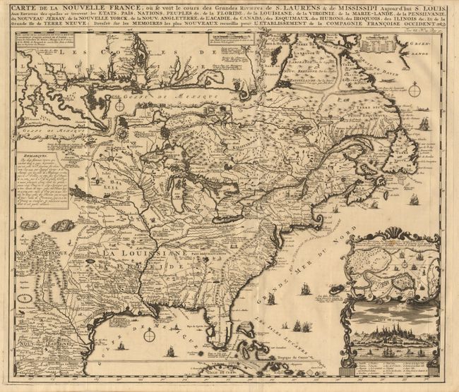
Auction 94, Lot 89
Subject: Colonial America
Chatelain, Henry Abraham
Carte de la Nouvelle France, ou se voit le cours des Grandes Rivieres de S. Laurens & de Mississipi Aujour d'hui S. Louis, Aux Environs des-quelles se trouvent les Etats, Pais, Nations, Peuples &c., 1719
Size: 19 x 16.5 inches (48.3 x 41.9 cm)
Estimate: $2,200 - $2,400
Sold for: $1,800
Closed on 3/7/2001
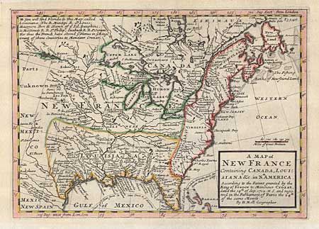
Auction 94, Lot 91
Subject: Colonial United States and Canada
Moll, Herman
A Map of New France Containing Canada, Louisiana &c. in Nth. America According to the Patent granted by the King of France to Monsieur Crozat, dated the 14th of Sep. 1712 N.S. and registered in the Parliament of Paris the 24th of the same Month, 1745
Size: 10.2 x 7.2 inches (25.9 x 18.3 cm)
Estimate: $400 - $450
Sold for: $475
Closed on 3/7/2001
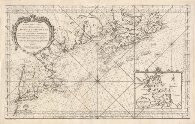
Auction 94, Lot 92
Subject: Colonial Canada and United States
Bellin, Jacques Nicolas
Carte Reduite des Costes Orientales de l'Amerique Septentrionale. 1st Feuille Contenant l'Isle Royale, l'Accadie, la Bay Francoise, la Nouvelle Angleterre et la Nouvelle Yorc …, 1757
Size: 35 x 21.5 inches (88.9 x 54.6 cm)
Estimate: $2,750 - $3,250
Sold for: $2,300
Closed on 3/7/2001
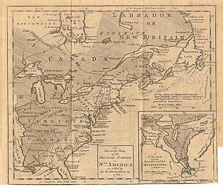
Auction 94, Lot 93
Subject: Colonial Canada and United States
Gibson, John
An Accurate Map of the British Empire in Nth. America as settled by the Preliminaries in 1762., 1762
Size: 9.5 x 8 inches (24.1 x 20.3 cm)
Estimate: $220 - $250
Sold for: $325
Closed on 3/7/2001
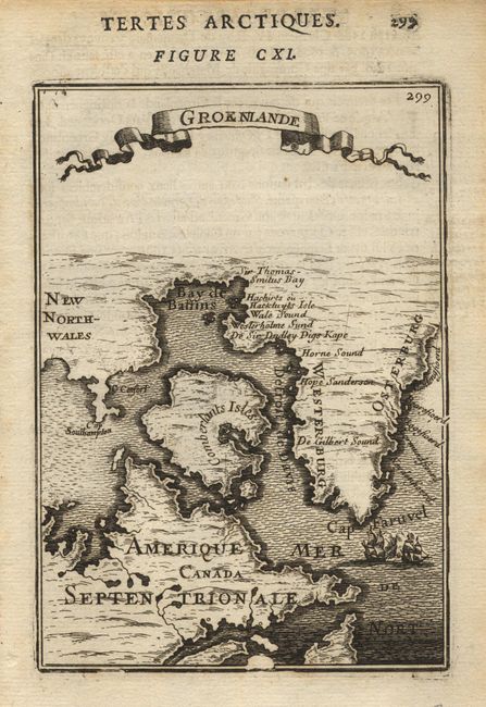
Auction 94, Lot 100
Subject: Canada and Greenland
Mallet, Alain Manesson
Groenlande, 1683
Size: 4.1 x 5.8 inches (10.4 x 14.7 cm)
Estimate: $140 - $160
Sold for: $100
Closed on 3/7/2001
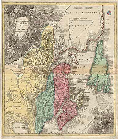
Auction 94, Lot 101
Subject: Canada
Lotter, Tobias Conrad
Partie De L'Amerique Septent?, 1756
Size: 19.5 x 22.7 inches (49.5 x 57.7 cm)
Estimate: $1,400 - $1,600
Sold for: $800
Closed on 3/7/2001
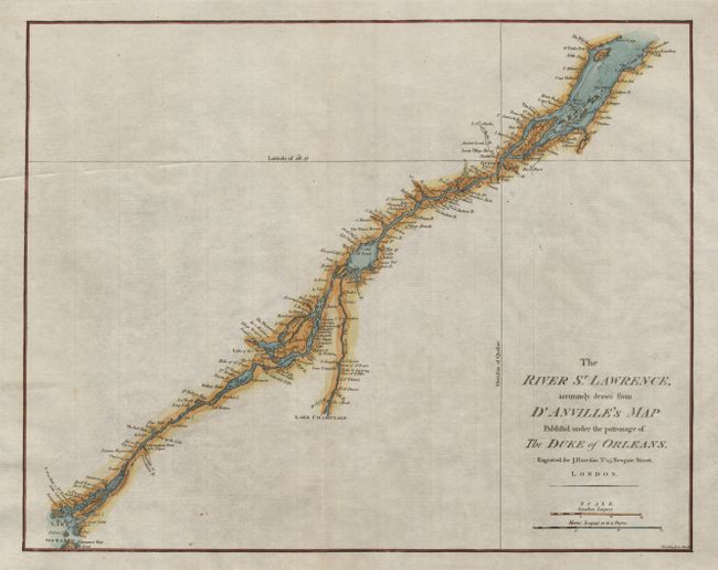
Auction 94, Lot 102
Subject: Canada
Harrison, John
The River St. Lawrence, accurately drawn from d'Anville's Map Published under the patronage of The Duke of Orleans, 1791
Size: 16.5 x 13.1 inches (41.9 x 33.3 cm)
Estimate: $200 - $300
Sold for: $100
Closed on 3/7/2001

Auction 94, Lot 103
Subject: Canada
Cary, John
A New Map of Nova Scotia, Newfoundland &c. from the Latest Authorities, 1807
Size: 20.3 x 17.9 inches (51.6 x 45.5 cm)
Estimate: $275 - $325
Unsold
Closed on 3/7/2001
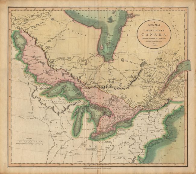
Auction 94, Lot 104
Subject: Canada and United States
Cary, John
A New Map of Upper & Lower Canada From the Latest Authorities, 1807
Size: 20 x 18 inches (50.8 x 45.7 cm)
Estimate: $300 - $400
Sold for: $400
Closed on 3/7/2001

Auction 94, Lot 105
Subject: Canada and United States
SDUK Society for the Diffusion of Useful Knowledge
[Set of 15 maps], 1832-34
Size: 12 x 15 inches (30.5 x 38.1 cm)
Estimate: $1,300 - $1,400
Unsold
Closed on 3/7/2001
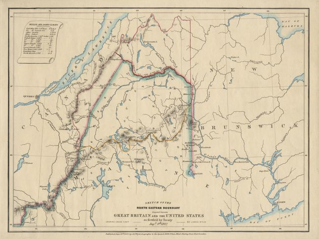
Auction 94, Lot 107
Subject: Canda and United States
Wyld
Sketch of the North Eastern Boundary disputed between Great Britain and the United States as Settled by Treaty Augt. 9th 1842, 1842
Size: 12.6 x 9.4 inches (32 x 23.9 cm)
Estimate: $150 - $200
Sold for: $140
Closed on 3/7/2001
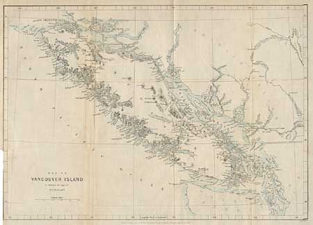
Auction 94, Lot 108
Subject: Canada and United States
Murray, J.
Map of Vancouver Island to illustrate the Paper of Dr. D.C. Forbes, R.N., 1864
Size: 14.5 x 10.5 inches (36.8 x 26.7 cm)
Estimate: $70 - $90
Sold for: $85
Closed on 3/7/2001
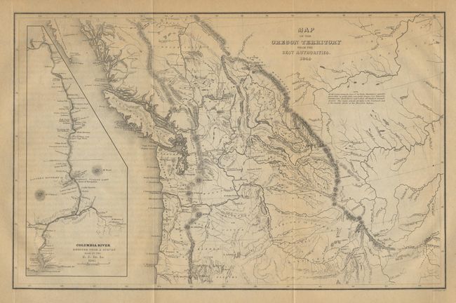
Auction 94, Lot 123
Subject: Northwestern United States
Wilkes, Charles
Map of the Oregon Territory by the U.S. Ex. Ex, 1849
Size: 8.5 x 13 inches (21.6 x 33 cm)
Estimate: $350 - $400
Sold for: $325
Closed on 3/7/2001
14 lots