Filtered by Category:United States(Show All Categories)
Showing results for:Auction 186
Catalog Archive
218 lots
Page 1 of 5
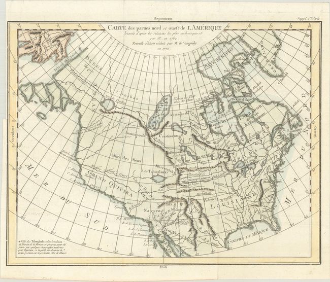
Auction 186, Lot 127
Subject: Colonial United States & Canada
Robert de Vaugondy
Carte des Parties Nord et Ouest de l'Amerique Dressee d'Apres les Relations les Plus Authentiques par M... en 1764..., 1772
Size: 15.1 x 11.7 inches (38.4 x 29.7 cm)
Estimate: $240 - $300
Sold for: $220
Closed on 2/9/2022
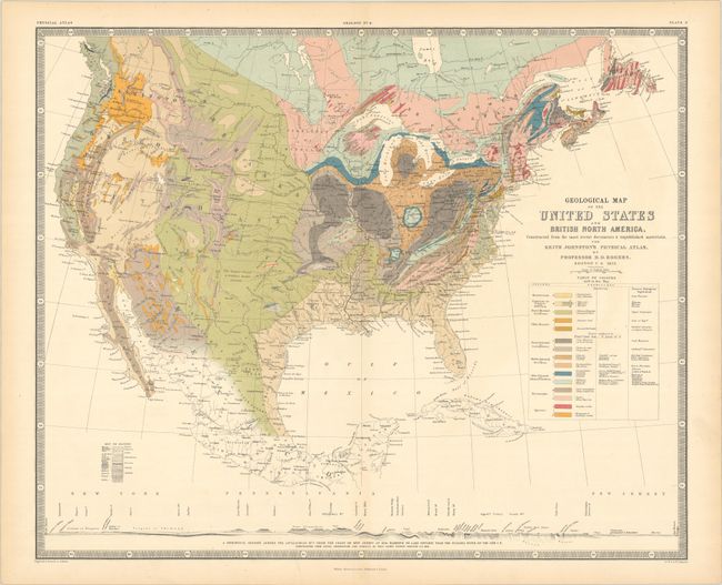
Auction 186, Lot 128
Subject: United States & Canada
Rogers, Henry Darwin
Geological Map of the United States and British North America, Constructed from the Most Recent Documents & Unpublished Materials..., 1855
Size: 24.3 x 19.9 inches (61.7 x 50.5 cm)
Estimate: $300 - $375
Sold for: $450
Closed on 2/9/2022
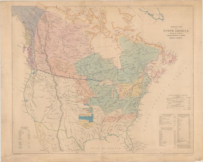
Auction 186, Lot 129
Subject: United States & Canada
Arrowsmith, John
Aboriginal Map of North America, Denoting the Boundaries and the Locations of Various Indian Tribes, 1857
Size: 22.2 x 18.6 inches (56.4 x 47.2 cm)
Estimate: $325 - $400
Sold for: $500
Closed on 2/9/2022
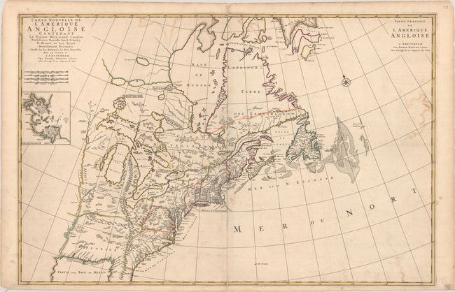
Auction 186, Lot 130
Subject: Colonial Eastern United States & Canada
Mortier, Pierre
Carte Nouvelle de l'Amerique Angloise Contenant la Virginie, Mary-Land, Caroline, Pensylvania Nouvelle Iorck, N: Iarsey N: France, et les Terres Nouvellement Decouerte..., 1700
Size: 35.8 x 23.4 inches (90.9 x 59.4 cm)
Estimate: $2,000 - $2,300
A Map Showing Fascinating Geographic Misconceptions
Sold for: $1,500
Closed on 2/9/2022
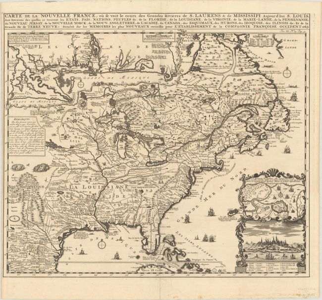
Auction 186, Lot 131
Subject: Colonial Eastern United States & Canada
Chatelain, Henry Abraham
Carte de la Nouvelle France, ou se voit le Cours des Grandes Rivieres de S. Laurens & de Mississipi Aujour d'hui S. Louis, aux Environs des-quelles se Trouvent les Etats, Pais, Nations, Peuples &c..., 1720
Size: 19.3 x 16.6 inches (49 x 42.2 cm)
Estimate: $2,400 - $3,000
One of the Most Informative 18th Century Maps of the French Possessions in North America
Sold for: $2,100
Closed on 2/9/2022
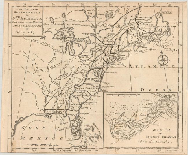
Auction 186, Lot 132
Subject: Colonial Eastern United States & Canada
Gibson, John
The British Governments in Nth. America Laid Down Agreeable to the Proclamation of Octr. 7. 1763, 1763
Size: 9.4 x 8 inches (23.9 x 20.3 cm)
Estimate: $450 - $550
Sold for: $375
Closed on 2/9/2022
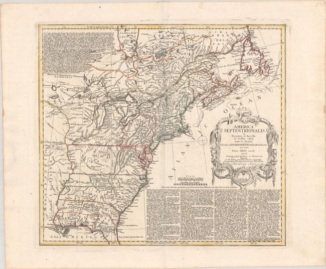
Auction 186, Lot 133
Subject: Colonial Eastern United States & Canada
Homann Heirs
America Septentrionalis a Domino d'Anville in Galliis edita nunc in Anglia Coloniis in Interiorem Virginiam deductis nec non Fluvii Ohio cursu…, 1777
Size: 20.1 x 18.1 inches (51.1 x 46 cm)
Estimate: $700 - $850
Sold for: $500
Closed on 2/9/2022
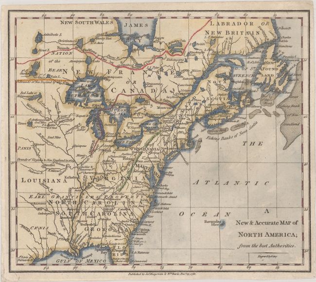
Auction 186, Lot 134
Subject: Colonial Eastern United States & Canada
Cary, John
A New & Accurate Map of North America; from the Best Authorities, 1780
Size: 8.7 x 7.6 inches (22.1 x 19.3 cm)
Estimate: $140 - $170
Sold for: $325
Closed on 2/9/2022
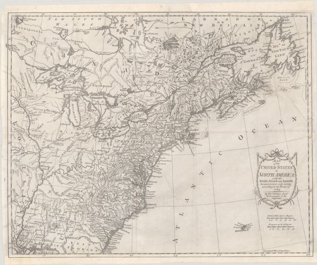
Auction 186, Lot 135
Subject: Eastern United States & Canada
Kitchin, Thomas
Map of the United States in North America: with the British, French and Spanish Dominions Adjoining, According to the Treaty of 1783, 1783
Size: 19.9 x 16.1 inches (50.5 x 40.9 cm)
Estimate: $1,000 - $1,300
One of the Earliest English-Produced Maps to Acknowledge the United States
Sold for: $850
Closed on 2/9/2022
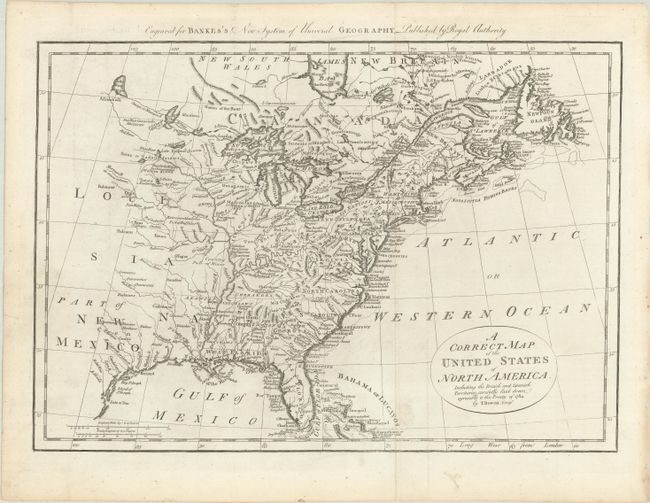
Auction 186, Lot 136
Subject: Eastern United States & Canada
Bowen, Thomas
A Correct Map of the United States of North America. Including the British and Spanish Territories, Carefully Laid Down Agreeable to the Treaty of 1784, 1787
Size: 17.6 x 12.4 inches (44.7 x 31.5 cm)
Estimate: $400 - $475
Sold for: $325
Closed on 2/9/2022
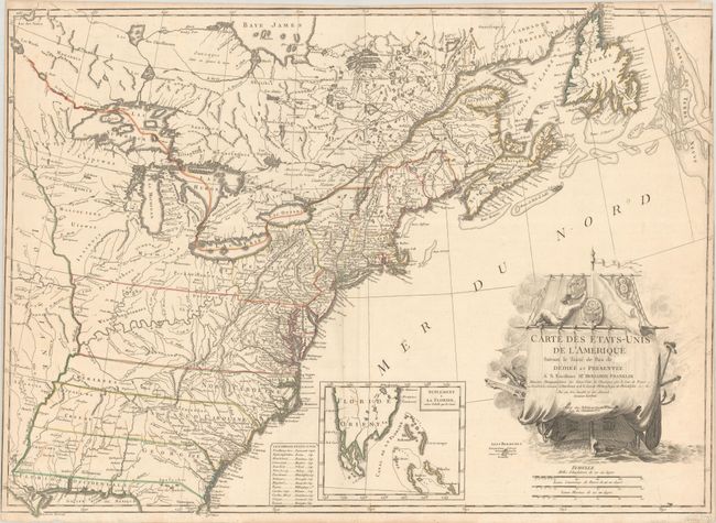
Auction 186, Lot 137
Subject: Eastern United States & Canada
Lattre, Jean
Carte des Etats-Unis de l'Amerique Suivant le Traite de Paix de ... Dediee et Presentee a S. Excellence Mr. Benjamin Franklin..., 1791
Size: 30 x 21.9 inches (76.2 x 55.6 cm)
Estimate: $5,500 - $7,000
First French Map of the New United States
Sold for: $7,000
Closed on 2/9/2022
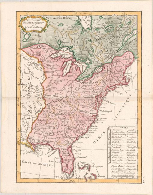
Auction 186, Lot 138
Subject: Eastern United States & Canada
Delamarche, Charles Francois
Etats-Unis de l'Amerique Seple. avec le Canada et la Floride, 1793
Size: 7.2 x 9.8 inches (18.3 x 24.9 cm)
Estimate: $200 - $230
Sold for: $150
Closed on 2/9/2022
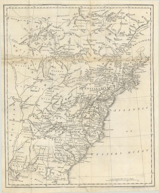
Auction 186, Lot 139
Subject: Eastern United States & Canada, Franklin
Phillips, Richard (Sir)
[Untitled - Map of the United States, Canada the River St. Lawrence, the Lakes &c.], 1805
Size: 13.1 x 15.9 inches (33.3 x 40.4 cm)
Estimate: $900 - $1,100
Features the Short-Lived Franklinia and Morgania
Sold for: $900
Closed on 2/9/2022
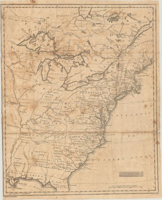
Auction 186, Lot 140
Subject: Eastern United States & Canada, Franklin
Rochefoucald Liancourt, Francois Alexander
America, 1805
Size: 12.9 x 15.8 inches (32.8 x 40.1 cm)
Estimate: $500 - $650
Sold for: $300
Closed on 2/9/2022
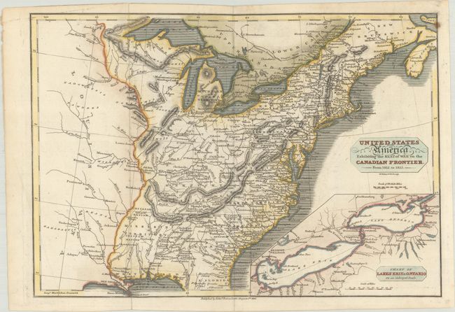
Auction 186, Lot 141
Subject: Eastern United States & Canada
Baines, Edward
United States of America Exhibiting the Seat of War on the Canadian Frontier. From 1812. to 1815, 1816
Size: 13.6 x 9.4 inches (34.5 x 23.9 cm)
Estimate: $300 - $375
Sold for: $425
Closed on 2/9/2022
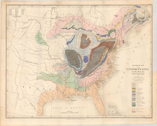
Auction 186, Lot 142
Subject: Eastern United States & Canada, Geology
Lyell, Charles
Geological Map of the United States Canada &c. Compiled from the State Surveys of the U.S. and Other Sources, 1845
Size: 19.7 x 15.3 inches (50 x 38.9 cm)
Estimate: $600 - $750
Sold for: $650
Closed on 2/9/2022
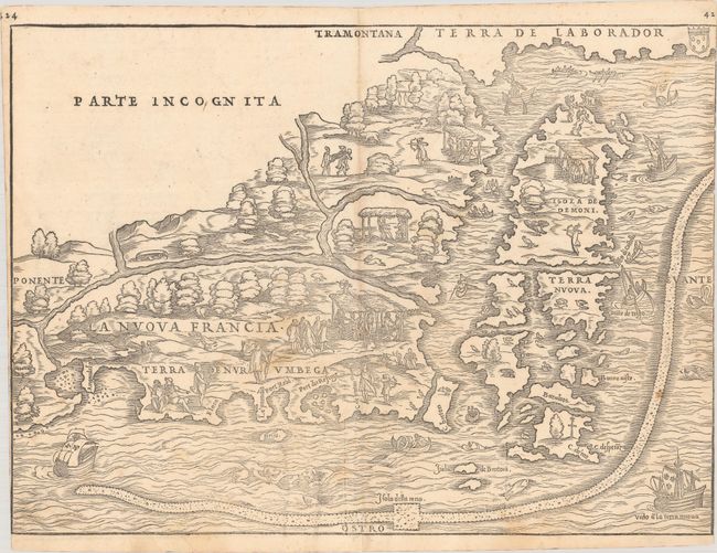
Auction 186, Lot 143
Subject: Colonial Northeastern United States & Canada
Gastaldi/Ramusio
La Nuova Francia, 1556
Size: 14.8 x 10.8 inches (37.6 x 27.4 cm)
Estimate: $5,000 - $6,500
Rare First State of the First Printed Map to Focus on New England and New France
Sold for: $3,500
Closed on 2/9/2022
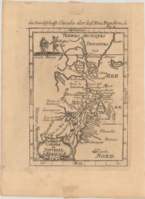
Auction 186, Lot 144
Subject: Colonial Northeastern United States & Canada
Mallet, Alain Manesson
Canada ou Nouvelle France, 1684
Size: 3.9 x 5.5 inches (9.9 x 14 cm)
Estimate: $160 - $190
Sold for: $120
Closed on 2/9/2022
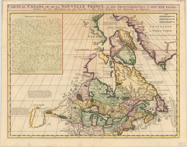
Auction 186, Lot 145
Subject: Colonial Northeastern United States & Canada
Chatelain, Henry Abraham
Carte du Canada ou de la Nouvelle France, & des Decouvertes qui y ont ete Faites, Dressee sur les Observations les Plus Nouvelles, & sur Divers Memoires tant Manuscrits qu' Imprimez, 1720
Size: 20.3 x 15.9 inches (51.6 x 40.4 cm)
Estimate: $600 - $750
Sold for: $475
Closed on 2/9/2022
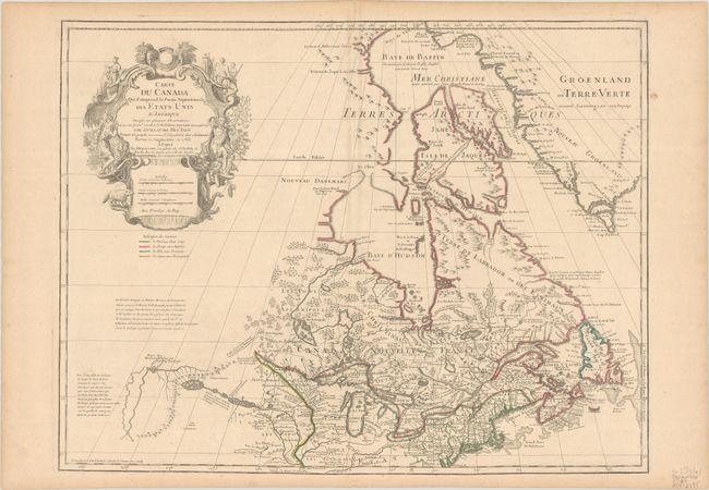
Auction 186, Lot 146
Subject: Colonial Northeastern United States & Canada, Great Lakes
Delisle/Dezauche
Carte du Canada qui Comprend la Partie Septentrionale des Etats Unis d'Amerique Dressee sur Plusieurs Observations et sur un Grand Nombre de Relations Imprimees ou Manuscrites..., 1783
Size: 25.6 x 19.7 inches (65 x 50 cm)
Estimate: $400 - $475
Sold for: $300
Closed on 2/9/2022
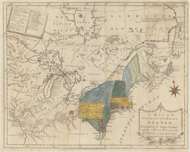
Auction 186, Lot 147
Subject: Northeastern United States & Canada
Morse, Jedidiah (Rev.)
A Map of the Northern and Middle States; Comprehending the Western Territory and the British Dominions in North America..., 1789
Size: 15.6 x 12.4 inches (39.6 x 31.5 cm)
Estimate: $400 - $500
Sold for: $550
Closed on 2/9/2022
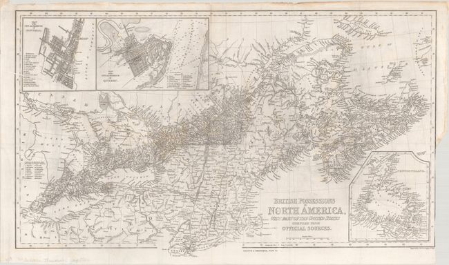
Auction 186, Lot 148
Subject: Northeastern United States & Canada
Harper Bros.
British Possessions in North America, with Part of the United States Compiled from Official Sources, 1843
Size: 24.6 x 14.5 inches (62.5 x 36.8 cm)
Estimate: $140 - $170
Sold for: $160
Closed on 2/9/2022
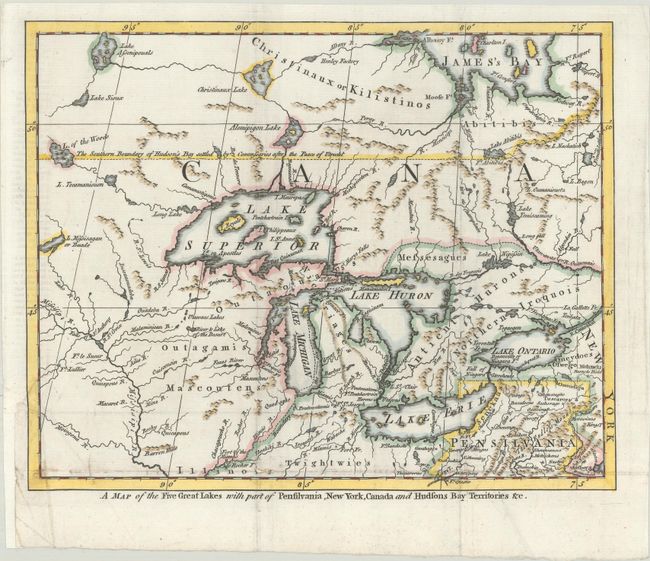
Auction 186, Lot 149
Subject: Colonial Great Lakes
A Map of the Five Great Lakes with Part of Pensilvania, New York, Canada and Hudsons Bay Territories &c., 1755
Size: 10.3 x 8.3 inches (26.2 x 21.1 cm)
Estimate: $400 - $475
Sold for: $900
Closed on 2/9/2022
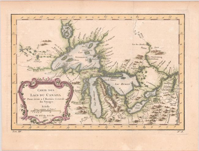
Auction 186, Lot 150
Subject: Colonial Central United States & Canada, Great Lakes
Bellin, Jacques Nicolas
Carte des Lacs du Canada pour Servir a l'Histoire Generale des Voyages, 1757
Size: 11.5 x 7.8 inches (29.2 x 19.8 cm)
Estimate: $350 - $425
Sold for: $325
Closed on 2/9/2022
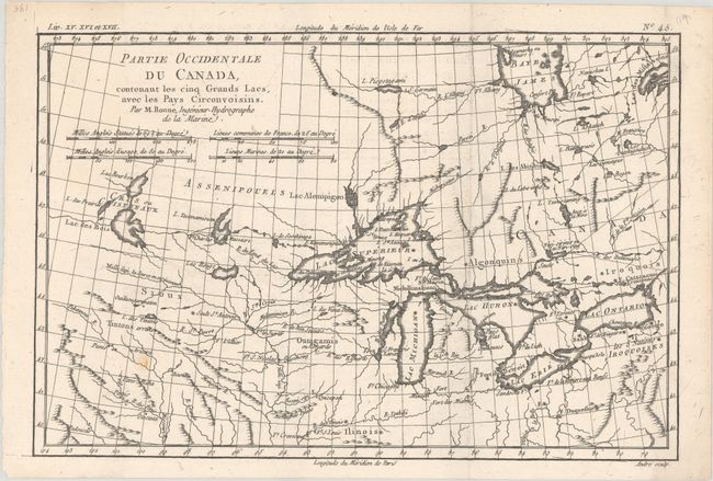
Auction 186, Lot 151
Subject: Colonial Central United States & Canada, Great Lakes
Bonne, Rigobert
Partie Occidentale du Canada, Contenant les Cinq Grands Lacs, avec les Pays Circonvoisins, 1775
Size: 12.6 x 8.4 inches (32 x 21.3 cm)
Estimate: $200 - $230
Sold for: $150
Closed on 2/9/2022
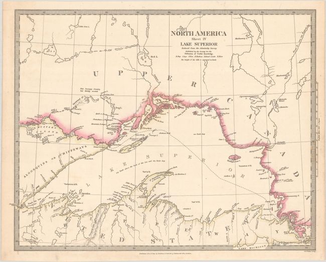
Auction 186, Lot 152
Subject: Lake Superior
SDUK Society for the Diffusion of Useful Knowledge
North America Sheet IV Lake Superior, 1832
Size: 15.4 x 12 inches (39.1 x 30.5 cm)
Estimate: $110 - $140
Sold for: $55
Closed on 2/9/2022
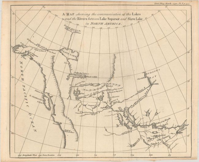
Auction 186, Lot 153
Subject: Western Canada & Alaska
Anon.
A Map Shewing the Communication of the Lakes and the Rivers Between Lake Superior and Slave Lake in North America, 1790
Size: 9.3 x 7.8 inches (23.6 x 19.8 cm)
Estimate: $240 - $300
Sold for: $140
Closed on 2/9/2022
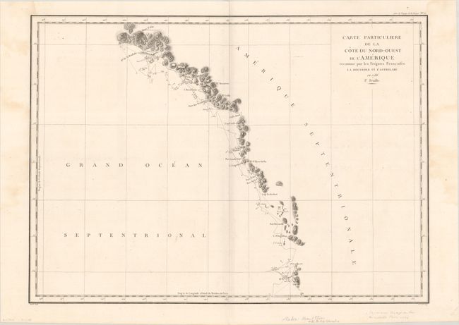
Auction 186, Lot 154
Subject: Western Canada & Alaska
La Perouse, Comte Jean F. Galoup, de
Carte Particuliere de la Cote du Nord-Ouest de l'Amerique Reconnue par les Fregates Francaises la Boussole et l'Astrolabe en 1786. 1e. Feuille, 1797
Size: 26.9 x 19.5 inches (68.3 x 49.5 cm)
Estimate: $160 - $190
Sold for: $120
Closed on 2/9/2022
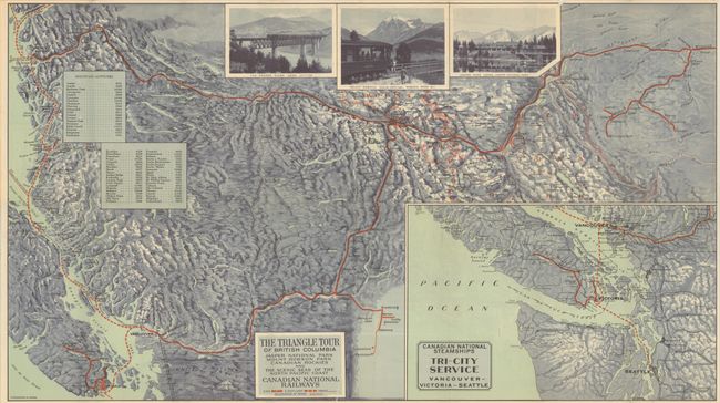
Auction 186, Lot 155
Subject: Pacific Northwest United States & Canada
The Triangle Tour of British Columbia - Jasper National Park Mount Robson Park Canadian Rockies and the Sceneic Seas of the North Pacific Coast [on verso] Alaska and the Yukon, 1930
Size: 29.8 x 16.8 inches (75.7 x 42.7 cm)
Estimate: $200 - $230
Sold for: $190
Closed on 2/9/2022
Auction 186, Lot 156
Subject: United States
Bradford, Thomas Gamaliel
United States, 1835
Size: 10.1 x 7.8 inches (25.7 x 19.8 cm)
Estimate: $120 - $150
NO RESERVE
Sold for: $130
Closed on 2/9/2022
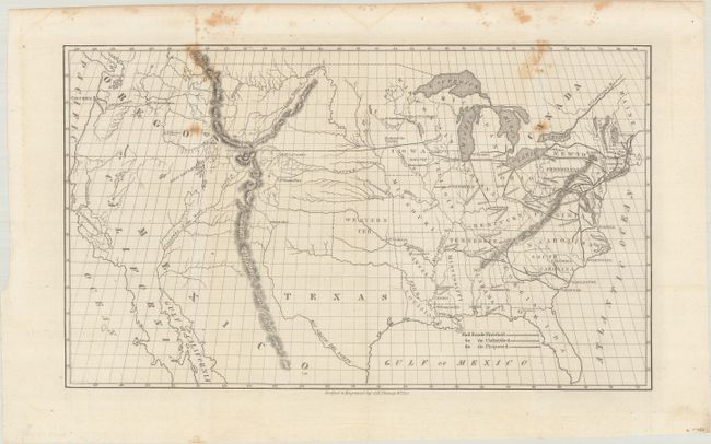
Auction 186, Lot 157
Subject: United States, Railroads
Throop, O. H.
[Untitled - Map of Proposed Routes of Western Railroads], 1846
Size: 15.9 x 10 inches (40.4 x 25.4 cm)
Estimate: $160 - $190
Sold for: $120
Closed on 2/9/2022
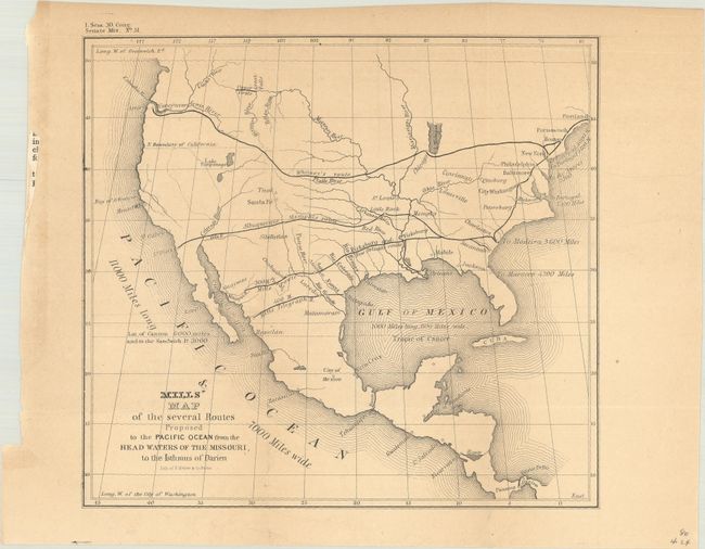
Auction 186, Lot 158
Subject: United States
U.S. Government
Mills' Map of the Several Routes Proposed to the Pacific Ocean from the Head Waters of the Missouri, to the Isthmus of Darien, 1848
Size: 9 x 8.2 inches (22.9 x 20.8 cm)
Estimate: $120 - $150
Sold for: $90
Closed on 2/9/2022
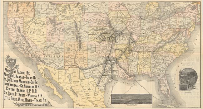
Auction 186, Lot 159
Subject: United States, Railroads
Railroad Companies, (Various)
Map of the Missouri Pacific Ry. Missouri, Kansas and Texas Ry. St. Louis, Iron Mountain and So. Ry. International and Gt. Northern R.R. ... and Connections, 1887
Size: 31 x 16.8 inches (78.7 x 42.7 cm)
Estimate: $250 - $325
Sold for: $600
Closed on 2/9/2022
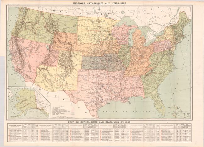
Auction 186, Lot 160
Subject: United States
Hausermann, R.
Missions Catholiques aux Etats Unis, 1900
Size: 37.3 x 23.3 inches (94.7 x 59.2 cm)
Estimate: $240 - $300
Sold for: $100
Closed on 2/9/2022
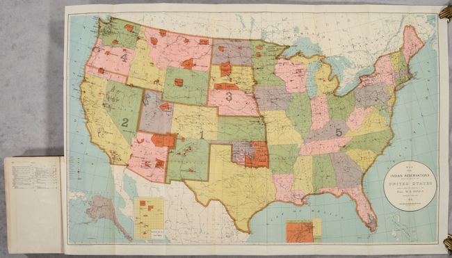
Auction 186, Lot 161
Subject: United States
U.S. Bureau of Indian Affairs
[Map in Report] Map Showing Indian Reservations Within the Limits of the United States... [in] Annual Reports of the Department of the Interior for the Fiscal Year Ended June 30, 1901. Indian Affairs. Part I..., 1902
Size: 33 x 21.1 inches (83.8 x 53.6 cm)
Estimate: $140 - $170
Sold for: $550
Closed on 2/9/2022
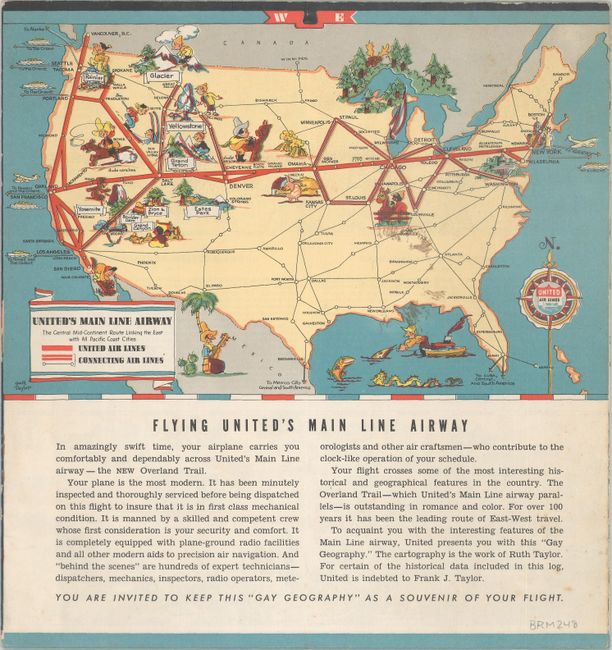
Auction 186, Lot 162
Subject: United States
White, Ruth Taylor
United Air Lines - A Gay Geography of the Main Line Airway, 1935
Size: 19.8 x 5.9 inches (50.3 x 15 cm)
Estimate: $160 - $190
Sold for: $190
Closed on 2/9/2022
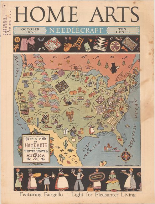
Auction 186, Lot 163
Subject: United States
Map of Home Arts of the United States of America, 1938
Size: 8.4 x 10.9 inches (21.3 x 27.7 cm)
Estimate: $50 - $60
NO RESERVE
Sold for: $19
Closed on 2/9/2022
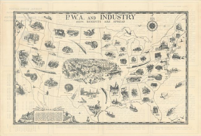
Auction 186, Lot 164
Subject: United States
U.S. Government
P.W.A. and Industry - How Benefits Are Spread, 1940
Size: 16.9 x 11 inches (42.9 x 27.9 cm)
Estimate: $160 - $190
Sold for: $160
Closed on 2/9/2022
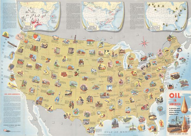
Auction 186, Lot 165
Subject: United States, Oil
Oil in America - A Pictorial Story of the Petroleum Industry in the United States, 1957
Size: 33.4 x 23.9 inches (84.8 x 60.7 cm)
Estimate: $180 - $220
Sold for: $160
Closed on 2/9/2022
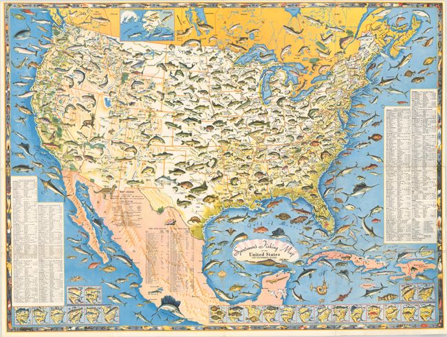
Auction 186, Lot 166
Subject: United States
Sportsmen's Fishing Map of the United States and Neighboring Waters, 1957
Size: 25 x 18.9 inches (63.5 x 48 cm)
Estimate: $220 - $250
Sold for: $475
Closed on 2/9/2022
Auction 186, Lot 167
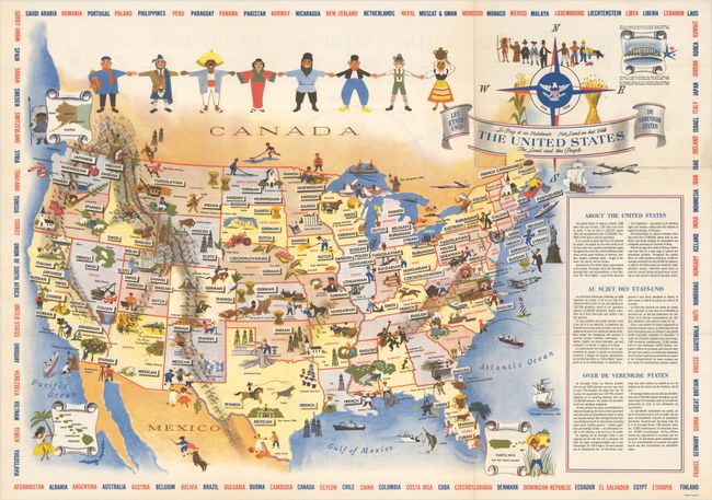
Subject: United States
The United States - The Land and the People, 1958
Size: 25.9 x 18.3 inches (65.8 x 46.5 cm)
Estimate: $160 - $190
Sold for: $120
Closed on 2/9/2022
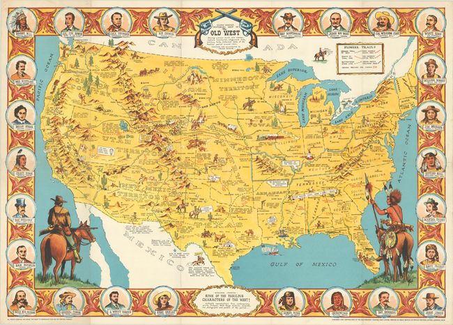
Auction 186, Lot 168
Subject: United States
Danny Arnold's Pictorial Map of the Old West Showing Pioneer Trails and Battles, Indian's Territories, Stagecoach Lines, Military Forts, Historical Data of the Frontier Period Around 1840, 1960
Size: 33.8 x 23.8 inches (85.9 x 60.5 cm)
Estimate: $240 - $300
Sold for: $240
Closed on 2/9/2022
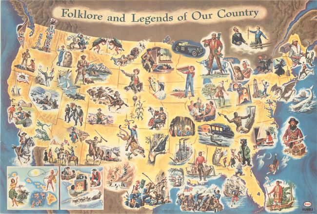
Auction 186, Lot 169
Subject: United States
Folklore and Legends of Our Country, 1962
Size: 33.5 x 22.7 inches (85.1 x 57.7 cm)
Estimate: $180 - $220
Sold for: $120
Closed on 2/9/2022

Auction 186, Lot 170
Subject: Colonial Eastern United States
Bowen, Emanuel
A New & Accurate Map of Louisiana, with Part of Florida and Canada, and the Adjacent Countries. Drawn from Surveys, Assisted by the Most Approved English & French Maps & Charts..., 1747
Size: 16.5 x 13.6 inches (41.9 x 34.5 cm)
Estimate: $950 - $1,100
Sold for: $700
Closed on 2/9/2022
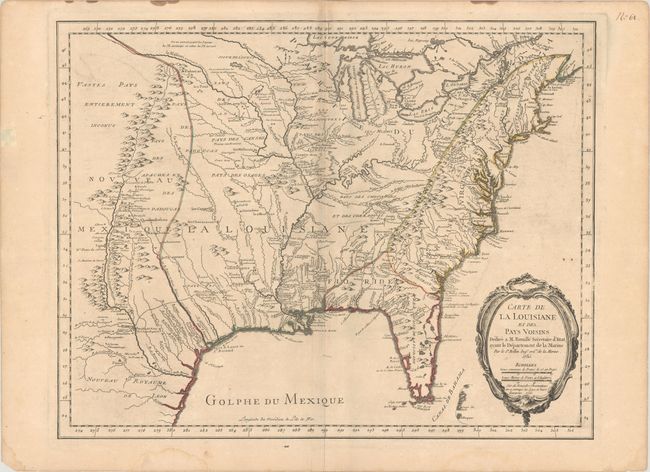
Auction 186, Lot 171
Subject: Colonial Eastern United States
Bellin, Jacques Nicolas
Carte de la Louisiane et des Pays Voisins Dediee a M. Rouille Secretaire d'Etat, Ayant le Departement de la Marine, 1755
Size: 24.1 x 18.8 inches (61.2 x 47.8 cm)
Estimate: $1,200 - $1,500
Bellin's Scarce French and Indian War-Era Map of the Colonial United States
Sold for: $1,200
Closed on 2/9/2022
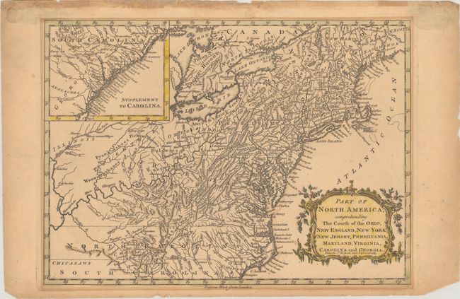
Auction 186, Lot 172
Subject: Colonial Eastern United States
Barrow, John (Sir)
Part of North America; Comprehending the Course of the Ohio, New England, New York, New Jersey, Pensilvania, Maryland, Virginia, Carolina and Georgia, 1759
Size: 11.7 x 8.4 inches (29.7 x 21.3 cm)
Estimate: $250 - $325
Sold for: $180
Closed on 2/9/2022
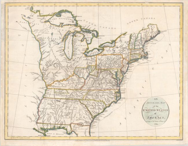
Auction 186, Lot 173
Subject: Eastern United States
Russell, John C.
An Accurate Map of the United States of America, According to the Treaty of Peace of 1783, 1794
Size: 18.6 x 14.3 inches (47.2 x 36.3 cm)
Estimate: $475 - $600
Sold for: $350
Closed on 2/9/2022
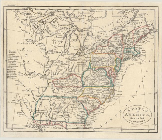
Auction 186, Lot 174
Subject: Eastern United States
Russell, John C.
States of America, from the Best Authorities, 1795
Size: 8.9 x 7.3 inches (22.6 x 18.5 cm)
Estimate: $110 - $140
NO RESERVE
Sold for: $300
Closed on 2/9/2022
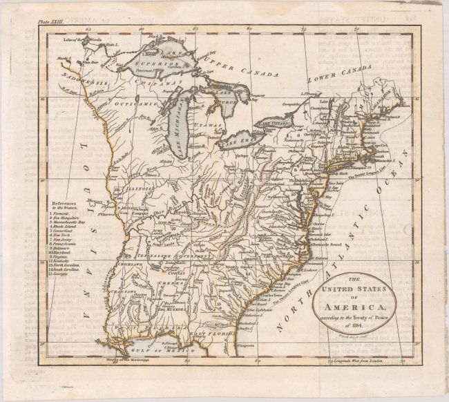
Auction 186, Lot 175
Subject: Eastern United States
[Lot of 2] The United States of America, According to the Treaty of Peace of 1784 [and] United States, 1795-1822
Size: See Description
Estimate: $300 - $375
Sold for: $220
Closed on 2/9/2022
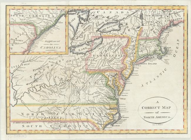
Auction 186, Lot 176
Subject: Eastern United States
A Correct Map of North America, 1800
Size: 11.5 x 8.2 inches (29.2 x 20.8 cm)
Estimate: $240 - $300
Sold for: $180
Closed on 2/9/2022
218 lots
Page 1 of 5