Filtered by Category:Canada(Show All Categories)
Showing results for:Auction 186
Catalog Archive
33 lots
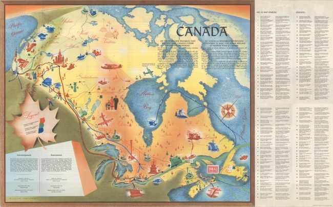
Auction 186, Lot 121
Subject: Canada
Canada, 1950
Size: 25.2 x 20.5 inches (64 x 52.1 cm)
Estimate: $140 - $170
Sold for: $80
Closed on 2/9/2022
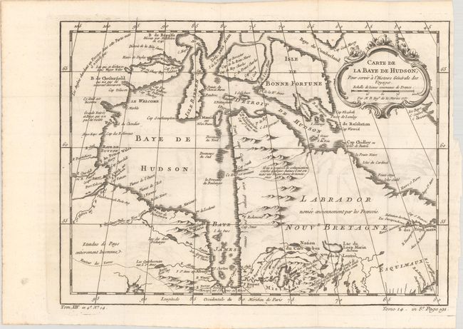
Auction 186, Lot 122
Subject: Eastern Canada
Bellin, Jacques Nicolas
[Lot of 3] Carte de la Baye de Hudson... [and] Carte de l'Acadie, Isle Royale, et Pais Voisins... [and] Carte du Golphe de St. Laurent et Pays Voisins..., 1780
Size: See Description
Estimate: $250 - $325
Sold for: $180
Closed on 2/9/2022
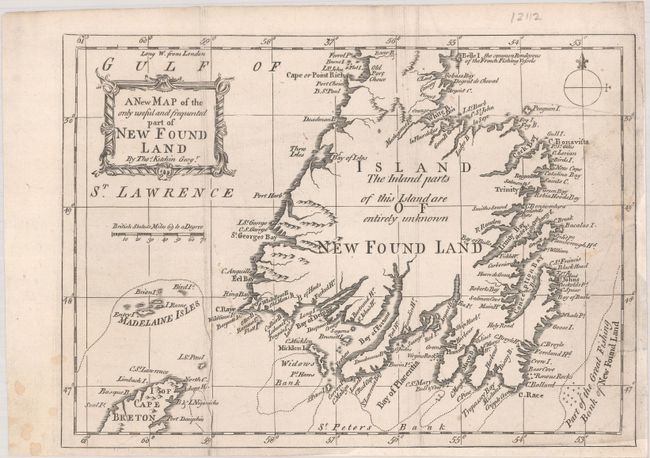
Auction 186, Lot 123
Subject: Newfoundland, Canada
Kitchin, Thomas
A New Map of the Only Useful and Frequented Part of New Found Land, 1762
Size: 9.7 x 7 inches (24.6 x 17.8 cm)
Estimate: $140 - $170
Sold for: $110
Closed on 2/9/2022
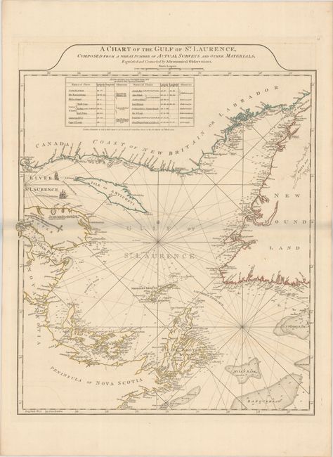
Auction 186, Lot 124
Subject: Gulf of St. Lawrence, Canada
Jefferys/Sayer & Bennett
A Chart of the Gulf of St. Laurence, Composed from a Great Number of Actual Surveys and Other Materials, Regulated and Connected by Astronomical Observations, 1775
Size: 19.5 x 24.3 inches (49.5 x 61.7 cm)
Estimate: $240 - $300
Sold for: $180
Closed on 2/9/2022
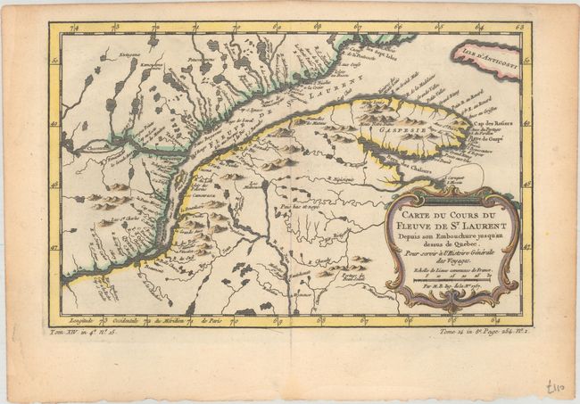
Auction 186, Lot 125
Subject: St. Lawrence River
Bellin, Jacques Nicolas
[Lot of 2] Carte du Cours du Fleuve de St. Laurent Depuis son Embouchure Jusqu'au Dessus de Quebec. Pour Servir a l'Histoire Generale des Voyages [and] Suite du Cours du Fleuve de St. Laurent Depuis Quebec Jusqu au Lac Ontario..., 1757
Size: 11.9 x 7.6 inches (30.2 x 19.3 cm)
Estimate: $190 - $220
Sold for: $140
Closed on 2/9/2022
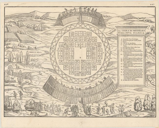
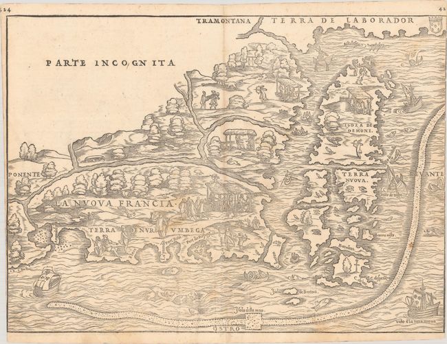
Auction 186, Lot 126
Subject: Montreal, Canada
Gastaldi/Ramusio
La Terra de Hochelaga Nella Nova Francia, 1556
Size: 14.5 x 10.6 inches (36.8 x 26.9 cm)
Estimate: $2,400 - $3,000
The First Published Plan of a Settlement in North America
Sold for: $3,000
Closed on 2/9/2022
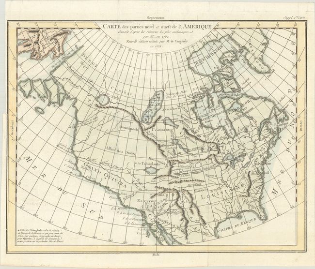
Auction 186, Lot 127
Subject: Colonial United States & Canada
Robert de Vaugondy
Carte des Parties Nord et Ouest de l'Amerique Dressee d'Apres les Relations les Plus Authentiques par M... en 1764..., 1772
Size: 15.1 x 11.7 inches (38.4 x 29.7 cm)
Estimate: $240 - $300
Sold for: $220
Closed on 2/9/2022
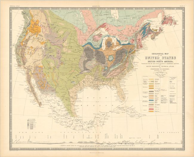
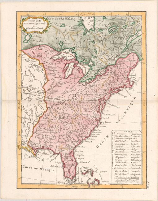
Auction 186, Lot 128
Subject: United States & Canada
Rogers, Henry Darwin
Geological Map of the United States and British North America, Constructed from the Most Recent Documents & Unpublished Materials..., 1855
Size: 24.3 x 19.9 inches (61.7 x 50.5 cm)
Estimate: $300 - $375
Sold for: $450
Closed on 2/9/2022
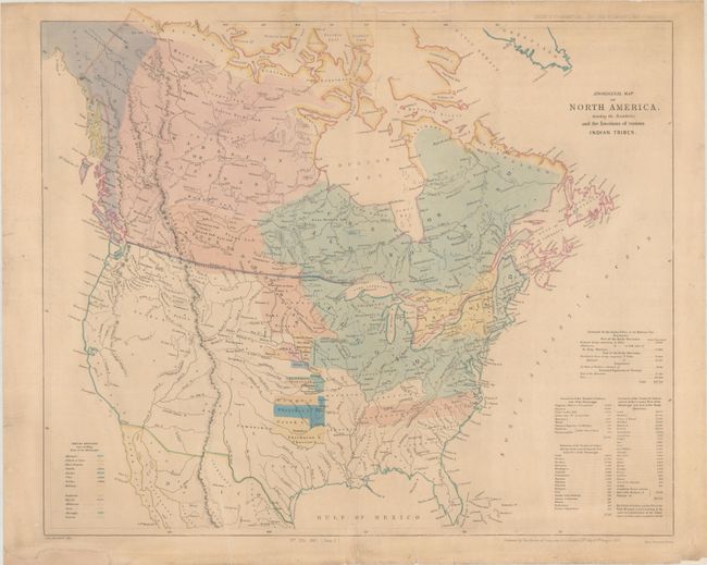
Auction 186, Lot 129
Subject: United States & Canada
Arrowsmith, John
Aboriginal Map of North America, Denoting the Boundaries and the Locations of Various Indian Tribes, 1857
Size: 22.2 x 18.6 inches (56.4 x 47.2 cm)
Estimate: $325 - $400
Sold for: $500
Closed on 2/9/2022
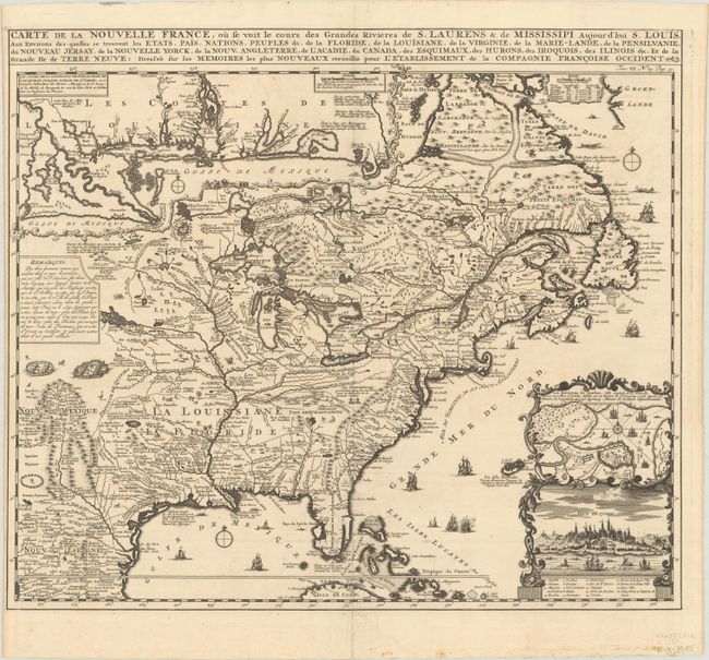
Auction 186, Lot 131
Subject: Colonial Eastern United States & Canada
Chatelain, Henry Abraham
Carte de la Nouvelle France, ou se voit le Cours des Grandes Rivieres de S. Laurens & de Mississipi Aujour d'hui S. Louis, aux Environs des-quelles se Trouvent les Etats, Pais, Nations, Peuples &c..., 1720
Size: 19.3 x 16.6 inches (49 x 42.2 cm)
Estimate: $2,400 - $3,000
One of the Most Informative 18th Century Maps of the French Possessions in North America
Sold for: $2,100
Closed on 2/9/2022
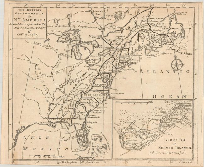
Auction 186, Lot 132
Subject: Colonial Eastern United States & Canada
Gibson, John
The British Governments in Nth. America Laid Down Agreeable to the Proclamation of Octr. 7. 1763, 1763
Size: 9.4 x 8 inches (23.9 x 20.3 cm)
Estimate: $450 - $550
Sold for: $375
Closed on 2/9/2022
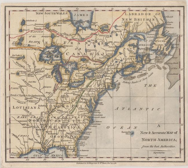
Auction 186, Lot 134
Subject: Colonial Eastern United States & Canada
Cary, John
A New & Accurate Map of North America; from the Best Authorities, 1780
Size: 8.7 x 7.6 inches (22.1 x 19.3 cm)
Estimate: $140 - $170
Sold for: $325
Closed on 2/9/2022
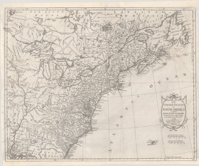
Auction 186, Lot 135
Subject: Eastern United States & Canada
Kitchin, Thomas
Map of the United States in North America: with the British, French and Spanish Dominions Adjoining, According to the Treaty of 1783, 1783
Size: 19.9 x 16.1 inches (50.5 x 40.9 cm)
Estimate: $1,000 - $1,300
One of the Earliest English-Produced Maps to Acknowledge the United States
Sold for: $850
Closed on 2/9/2022
Auction 186, Lot 136
Subject: Eastern United States & Canada
Bowen, Thomas
A Correct Map of the United States of North America. Including the British and Spanish Territories, Carefully Laid Down Agreeable to the Treaty of 1784, 1787
Size: 17.6 x 12.4 inches (44.7 x 31.5 cm)
Estimate: $400 - $475
Sold for: $325
Closed on 2/9/2022
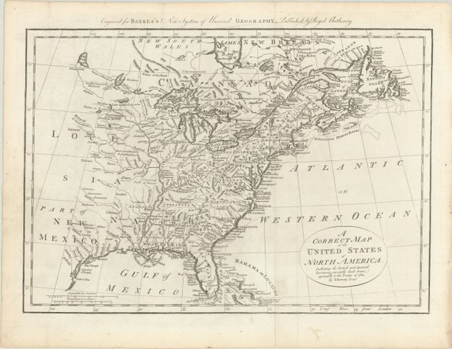
Auction 186, Lot 137
Subject: Eastern United States & Canada
Lattre, Jean
Carte des Etats-Unis de l'Amerique Suivant le Traite de Paix de ... Dediee et Presentee a S. Excellence Mr. Benjamin Franklin..., 1791
Size: 30 x 21.9 inches (76.2 x 55.6 cm)
Estimate: $5,500 - $7,000
First French Map of the New United States
Sold for: $7,000
Closed on 2/9/2022
Auction 186, Lot 138
Subject: Eastern United States & Canada
Delamarche, Charles Francois
Etats-Unis de l'Amerique Seple. avec le Canada et la Floride, 1793
Size: 7.2 x 9.8 inches (18.3 x 24.9 cm)
Estimate: $200 - $230
Sold for: $150
Closed on 2/9/2022
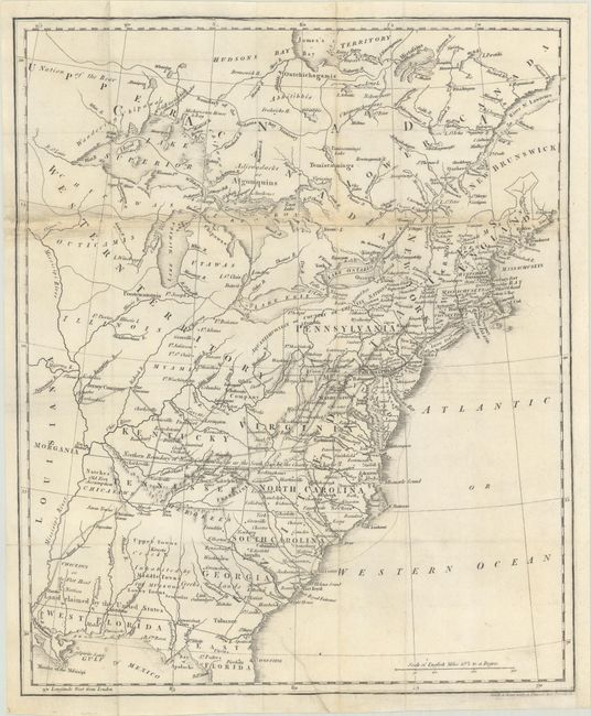
Auction 186, Lot 139
Subject: Eastern United States & Canada, Franklin
Phillips, Richard (Sir)
[Untitled - Map of the United States, Canada the River St. Lawrence, the Lakes &c.], 1805
Size: 13.1 x 15.9 inches (33.3 x 40.4 cm)
Estimate: $900 - $1,100
Features the Short-Lived Franklinia and Morgania
Sold for: $900
Closed on 2/9/2022
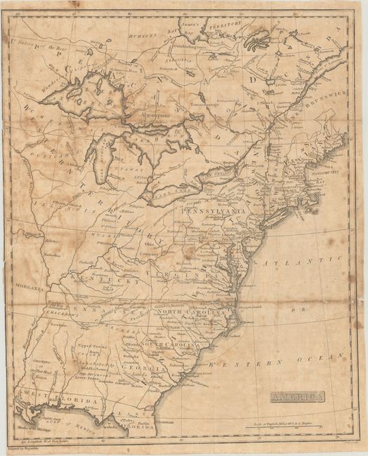
Auction 186, Lot 140
Subject: Eastern United States & Canada, Franklin
Rochefoucald Liancourt, Francois Alexander
America, 1805
Size: 12.9 x 15.8 inches (32.8 x 40.1 cm)
Estimate: $500 - $650
Sold for: $300
Closed on 2/9/2022
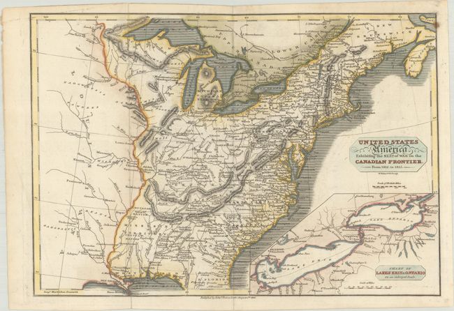
Auction 186, Lot 141
Subject: Eastern United States & Canada
Baines, Edward
United States of America Exhibiting the Seat of War on the Canadian Frontier. From 1812. to 1815, 1816
Size: 13.6 x 9.4 inches (34.5 x 23.9 cm)
Estimate: $300 - $375
Sold for: $425
Closed on 2/9/2022
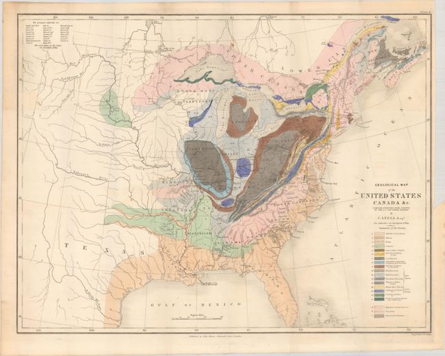
Auction 186, Lot 142
Subject: Eastern United States & Canada, Geology
Lyell, Charles
Geological Map of the United States Canada &c. Compiled from the State Surveys of the U.S. and Other Sources, 1845
Size: 19.7 x 15.3 inches (50 x 38.9 cm)
Estimate: $600 - $750
Sold for: $650
Closed on 2/9/2022
Auction 186, Lot 143
Subject: Colonial Northeastern United States & Canada
Gastaldi/Ramusio
La Nuova Francia, 1556
Size: 14.8 x 10.8 inches (37.6 x 27.4 cm)
Estimate: $5,000 - $6,500
Rare First State of the First Printed Map to Focus on New England and New France
Sold for: $3,500
Closed on 2/9/2022
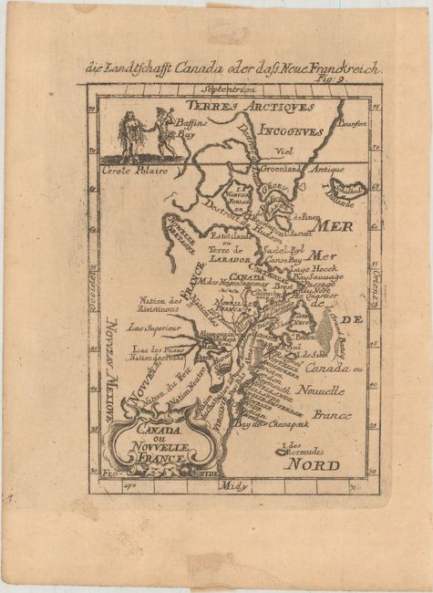
Auction 186, Lot 144
Subject: Colonial Northeastern United States & Canada
Mallet, Alain Manesson
Canada ou Nouvelle France, 1684
Size: 3.9 x 5.5 inches (9.9 x 14 cm)
Estimate: $160 - $190
Sold for: $120
Closed on 2/9/2022
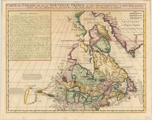
Auction 186, Lot 145
Subject: Colonial Northeastern United States & Canada
Chatelain, Henry Abraham
Carte du Canada ou de la Nouvelle France, & des Decouvertes qui y ont ete Faites, Dressee sur les Observations les Plus Nouvelles, & sur Divers Memoires tant Manuscrits qu' Imprimez, 1720
Size: 20.3 x 15.9 inches (51.6 x 40.4 cm)
Estimate: $600 - $750
Sold for: $475
Closed on 2/9/2022
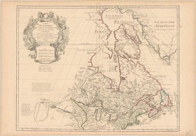
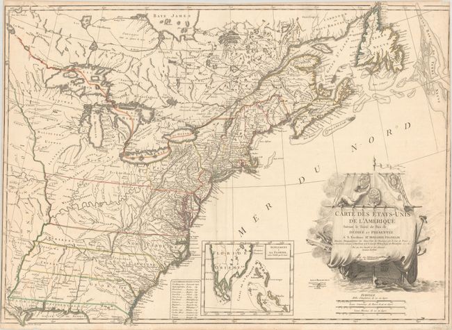
Auction 186, Lot 146
Subject: Colonial Northeastern United States & Canada, Great Lakes
Delisle/Dezauche
Carte du Canada qui Comprend la Partie Septentrionale des Etats Unis d'Amerique Dressee sur Plusieurs Observations et sur un Grand Nombre de Relations Imprimees ou Manuscrites..., 1783
Size: 25.6 x 19.7 inches (65 x 50 cm)
Estimate: $400 - $475
Sold for: $300
Closed on 2/9/2022
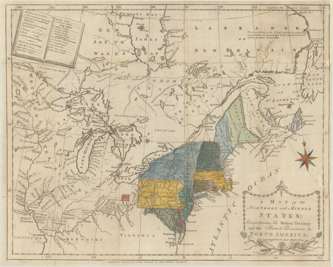
Auction 186, Lot 147
Subject: Northeastern United States & Canada
Morse, Jedidiah (Rev.)
A Map of the Northern and Middle States; Comprehending the Western Territory and the British Dominions in North America..., 1789
Size: 15.6 x 12.4 inches (39.6 x 31.5 cm)
Estimate: $400 - $500
Sold for: $550
Closed on 2/9/2022
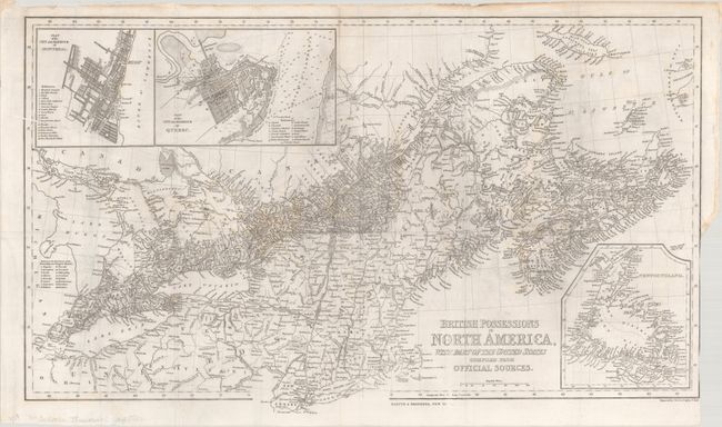
Auction 186, Lot 148
Subject: Northeastern United States & Canada
Harper Bros.
British Possessions in North America, with Part of the United States Compiled from Official Sources, 1843
Size: 24.6 x 14.5 inches (62.5 x 36.8 cm)
Estimate: $140 - $170
Sold for: $160
Closed on 2/9/2022
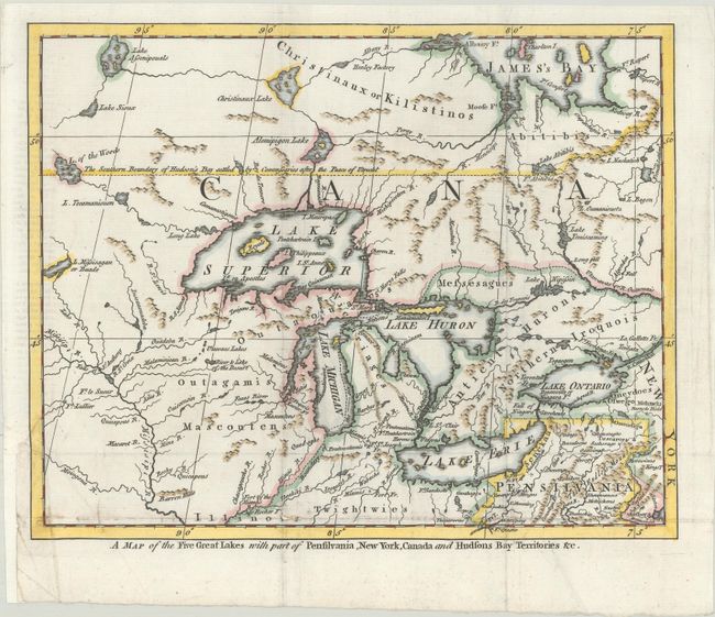
Auction 186, Lot 149
Subject: Colonial Great Lakes
A Map of the Five Great Lakes with Part of Pensilvania, New York, Canada and Hudsons Bay Territories &c., 1755
Size: 10.3 x 8.3 inches (26.2 x 21.1 cm)
Estimate: $400 - $475
Sold for: $900
Closed on 2/9/2022
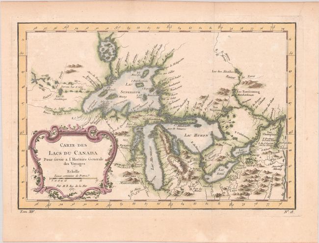
Auction 186, Lot 150
Subject: Colonial Central United States & Canada, Great Lakes
Bellin, Jacques Nicolas
Carte des Lacs du Canada pour Servir a l'Histoire Generale des Voyages, 1757
Size: 11.5 x 7.8 inches (29.2 x 19.8 cm)
Estimate: $350 - $425
Sold for: $325
Closed on 2/9/2022
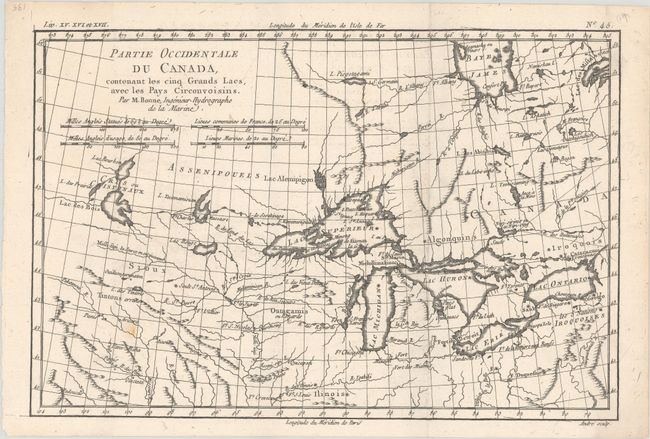
Auction 186, Lot 151
Subject: Colonial Central United States & Canada, Great Lakes
Bonne, Rigobert
Partie Occidentale du Canada, Contenant les Cinq Grands Lacs, avec les Pays Circonvoisins, 1775
Size: 12.6 x 8.4 inches (32 x 21.3 cm)
Estimate: $200 - $230
Sold for: $150
Closed on 2/9/2022
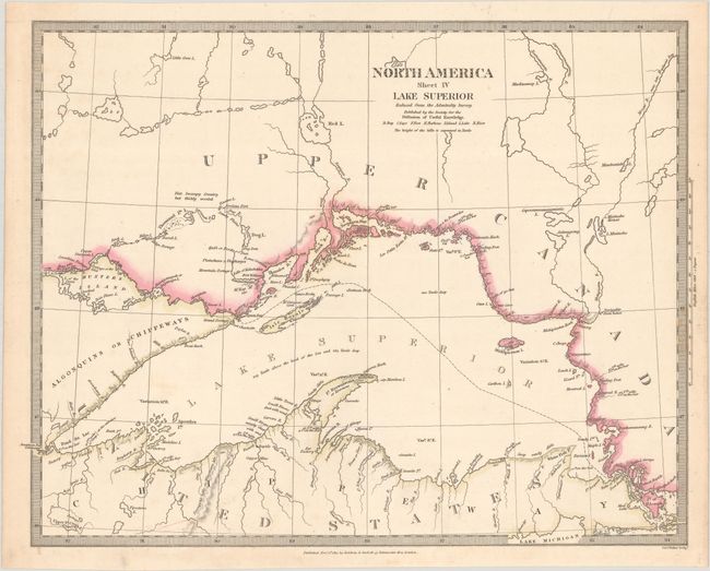
Auction 186, Lot 152
Subject: Lake Superior
SDUK Society for the Diffusion of Useful Knowledge
North America Sheet IV Lake Superior, 1832
Size: 15.4 x 12 inches (39.1 x 30.5 cm)
Estimate: $110 - $140
Sold for: $55
Closed on 2/9/2022
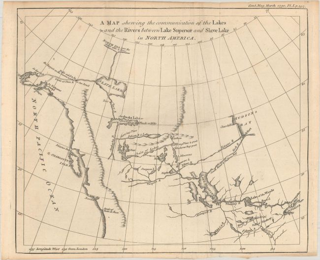
Auction 186, Lot 153
Subject: Western Canada & Alaska
Anon.
A Map Shewing the Communication of the Lakes and the Rivers Between Lake Superior and Slave Lake in North America, 1790
Size: 9.3 x 7.8 inches (23.6 x 19.8 cm)
Estimate: $240 - $300
Sold for: $140
Closed on 2/9/2022
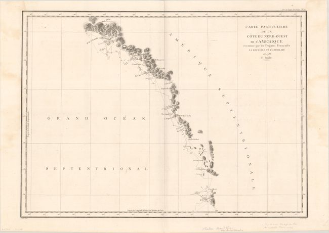
Auction 186, Lot 154
Subject: Western Canada & Alaska
La Perouse, Comte Jean F. Galoup, de
Carte Particuliere de la Cote du Nord-Ouest de l'Amerique Reconnue par les Fregates Francaises la Boussole et l'Astrolabe en 1786. 1e. Feuille, 1797
Size: 26.9 x 19.5 inches (68.3 x 49.5 cm)
Estimate: $160 - $190
Sold for: $120
Closed on 2/9/2022
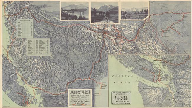
Auction 186, Lot 155
Subject: Pacific Northwest United States & Canada
The Triangle Tour of British Columbia - Jasper National Park Mount Robson Park Canadian Rockies and the Sceneic Seas of the North Pacific Coast [on verso] Alaska and the Yukon, 1930
Size: 29.8 x 16.8 inches (75.7 x 42.7 cm)
Estimate: $200 - $230
Sold for: $190
Closed on 2/9/2022
33 lots