Subject: Colonial Great Lakes
Period: 1755 (circa)
Publication: London Magazine
Color: Hand Color
Size:
10.3 x 8.3 inches
26.2 x 21.1 cm
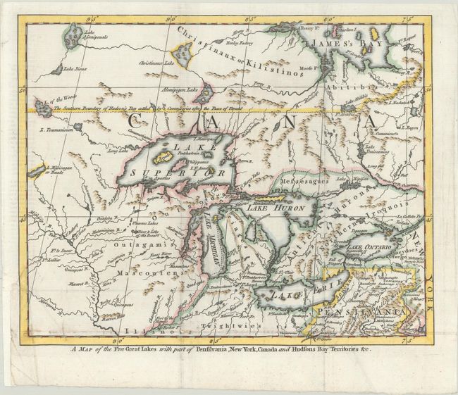
This uncommon small map covers the Great Lakes region prior to the French and Indian War. A dotted line beginning at Lake of the Woods depicts The Southern Boundary of Hudson's Bay Settled by Commisaries After the Peace of Utrecht. A spurious mountain range is shown down the length of Michigan, as well as the fictitious islands of Philippeux, Pontchartrain, Maurepas, and St. Anne in Lake Superior. Published in the September 1755 issue of the London Magazine. Although the map works as a standalone map with its own title and borders, it was the third in a series of maps of North America "which may be joined together, and will make a compleat Map of that part of the world," published by London Magazine from July to September 1755. The other two maps are A Map of Virginia, North and South Carolina, Georgia, Maryland with Part of New Jersey, &c. (published in July 1755) and A Map of the British & French Plantations in North America (published in August 1755).
References: Jolly #LOND-97.
Condition: B+
A fine impression issued folding, now flat, on watermarked paper with a binding trim in the bottom left blank margin that has been replaced with old paper. Several small separations along the bottom fold and a short binding tear have been repaired with archival materials on verso.