Catalog Archive
Auction 186, Lot 161

"[Map in Report] Map Showing Indian Reservations Within the Limits of the United States... [in] Annual Reports of the Department of the Interior for the Fiscal Year Ended June 30, 1901. Indian Affairs. Part I...", U.S. Bureau of Indian Affairs

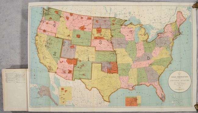
Subject: United States

Period: 1902 (published)

Publication:

Color: Printed Color

Size:
33 x 21.1 inches
83.8 x 53.6 cm
Download High Resolution Image
(or just click on image to launch the Zoom viewer)

This large map of the United States focuses on the many Indian Reservations in the United States as of 1901. The reservations are named and shown in orange overprinting. The map also shows military stations, towns and villages, railroads, Indian agencies, and schools with a key at lower left. Includes insets of Alaska and reservations in California and Indian Territory at bottom. Compiled under the direction of W.A. Jones, Commissioner of Indian Affairs. The map is still bound into the rear of the 806-page annual report. Octavo, hardbound in full contemporary leather with title label on the spine.

References:

Condition: A

Condition code is for the map, which is very clean and bright with a few faint spots. Report text is clean and tight with a hint of pleasant light toning. Binding has a few scuff marks and light soiling.

Estimate: $140 - $170

Sold for: $550

Closed on 2/9/2022

Archived