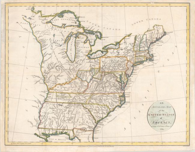
Subject: Eastern United States
Period: 1794 (dated)
Publication: An Historical, Geographical, Commercial, and Philosophical View of the American United States
Color: Hand Color
Size:
18.6 x 14.3 inches
47.2 x 36.3 cm
This is a very early map of the young United States that details the states, new territories, and the Indian lands east of the Mississippi River. The Western Territories include several Bounty Land Grants including Colonel Simmers, Army Land, Ohio Company, Donation Lands from the Commonwealth of Virginia, Illinois Company, Wabash Company, and New Jersey Company. The area northeast of the Mississippi River is largely unorganized and denoted as "Divided into 10 States by a Resolve of Congress in 1784." A large section of Kentucky is Land Reserved for the Virginia Troops. The newly formed Tennessee Government is outlined with a large section Reserved for the N. Carolina Troops. Georgia extends to the Mississippi River. Numerous Indian tribes and forts are indicated throughout. The Twenty Leagues Line is drawn in the Atlantic.
References: McCorkle #794.14; Phillips (A) #1363-4.
Condition: B+
Issued folding on watermarked paper with some faint staining and offsetting. A binding trim at right has been replaced with old paper, and a number of small chips and edge tears in the left margin have been replaced with a small portion of border in facsimile.