Subject: Colonial Central United States & Canada, Great Lakes
Period: 1775 (circa)
Publication: Atlas de Toutes les Parties Connues du Globe Terrestre...
Color: Black & White
Size:
12.6 x 8.4 inches
32 x 21.3 cm
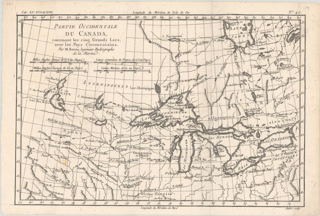
This is the first state of one of the most interesting maps of the Great Lakes depicting frontier forts, missions, and fur trade routes. It covers the region from James Bay south to show Ft. St. Louis, and from Lake Ontario through the Great Plains. It contains numerous Indian tribe names and forts including Detroit, St. Louis, Toronto and Chicagou. Lake Superior contains Isle Royale, as well as the phantom islands of St. Anne, Maurepas and Ponchartrain, which were reported by the Jesuit explorer Charlevoix. The Keweenaw Peninsula is noted as Pt. de Kiaonan. The source of the Mississippi is noted as inconue or unknown. Engraved by Andre.
References: Kershaw #973; Sellers and Van Ee #173.
Condition: A
A crisp impression on a bright sheet, issued folding with a hint of offsetting and a small paper flaw at bottom left.