Subject: Eastern United States & Canada
Period: 1783 (dated)
Publication:
Color: Black & White
Size:
19.9 x 16.1 inches
50.5 x 40.9 cm
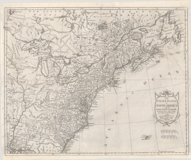
This is one of the earliest English-produced maps to officially acknowledge the United States. It depicts the new nation with its western border on the Mississippi River. The states of Georgia, South Carolina, North Carolina, and Virginia stretch from the Atlantic to the Mississippi. The map is filled with information on early settlements, forts, Indian villages, and fishing banks. The title is enclosed in a simple garland cartouche, with the island of Bermuda below. Kitchin, Hydrographer to the King, prepared the map for a special publication by Thomas Cadell (although the publisher's imprint has been trimmed from this example). It was subsequently issued in Raynal's history (1783-98) and possibly other publications.
References: McCorkle #783-11; Phillips (M) p. 862.
Condition: B
A nice impression issued folding, now flat, with light soiling. The margins were trimmed at top left and bottom and have been professionally replaced, with sections of neatline and border now in facsimile. 4" and 2" edge tears at right have been closed with archival materials on verso.