Subject: Eastern United States & Canada, Geology
Period: 1845 (published)
Publication: Travels in North America, in the Years 1841-2; with Geological Observations...
Color: Hand Color
Size:
19.7 x 15.3 inches
50 x 38.9 cm
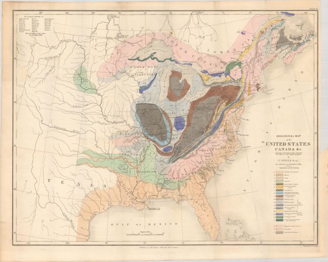
This is an important and early geological map by Sir Charles Lyell. Its color-coded key identifies 20 different geological types. The map extends to about the 110th meridian to include the Republic of Texas, Arkansas, Missouri, and the North West Territory. Lyell had two major and revolutionary goals in publishing his work and this map. First, he endeavored to establish a strict uniformitarian theory of the earth's geology in which the forces and processes observable at earth's surface are the same that have shaped earth's landscape throughout natural history. Second, Lyell sought to standardize the terminology and methodology employed in the science of geology. His map, along with James Hall's work of 1843, is a landmark improvement in geological representations and mapping.
References: Marcou & Marcou #34; Howes #L575; Sabin #42761.
Condition: A
Near fine with minor color offsetting and a binding trim at right. Issued folding.