Catalog Archive
Auction 186, Lot 141

"United States of America Exhibiting the Seat of War on the Canadian Frontier. From 1812. to 1815", Baines, Edward

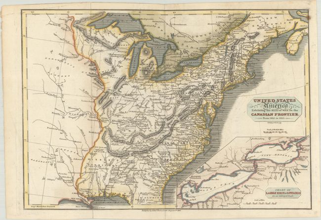
Subject: Eastern United States & Canada

Period: 1816 (dated)

Publication:

Color: Hand Color

Size:
13.6 x 9.4 inches
34.5 x 23.9 cm
Download High Resolution Image
(or just click on image to launch the Zoom viewer)

An uncommon map of the early United States, published shortly after the War of 1812. The map details the eastern United States including the plains region to the west of the Mississippi. Mississippi is a large territory that includes present-day Alabama. Michigan Territory is named. The map is filled with early settlement locations and Indian villages. Inset with a "Chart of Lakes Erie and Ontario on an Enlarged Scale," where much of the action took place during the war. Engraved by R. Walker.

References:

Condition: A

Issued folding on paper with an "HS 1814" watermark, an extraneous crease at bottom left, and marginal soiling.

Estimate: $300 - $375

Sold for: $425

Closed on 2/9/2022

Archived