Subject: United States & Canada
Period: 1857 (dated)
Publication:
Color: Hand Color
Size:
22.2 x 18.6 inches
56.4 x 47.2 cm
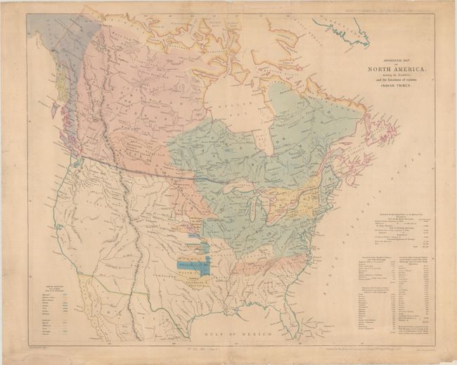
This map appears to be based upon an earlier map (1844) published by the Religious Society of Friends entitled A Map of North America, Denoting the Boundaries of the Yearly Meetings of Friends and the Locations of the Various Indian Tribes. It shows the known tribes in all of Canada and the eastern United States with a color-coded key at bottom left locating 11 different tribes. The Catawba, Uchee, and Natchez Indians are noted as extinct. A table at bottom right indicates the native populations by region. Issued in a British report for the "Select Committee...On the Hudson's Bay Company." Printed by Henry Hansard.
References:
Condition: B+
Backed with tissue to reinforce and repair a 2" tear at top, a few small centerfold separations, and several small edge tears confined to the margins. There is light soiling and two chips in the top and bottom blank margins that have been replaced with old paper.