Subject: Colonial Northeastern United States & Canada
Period: 1684 (circa)
Publication: Beschreibung des Gantzen Welt-Kreisses...
Color: Black & White
Size:
3.9 x 5.5 inches
9.9 x 14 cm
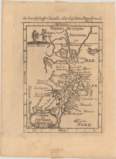
This charming small map depicts the eastern seaboard from Chesapeake Bay to Greenland. The Great Lakes are shown open-ended in the west allowing the possibility of a Northwest Passage. The map extends to include Bermuda. It names Lake Superior, the Cercle Polaire, and shows Nouveu Mexique at extreme lower left. The map is decorated with a strapwork title cartouche at lower left and a vignette at upper left that shows two Indians and an infant. From a German edition of Mallet's Description de l'Univers.
References: cf. Kershaw #267; McCorkle #683.3; Pastoureau, MANESSON-MALLET I B.
Condition: B+
Lightly toned with brown paper hinge tape on verso and a bit of soil in blank margins.