Filtered by Category:United States(Show All Categories)
Showing results for:Auction 185
Catalog Archive
238 lots
Page 1 of 5
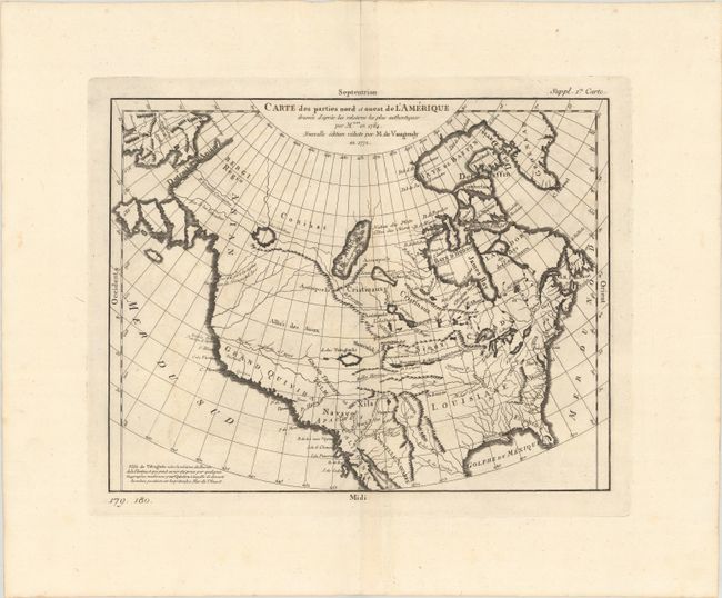
Auction 185, Lot 122
Subject: Colonial United States & Canada
Robert de Vaugondy, Didier
Carte des Parties Nord et Ouest de l'Amerique Dressee d'Apres les Relations les Plus Authentiques..., 1772
Size: 14.4 x 11.3 inches (36.6 x 28.7 cm)
Estimate: $200 - $230
Sold for: $180
Closed on 11/17/2021
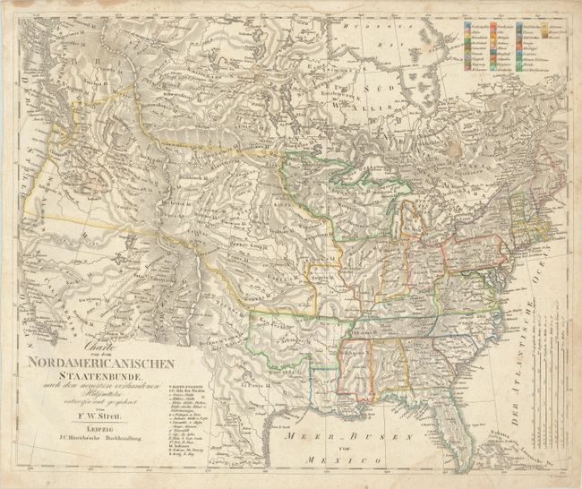
Auction 185, Lot 123
Subject: United States & Canada
Streit, Friedrich Wilhelm
Charte von dem Nordamericanischen Staatenbunde, nach den Neuesten Vorhandenen..., 1821
Size: 18.6 x 15.3 inches (47.2 x 38.9 cm)
Estimate: $325 - $400
Sold for: $200
Closed on 11/17/2021
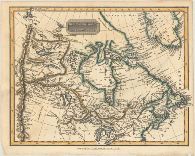
Auction 185, Lot 124
Subject: Canada & Northern United States
[Lot of 3] British Colonies in North America [and] British Colonies, in North America; from the Best Authorities [and] British Colonies, in North America from the Best Authorities, 1797-1815
Size: See Description
Estimate: $240 - $300
Sold for: $230
Closed on 11/17/2021
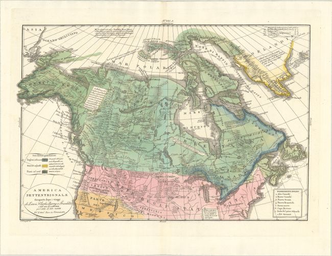
Auction 185, Lot 125
Subject: Canada & Northern United States
Tasso, G.
America Settentrionale Disegnata Dopo i Viaggi di Lewis, Clarke, Parry e Franklin..., 1832
Size: 17.9 x 12.3 inches (45.5 x 31.2 cm)
Estimate: $400 - $475
Sold for: $200
Closed on 11/17/2021
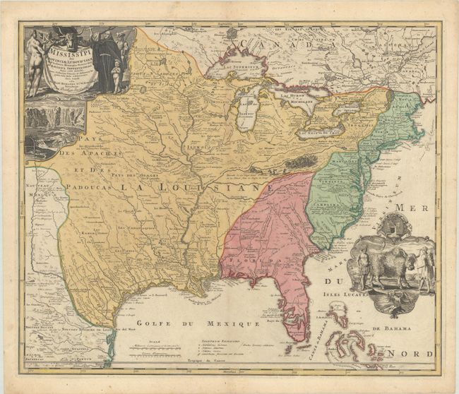
Auction 185, Lot 126
Subject: Colonial Eastern United States & Canada
Homann, Johann Baptist
Amplissimae Regionis Mississipi seu Provinciae Ludovicianae a R.P. Ludovico Hennepin Francisc Miss. in America Septentrionali Anno 1687..., 1730
Size: 22.9 x 19.3 inches (58.2 x 49 cm)
Estimate: $2,000 - $2,300
Striking Map of Colonial America with Bison Vignette
Sold for: $1,500
Closed on 11/17/2021
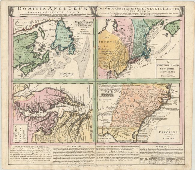
Auction 185, Lot 127
Subject: Colonial Eastern United States & Canada
Homann Heirs
Dominia Anglorum in America Septentrionali... / Die Gros-Britannische Colonie-Laender in Nord-America..., 1740
Size: 21.9 x 19.8 inches (55.6 x 50.3 cm)
Estimate: $475 - $600
Sold for: $350
Closed on 11/17/2021
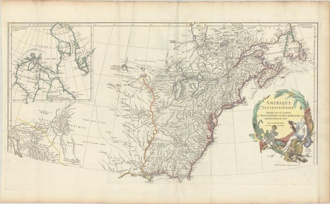
Auction 185, Lot 128
Subject: Colonial Eastern United States & Canada
Anville, Jean Baptiste Bourguignon d'
Amerique Septentrionale Publiee sous les Auspices de Monseigneur le Duc d'Orleans Premier Prince du Sang, 1746
Size: 33.8 x 18 inches (85.9 x 45.7 cm)
Estimate: $600 - $750
Sold for: $450
Closed on 11/17/2021
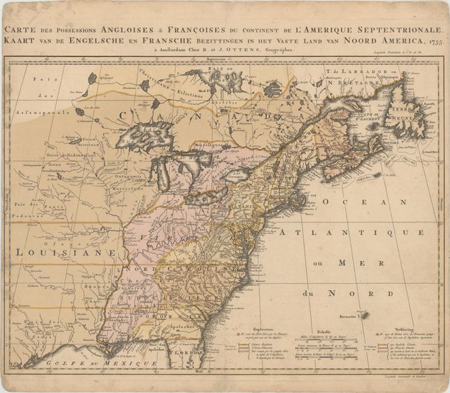
Auction 185, Lot 129
Subject: Colonial Eastern United States & Canada
Ottens, Reiner and Joshua
Carte des Possessions Angloises & Francoises du Continent de l'Amerique Septentrionale / Kaart van de Engelsche en Fransche Bezittingen in het Vaste Land van Noord America, 1755
Size: 22.4 x 16.3 inches (56.9 x 41.4 cm)
Estimate: $1,500 - $1,800
Dutch Version of an Important Map Showing Territorial Claims at the Outset of the French and Indian War
Unsold
Closed on 11/17/2021
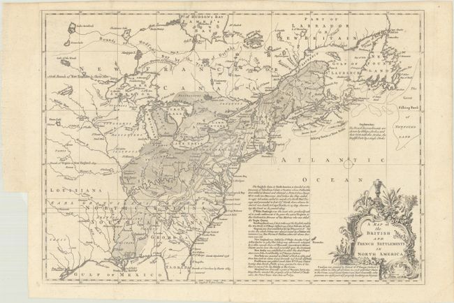
Auction 185, Lot 130
Subject: Colonial Eastern United States & Canada
Lodge, John
A Map of the British and French Settlements in North America, 1755
Size: 15.3 x 11 inches (38.9 x 27.9 cm)
Estimate: $500 - $650
Sold for: $375
Closed on 11/17/2021
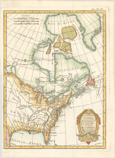
Auction 185, Lot 131
Subject: Colonial Eastern United States & Canada
Bonne/Raynal
Partie du Nord de l'Amerique Septentrionale, pour Servir a l'Histoire Philosophique et Politique des Etablissemens et du Commerce des Europeens dans les Deux Indes, 1774
Size: 9.4 x 12.7 inches (23.9 x 32.3 cm)
Estimate: $200 - $230
Sold for: $150
Closed on 11/17/2021
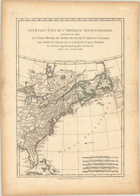
Auction 185, Lot 132
Subject: Colonial Eastern United States & Canada
Bonne, Rigobert
Les Etats Unis de l'Amerique Septentrionale, Contenant en Outre, les Isles Royale, de Terre Neuve, de St. Jean et l'Acadie; avec Partie du Canada, de la Louisiane et de la Floride, 1781
Size: 8.4 x 12.6 inches (21.3 x 32 cm)
Estimate: $160 - $190
Sold for: $95
Closed on 11/17/2021
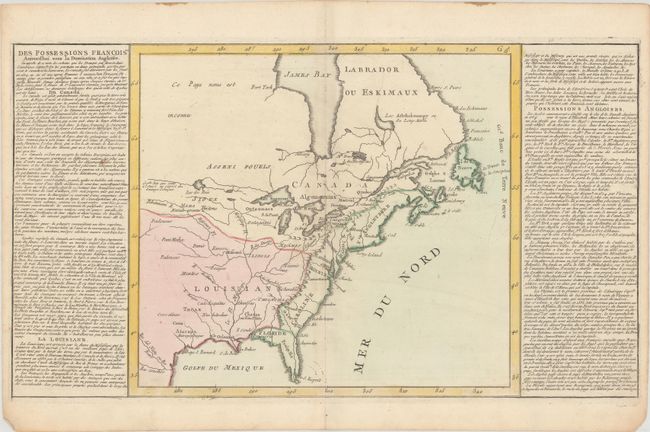
Auction 185, Lot 133
Subject: Eastern United States & Canada
[Lot of 2] Des Possessions Francoises Aujourd'hui sous la Domination Angloises... [and] Etats-Unis de l'Amerique Seple. avec le Canada et la Floride, 1780-90
Size: See Description
Estimate: $275 - $350
Sold for: $325
Closed on 11/17/2021
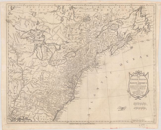
Auction 185, Lot 134
Subject: Eastern United States & Canada
Kitchin, Thomas
Map of the United States in North America: with the British, French and Spanish Dominions Adjoining, According to the Treaty of 1783, 1783
Size: 20.3 x 16.2 inches (51.6 x 41.1 cm)
Estimate: $1,100 - $1,400
One of the Earliest English-Produced Maps to Acknowledge the United States
Sold for: $800
Closed on 11/17/2021
Auction 185, Lot 135
Subject: Eastern United States & Canada
Le Rouge, George Louis
Carte d'une Partie de l'Amerique Septentrionale, pour Servir a l'Histoire de la Derniere Guerre, 1787
Size: 19.4 x 24.1 inches (49.3 x 61.2 cm)
Estimate: $1,000 - $1,300
Sold for: $500
Closed on 11/17/2021
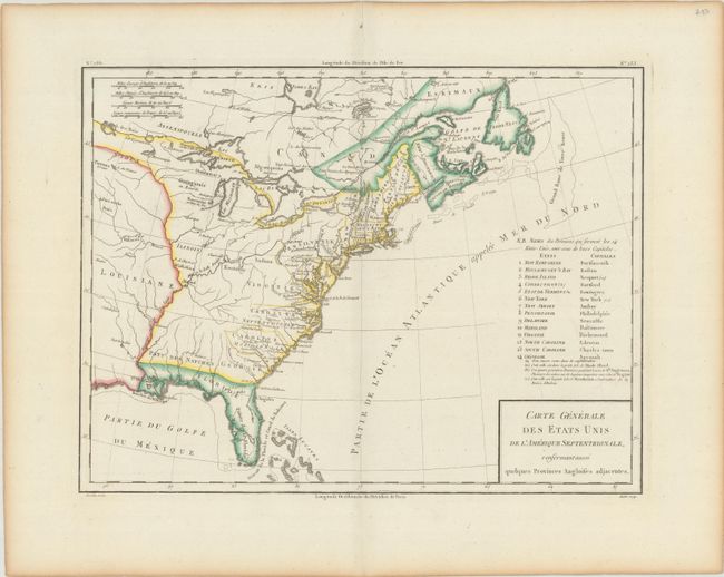
Auction 185, Lot 136
Subject: Eastern United States & Canada
Tardieu, Pierre Francois
Carte Generale des Etats Unis de l'Amerique Septentrionale, Renfermant Aussi Quelques Provinces Angloises Adjacentes, 1797
Size: 16.9 x 12.8 inches (42.9 x 32.5 cm)
Estimate: $240 - $300
Sold for: $120
Closed on 11/17/2021
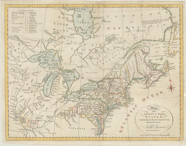
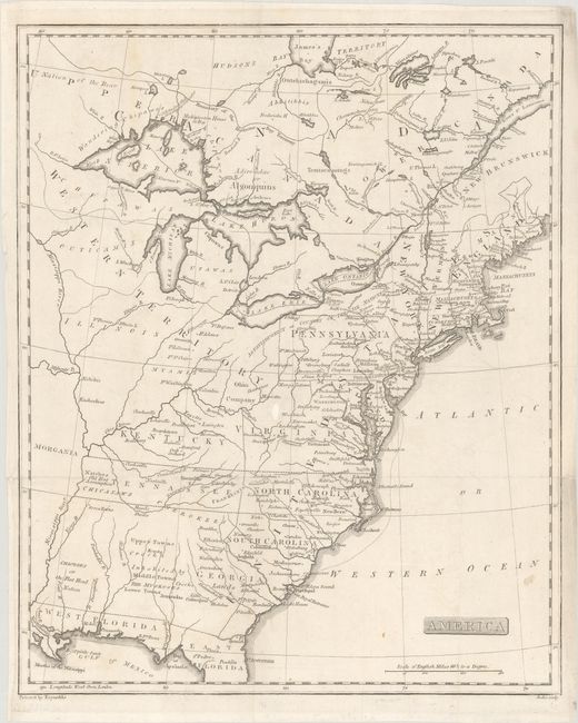
Auction 185, Lot 137
Subject: Northeastern United States & Canada
Doolittle, Amos
Map of the Northern & Middle States: Comprehending the Western Territory & the British Dominions in North America from the Best Authorities, 1800
Size: 15.1 x 11.6 inches (38.4 x 29.5 cm)
Estimate: $325 - $400
Sold for: $230
Closed on 11/17/2021
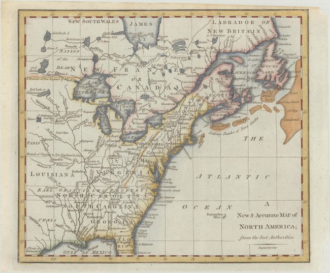
Auction 185, Lot 138
Subject: Eastern United States & Canada
Cary, John
A New & Accurate Map of North America; from the Best Authorities, 1801
Size: 8.8 x 7.6 inches (22.4 x 19.3 cm)
Estimate: $160 - $190
Sold for: $275
Closed on 11/17/2021
Auction 185, Lot 139
Subject: Eastern United States & Canada, Franklin
Rochefoucald Liancourt, Francois Alexander
America, 1805
Size: 12.9 x 15.9 inches (32.8 x 40.4 cm)
Estimate: $1,000 - $1,300
Sold for: $950
Closed on 11/17/2021
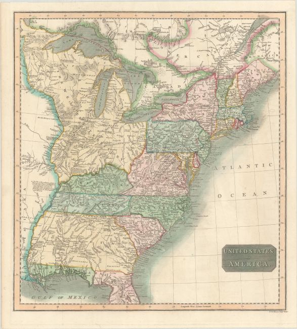
Auction 185, Lot 140
Subject: Eastern United States & Canada
Thomson, John
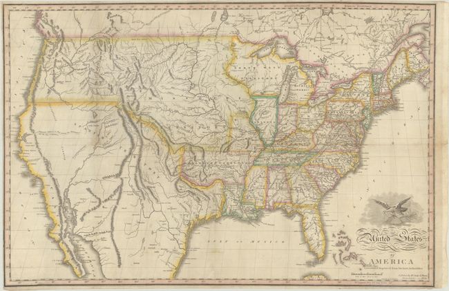
United States of America, 1815
Size: 14.8 x 16.1 inches (37.6 x 40.9 cm)
Estimate: $190 - $220
Sold for: $240
Closed on 11/17/2021
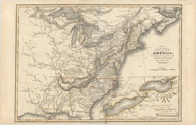
Auction 185, Lot 141
Subject: Eastern United States & Canada
Baines, Edward
United States of America, Exhibiting the Seat of War on the Canadian Frontier from 1812 to 1815, 1816
Size: 13.5 x 9.6 inches (34.3 x 24.4 cm)
Estimate: $300 - $375
Sold for: $160
Closed on 11/17/2021
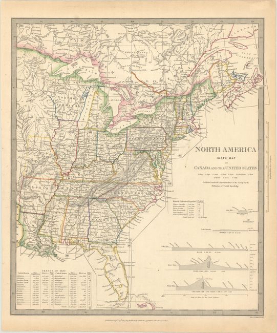
Auction 185, Lot 142
Subject: Eastern United States & Canada
SDUK Society for the Diffusion of Useful Knowledge
North America Index Map to Canada and the United States, 1834
Size: 12.7 x 14.5 inches (32.3 x 36.8 cm)
Estimate: $50 - $70
NO RESERVE
Sold for: $75
Closed on 11/17/2021
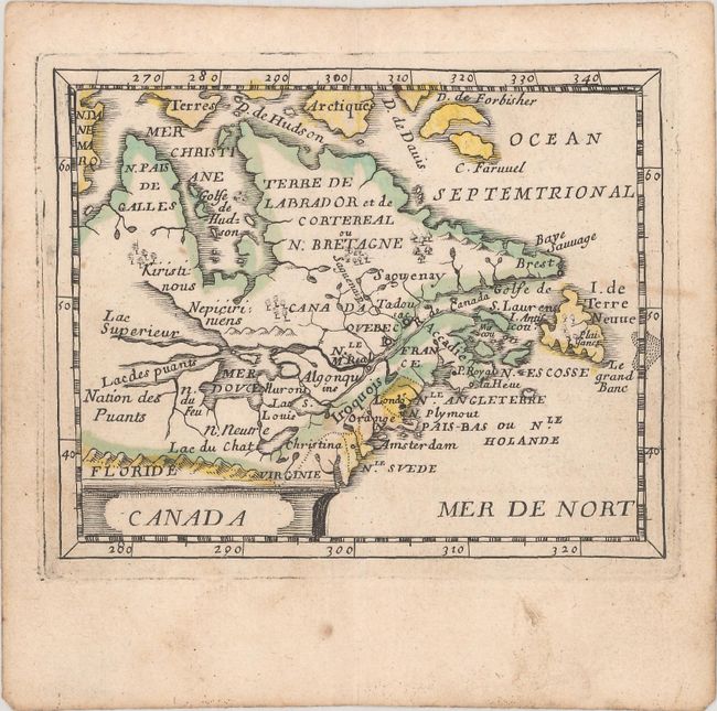
Auction 185, Lot 143
Subject: Colonial Northeastern United States & Canada
Duval/Beer
Canada, 1661
Size: 4.8 x 3.8 inches (12.2 x 9.7 cm)
Estimate: $475 - $600
Sold for: $300
Closed on 11/17/2021
Auction 185, Lot 144
Subject: Colonial Northeastern United States & Canada, Great Lakes
Albrizzi, Girolamo
Carta Geografica del Canada nell' America Settentrionale, 1750
Size: 16.9 x 13.1 inches (42.9 x 33.3 cm)
Estimate: $750 - $900
Sold for: $650
Closed on 11/17/2021
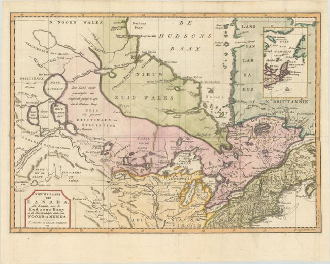
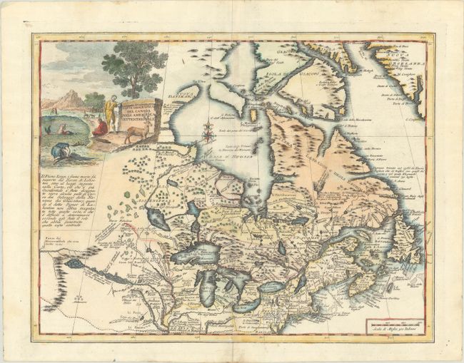
Auction 185, Lot 145
Subject: Colonial Northeastern United States & Canada
Tirion, Isaac
Nieuwe Kaart van Kanada, de Landen aan de Hudsons-Baay en de Noordwestelyke Deelen van Noord-Amerika, 1769
Size: 17.3 x 12.3 inches (43.9 x 31.2 cm)
Estimate: $200 - $230
Sold for: $200
Closed on 11/17/2021
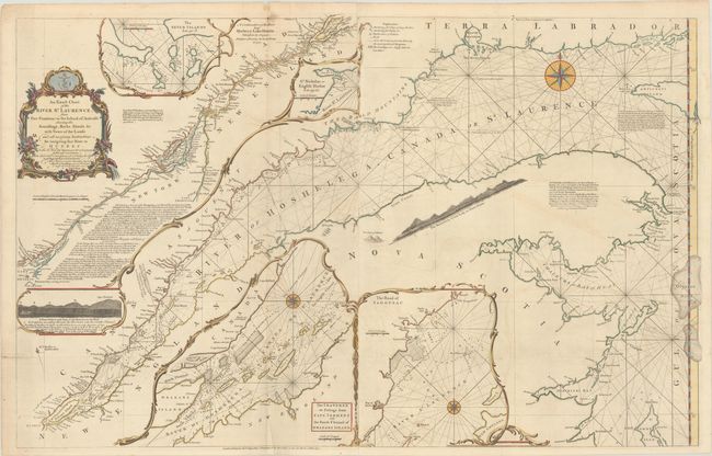
Auction 185, Lot 146
Subject: Colonial Northeastern United States & Canada
Jefferys/Sayer
An Exact Chart of the River St. Laurence, from Fort Frontenac to the Island of Anticosti Shewing the Soundings, Rocks, Shoals &c. with Views of the Lands..., 1775
Size: 37.4 x 23.7 inches (95 x 60.2 cm)
Estimate: $500 - $600
Sold for: $500
Closed on 11/17/2021
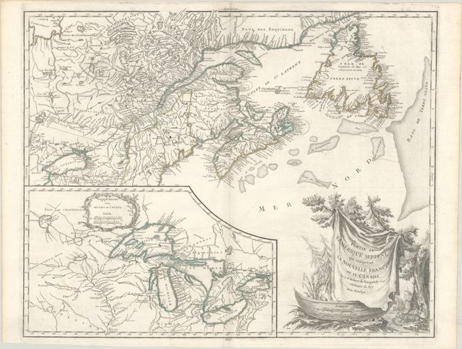
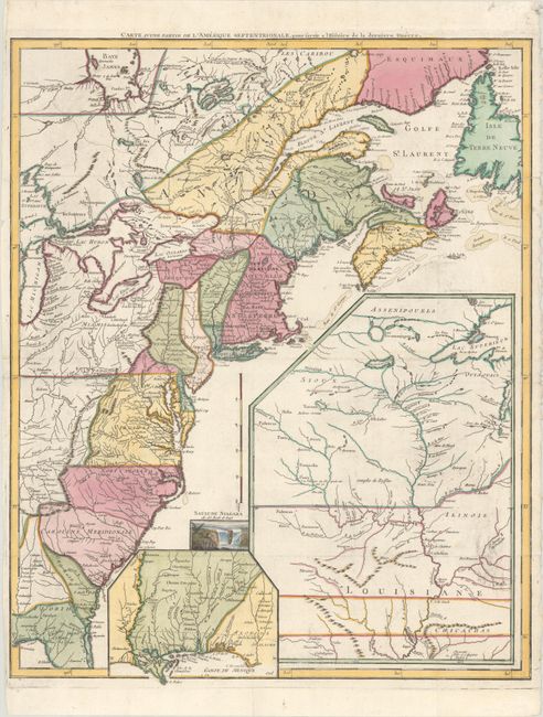
Auction 185, Lot 147
Subject: Northeastern United States & Canada, Great Lakes
Robert de Vaugondy, Didier
Partie de l'Amerique Septent? qui Comprend la Nouvelle France ou le Canada, 1799
Size: 23.6 x 18.9 inches (59.9 x 48 cm)
Estimate: $475 - $600
Sold for: $350
Closed on 11/17/2021
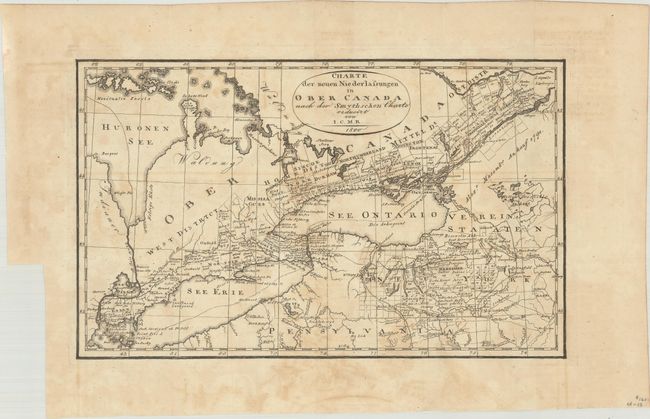
Auction 185, Lot 148
Subject: Northeastern United States & Canada, Great Lakes
I.C.M.R.
Charte der Neuen Niederlassungen in Ober Canada nach der Smythschen Charte, 1800
Size: 12.4 x 7.6 inches (31.5 x 19.3 cm)
Estimate: $140 - $170
Sold for: $220
Closed on 11/17/2021
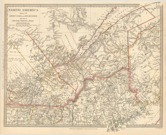
Auction 185, Lot 149
Subject: Northeastern United States & Canada
[Lot of 2] North America Sheet II Lower-Canada and New Brunswick with Part of New-York, Vermont and Maine [and] Lower Canada, New Brunswick, Nova Scotia &c., 1832-60
Size: See Description
Estimate: $80 - $100
NO RESERVE
Sold for: $120
Closed on 11/17/2021
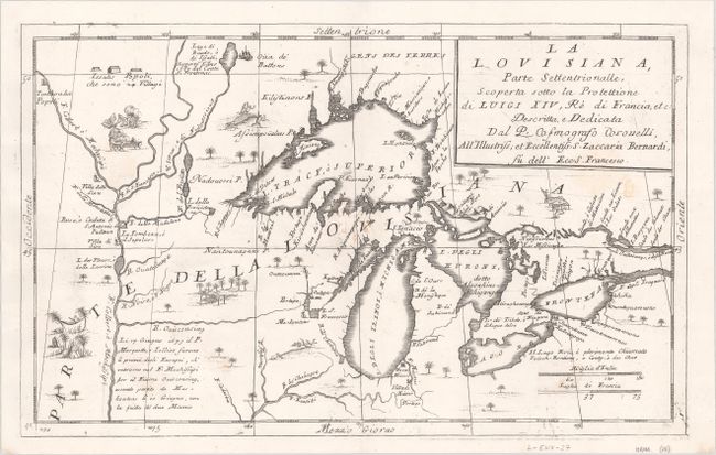
Auction 185, Lot 150
Subject: Colonial Central United States & Canada, Great Lakes
Coronelli, Vincenzo Maria
La Louisiana, Parte Settentrionalle, Scoperta Sotto la Protettione di Luigi XIV, Re di Francia, Etc. , 1696
Size: 16.4 x 10.1 inches (41.7 x 25.7 cm)
Estimate: $2,750 - $3,500
Coronelli's Important Map of the Great Lakes & Upper Mississippi River Valley
Sold for: $4,500
Closed on 11/17/2021
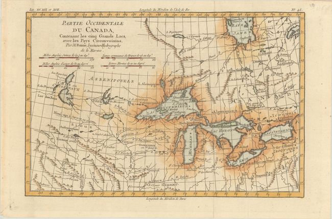
Auction 185, Lot 151
Subject: Colonial Central United States & Canada, Great Lakes
Bonne, Rigobert
Partie Occidentale du Canada, Contenant les Cinq Grands Lacs, avec les Pays Circonvoisins, 1780
Size: 12.5 x 8.3 inches (31.8 x 21.1 cm)
Estimate: $220 - $250
Sold for: $110
Closed on 11/17/2021
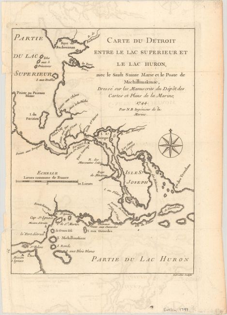
Auction 185, Lot 152
Subject: Colonial Great Lakes
Bellin, Jacques Nicolas
Carte du Detroit Entre le Lac Superieur et le Lac Huron, avec le Sault Sainte Marie et le Poste de Michillimakinac..., 1744
Size: 6.3 x 8.4 inches (16 x 21.3 cm)
Estimate: $200 - $230
Sold for: $300
Closed on 11/17/2021
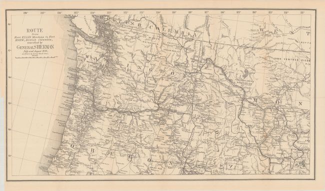
Auction 185, Lot 153
Subject: Northwestern United States & British Columbia
U.S. Government
[Map with Report] Route from Fort Ellis Montana to Fort Hope, British Columbia, Travelled by General Sherman July and August 1884, as Shown by Heavy Black Line, 1883
Size: 27.4 x 15.2 inches (69.6 x 38.6 cm)
Estimate: $250 - $325
Sold for: $150
Closed on 11/17/2021
Auction 185, Lot 154
Subject: United States
Anderson, Hugh
United States of America Corrected & Improved from the Best Authorities, 1824
Size: 24.9 x 16.5 inches (63.2 x 41.9 cm)
Estimate: $950 - $1,200
Sold for: $1,500
Closed on 11/17/2021
Auction 185, Lot 155
Subject: United States
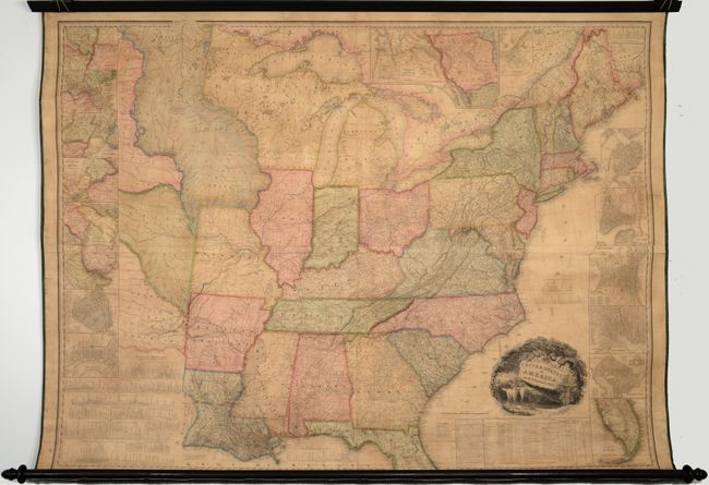
Tanner, Henry Schenck
United States of America, 1829
Size: 59.8 x 45.4 inches (151.9 x 115.3 cm)
Estimate: $7,000 - $8,500
First Edition of Tanner's Important Map of the United States
Sold for: $7,000
Closed on 11/17/2021
Auction 185, Lot 156
Subject: United States
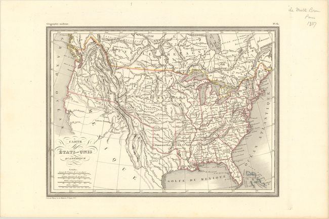
Thierry
Carte des Etats-Unis d'Amerique, 1836
Size: 11.8 x 8.6 inches (30 x 21.8 cm)
Estimate: $110 - $140
Sold for: $150
Closed on 11/17/2021
Auction 185, Lot 157
Subject: United States, Railroads
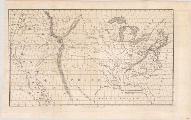
Throop, O. H.
[Untitled - Map of Proposed Routes of Western Railroads], 1846
Size: 15.9 x 10 inches (40.4 x 25.4 cm)
Estimate: $180 - $220
Sold for: $130
Closed on 11/17/2021
Auction 185, Lot 158
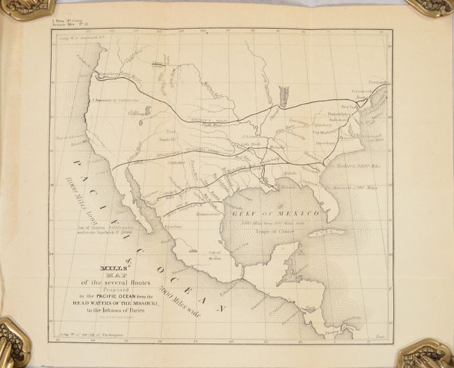
Subject: United States
U.S. Government
[Map in Report] Mills' Map of the Several Routes Proposed to the Pacific Ocean from the Head Waters of the Missouri, to the Isthmus of Darien [in] Memorial of Robert Mills, Respecting a New Route to the Pacific Ocean..., 1848
Size: 9 x 8.2 inches (22.9 x 20.8 cm)
Estimate: $140 - $170
Sold for: $70
Closed on 11/17/2021
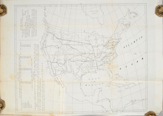
Auction 185, Lot 159
Subject: United States, Railroads
Whitney, Asa
[2 Maps in Report] Whitney's Railroad to the Pacific, 1850
Size: 5.8 x 8.8 inches (14.7 x 22.4 cm)
Estimate: $250 - $325
Sold for: $180
Closed on 11/17/2021
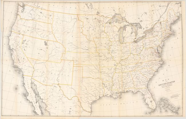
Auction 185, Lot 160
Subject: United States
Burr, David H.
Map of the United States Exhibiting the Several Collection Districts, 1854
Size: 49.3 x 31.4 inches (125.2 x 79.8 cm)
Estimate: $250 - $325
Sold for: $180
Closed on 11/17/2021
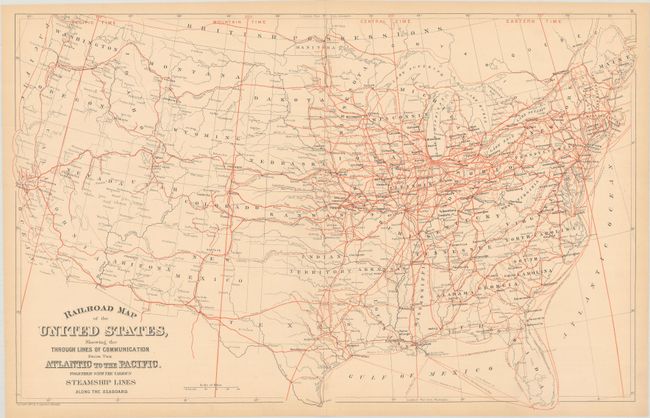
Auction 185, Lot 161
Subject: United States
Mitchell, Samuel Augustus
[Lot of 2] Railroad Map of the United States, Showing the Through Lines of Communication from the Atlantic to the Pacific... [and] Map of the United States and Territories. Together with Canada &c., 1880-82
Size: See Description
Estimate: $160 - $190
Sold for: $180
Closed on 11/17/2021
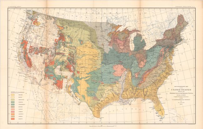
Auction 185, Lot 162
Subject: United States, Geology
U.S. Geological Survey (USGS)
Reconnoissance Map of the United States Showing the Distribution of the Geologic System so Far as Known. Compiled from Data in Possession of the U.S. Geological Survey, 1893
Size: 28.2 x 17.4 inches (71.6 x 44.2 cm)
Estimate: $160 - $190
Sold for: $160
Closed on 11/17/2021
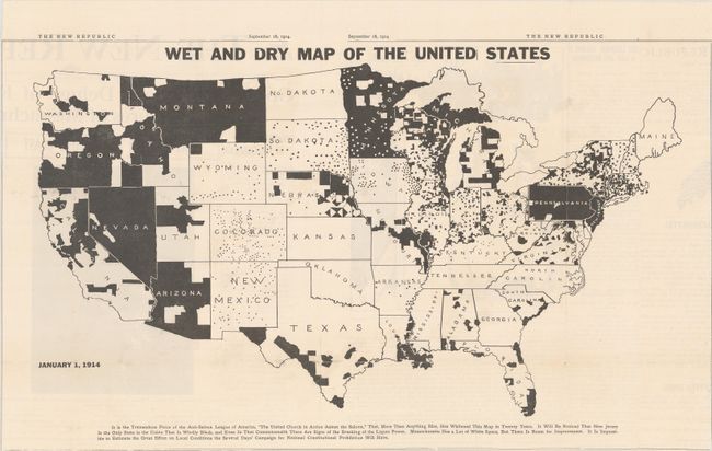
Auction 185, Lot 163
Subject: United States
Wet and Dry Map of the United States, 1914
Size: 21.9 x 12.6 inches (55.6 x 32 cm)
Estimate: $550 - $700
Rare Map Issued 6 Years Before the Prohibition Amendment Passed
Sold for: $650
Closed on 11/17/2021
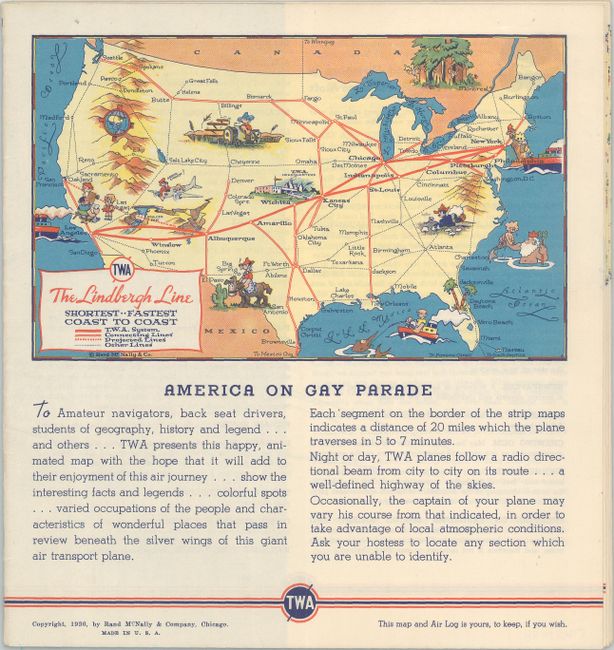
Auction 185, Lot 164
Subject: United States
White, Ruth Taylor
TWA - The Lindbergh Line Airway Map and Air Log, 1936
Size: 17 x 3.5 inches (43.2 x 8.9 cm)
Estimate: $200 - $230
Sold for: $100
Closed on 11/17/2021
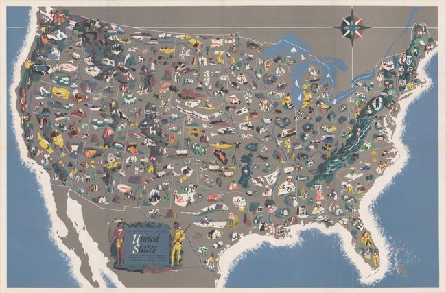
Auction 185, Lot 165
Subject: United States
Rand McNally & Co.
A Pictorial Map of the United States, 1944
Size: 36.8 x 24 inches (93.5 x 61 cm)
Estimate: $240 - $300
Unsold
Closed on 11/17/2021
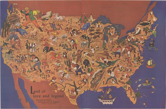
Auction 185, Lot 166
Subject: United States
Land of Lore and Legend - William Gropper's Folklore Map of America, 1946
Size: 20.6 x 13.7 inches (52.3 x 34.8 cm)
Estimate: $350 - $450
Unsold
Closed on 11/17/2021
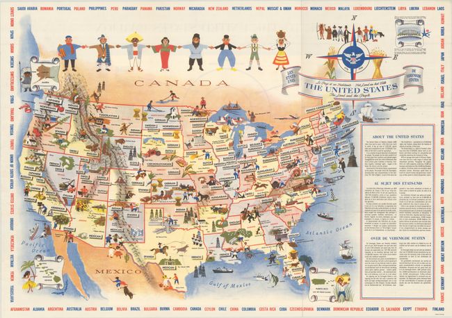
Auction 185, Lot 167
Subject: United States
The United States - The Land and the People, 1958
Size: 25.9 x 18.2 inches (65.8 x 46.2 cm)
Estimate: $180 - $220
Sold for: $120
Closed on 11/17/2021
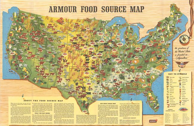
Auction 185, Lot 168
Subject: United States
Armour Food Source Map, 1960
Size: 37.2 x 24.3 inches (94.5 x 61.7 cm)
Estimate: $140 - $170
Sold for: $100
Closed on 11/17/2021
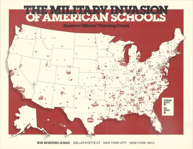
Auction 185, Lot 169
Subject: United States
The Military Invasion of American Schools - Reserve Officers' Training Corps, 1985
Size: 20.8 x 15.3 inches (52.8 x 38.9 cm)
Estimate: $120 - $150
NO RESERVE
Sold for: $55
Closed on 11/17/2021
Auction 185, Lot 170
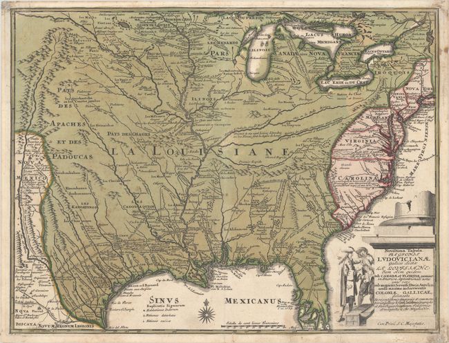
Subject: Colonial Eastern United States
Weigel, Christopher
Novissima Tabula Regionis Ludovicianae Gallice Dictae la Louisiane tam olim Quidem sub Canadae et Floridae Nomine in America Septentrionali..., 1734
Size: 16.4 x 12.4 inches (41.7 x 31.5 cm)
Estimate: $1,200 - $1,500
Uncommon Map of French Louisiana with a Title Cartouche Referencing the Mississippi Bubble Scheme
Sold for: $1,800
Closed on 11/17/2021
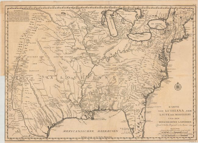
Auction 185, Lot 171
Subject: Colonial Eastern United States
Bellin, Jacques Nicolas
Karte von Luisiana, dem Laufe des Mississipi und den Benachbarten Laendern, 1744
Size: 21.8 x 15.5 inches (55.4 x 39.4 cm)
Estimate: $550 - $700
Sold for: $500
Closed on 11/17/2021
238 lots
Page 1 of 5