Subject: Northeastern United States & Canada
Period: 1832-60 (circa)
Publication:
Color: Hand Color
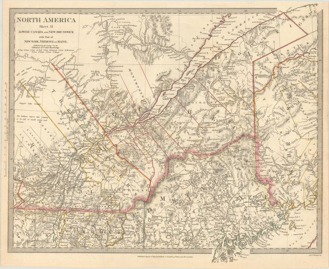
A. North America Sheet II Lower-Canada and New Brunswick with Part of New-York, Vermont and Maine, by SDUK Society for the Diffusion of Useful Knowledge, dated 1832 (15.5 x 12.9"). This detailed steel engraved map covers Lower Canada and parts of Maine, New Hampshire, Vermont, and New York. The "Boundary as claimed by the United States" is located in Quebec. A note in the western area of the map reads, "The Indians report this country to be full of small Lakes and Streams." Surrounded by a keyboard style border. Published by Baldwin & Cradock. Condition: Contemporary color with minor scattered foxing.
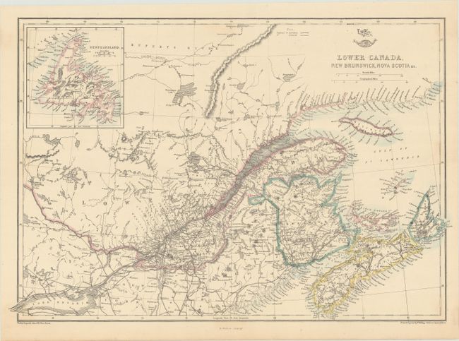
B. Lower Canada, New Brunswick, Nova Scotia &c., by Theodor Ettling, from Weekly Dispatch Atlas, circa 1860 (17.6 x 12.0"). This map of Lower Canada includes an inset of Newfoundland at top left. There is excellent detail of rivers, lakes, roads, and railroads (both extant and proposed). Drawn and engraved by Ettling; lithography by Edward Weller. Condition: There are just a few very faint stains.
References:
Condition: A
See description above.