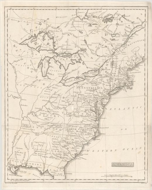
Subject: Eastern United States & Canada, Franklin
Period: 1805 (published)
Publication: The History of the Discovery and Settlement, to the Present Time...
Color: Black & White
Size:
12.9 x 15.9 inches
32.8 x 40.4 cm
This fascinating map of the Eastern United States and Canada features the short-lived states of Franklinia in eastern Tennessee (here labeled Tennassee) as well as Morgania in present-day Missouri. The latter was named after George Morgan, a land speculator, who attempted to create a new colony in the then Spanish controlled Louisiana Territory near New Madrid (Morgan gave up this endeavor a few years later). The Ohio Company land grant still appears north of the Ohio River, and Florida is divided between East and West. West of the Appalachians, detail is mostly limited to forts and the locations of numerous Indian tribes. Engraved by John Scoles.
References: Dotson & Baker (OWA) #20.
Condition: B+
Issued folding with a small chip in an unengraved area at center that has been replaced with archival materials. There are a few minor spots and a short edge tear at left that has been closed on verso with archival materials.