Subject: Northeastern United States & Canada, Great Lakes
Period: 1799 (circa)
Publication: Atlas Universel
Color: Hand Color
Size:
23.6 x 18.9 inches
59.9 x 48 cm
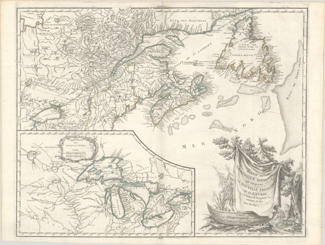
This is a handsome map of Newfoundland, Nova Scotia, and the entire course of the St. Lawrence River. The most prominent feature of the map is the very large inset of the 1744 Bellin version of the Great Lakes. The wonderful cartouche features the title on a blanket draped over a wooden canoe, which appears beside a threatening beaver. According to Kershaw and Pedley, this is the fourth state of the map with the original engraver's name (Haussard) removed from the cartouche and "Groux" added.
References: Kershaw #357; Pedley #459; Sellers and Van Ee #61; Karpinski p.141-42; McCorckle #755.36.
Condition: B+
A nice impression on watermarked paper with a small wormtrack in the inset that has been infilled with archival materials, some light spots, and printer's ink residue.